Last 25 days I have been to the most exotic yet most secluded corners of Indian Himalayas. I have hiked and climbed one of the most challenging and dangerous regions during this expedition.
I was extremely lucky to witness some incredible landscapes and was lucky to see it’s fascinating yet unique wildlife.
Auden’s Col Expedition
My expedition was in Garhwal Himalayas, Uttarakhand. It was roughly around 180+ km covering all major valley in the region including Gangotri National Park, Rudragiyara Valley, and Rudraprayag Valley. And I, along with my team was the first one to summit the infamous- Auden’s Col this year.
From hailstorms to snowstorms; From lush meadows to the infinite ocean of snow; From insane bad weather to crystal clear sunny days; From high altitude glacial lakes to starving for a glass of water, From life to death and everything in-between, I have seen everything during this expedition.
It started from one of the mighties places for Hindu pilgrims, at Gangotri and ended at another mighty adobe, at Kedarnath- The home of Shiva. In between, I have hiked to Kedartal, Patangini Pass, the infamous- Auden’s col, Mayali Pass(which I couldn’t summit because of an excessive amount of snow), Marsar Taal and Vasuki Taal.
Summiting Auden’s col was a very personal and emotional achievement for me as I was coveting this for so long and finally, it had happened.
If I’ll flaunt my achievement by saying it was my lone effort for this giant achievement, it would be so naïve and dishonest of me. I owe every bit of success of this expedition to mountain legend and big brother, Sonu bhai @raachotrekkers. Without his and the team’s immense efforts, nothing would’ve been possible. I genuinely thank you for doing what you are doing for years and years, Thank you bhai ji!
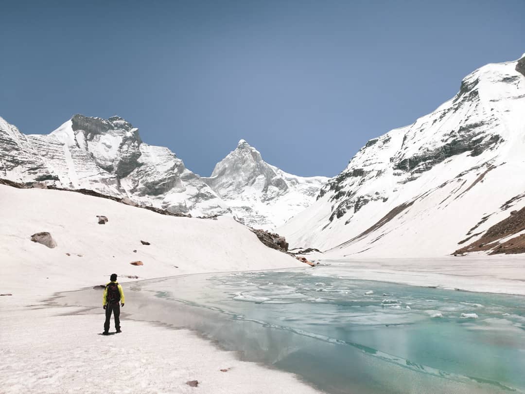
Taken at Kedar Tal region.
Meanwhile, I’ll try to share these incredible landscapes I was able to witness in my most honest and humble way.
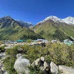
Gangotri to Kedartal trek
My clock read 4: 20 PM. I quickly wore my shoes and had to come out of my tent to wipe off the huge amount of snow accumulated above my tent. And then I looked up the sky it was all hazy and cloudy in all its glory!
The last 4 hours had been completely rough. Snowfall and thunderstorms have dominated the afternoon. Today’s climb was pretty intense and after about 7 hours of some super steep climbing, we reached the base of Patangini Pass at around 4920 m above sea level. There was not a single cloud in the sky, and hardly any wind when I reached the campsite.
Related: Auden’s Col (Rabbit is calling) 3-pass Trek Blog
Within no real-time, the weather has decided to change. Black gloomy clouds started hovering over and it didn’t take too long to stated snowing heavily. It lasted for about some 4 hours. The landscape outside was completely white-out. This is what Life in the Himalayas is all about, the unpredictability.
I came out of my tent to get some water for myself. As the temperature outside was way below zero, there was no ready water source nearby. We had to melt the snow to get some water for ourselves. But the view outside was an absolutely thrilling one and make you feel worth all these hardships in the mountains.
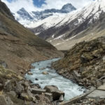
Kedartal lake
A few days back I wrote about Mt. Shivling, Mt. Thalay Sagar, and Mt. Meru being my crush mountains.
Thalay Sagar is a mountain in the Gangotri Group of peaks in the western Garhwal Himalayas, on the main ridge that lies south of the Gangotri Glacier.
It lies in the northern Indian state of Uttarakhand, 10 kilometers southwest of the Hindu holy site of Gaumukh (the source of mighty Ganges). It is also the second-highest peak on the south side of the Gangotri Glacier (after Kedarnath).
But the fascination starts here, it is more renown for being a dramatic rock peak, steep on all sides, and a haunting dream for mountaineers. It is adjacent to the Jogin group of peaks and has the glacial lake Kedartal at its base which is very popular among the trekking community.
Climbing History Of Thalaya Sagar Peak
A team of Japanese first attempted the summit in 1955 but unfortunately, an avalanche hit them just before the summit and resulted in fatal death of all climbers. In 1985, again a Japanese team has first made the successful summit from it’s North Face. And after that in 2008, a mountaineer from Bengal named Basanta Singha Roy became the first Indian to summit the peak.
From that day till today only a handful of mountaineers have climbed Thalay Sagar and the rest of us (including me) have done this in our wildest dreams!
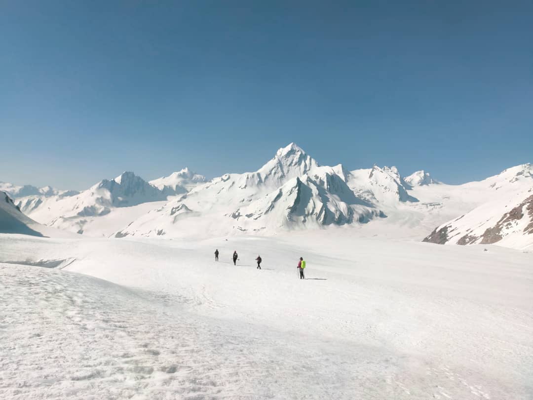
If you’re climbing to the glacier as notorious as Auden’s col, what route would you prefer?
Would you take the typical route which starts from Gangotri and attempting Auden’s col via Rudrigayara Valley or you would rather take a longer route which goes all the way to mighty Kedartal first, then you climb 5100m to a pass called Patangini Dhar; cross the ridge, negotiate an infinite ocean of snow, reach Auden’s Base and then attempt the summit from Gangotri III side? I chose the latter.
It was a longer route which first takes you to Kedartal first and then you march towards the mighty Auden’s Col. It also serves as kind of an acclimatization climb (though calling Kedartal hike as an acclimatization climb is quite unfair due to the difficulty of the route to Kedartal).
Also, the trail to Kedartal was very messed up due to the immense amount of untimely snowfall the region has received and the trail after Kedarkharak was also affected badly with avalanches and landslides.
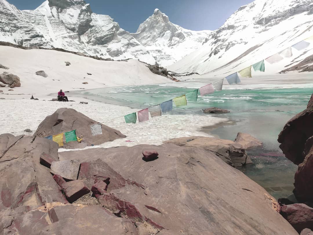
Taken at Kedartal.
Generally at this time of the year, one would expect the Tal to be in its beautiful turquoise blue color but because of heavy snowfall, Tal was completely frozen. And trust me, it had its own charm!
Exploring Kedartal
If you will ask any mountaineer which is that dream Mountain which you want to conquer, the answer will be likes of Mt. Everest, Mt. Lhotse, Ama Dablam, Mt. Kanchenjunga, Mt. Denali, etc.
My dream mountain is right there in the rightmost corner of this picture, it is called Mt. Thalay Sagar. Yes, two mountains in Himalayan ranges have fascinated me like anything in a recent while:
1. Mt. Thalay Sagar (6904 m)
2. Mt. Meru (6660 m)
Now I will need a life or two to describe how beautiful and fascinating Mount Meru is. I probably will talk about it sometime later. Its infamous “Shark’s Fin” route which was first summited by Conrad Anker & Renan Ozturk, and it’s stories give me utter goosebumps.
On the other hand, Mt. Thalay Sagar is like a dark horse, rather an underdog. Thalay Sagar is located 16km Southwest of Gaumukh Glacier. If you hike to Kedartal, you can see it right there in front of you. Thalay Sagar rise right from its base to sky-high at Kedartal.
Thalay Sagar is a rarely attempted peak in the Garhwal region. A team of Japanese first attempted the summit in 1955 but unfortunately, an avalanche hit them just before the summit and resulted in fatal death of all climbers. In 1985, again a Japanese team has first made the successful summit from it’s North Face. And after that in 2008, a mountaineer from Bengal named Basanta Singha Roy became the first Indian to summit the peak.
From that day till today the only handful of mountaineers have climbed Thalay Sagar because of the difficulty it’s route possesses.
As I rightly mentioned the word “dream” as I don’t know how many lives I will take to summit it (if at all this ever happens). But is it even a dream if it’s not out of your reach?
P. S. A very close friend of mine and a professional mountaineering guide Som Nath also shares the same dream. The only difference is, right now he just came back from Deo Tibba Summit Expedition and now he is scaling the Stok range; summiting Kang Yatse II.. while on the other side, I am right here, writing this silly post, eating chips, shamelessly dreaming about submitting Thalay Sagar one day!
Porters: Superheroes of Himalayas
Porters- the most underrated fraternity working and living since ages in mountains. While people around the globe have slowly started recognizing the importance of a Sherpa in mountaineering, porters, however, remain unsung.
While the work of a sherpa and a porter is closely aligned, there’s a significant difference when it comes to the responsibility they share. Porters are the community lives in the mountains who make their living out of carrying loads in the mountains.
Porters are the reason why every single trek/expedition ever succeeds in high altitude Mountains. Be it a moderate-high altitude hike or extremely high altitude mountaineering expeditions, it’s almost impossible to succeed in any expeditions without porters. They are the real backbone of mountaineering, and I mean it big time.
Everything you see in the mountains that nature didn’t put there – a porter did. For people like us, the trail can be hard, the air thin, and the gears are really heavy. Porters are accustomed (naturally gifted I would say) to the altitude and thin air (many even have different physical characteristics from you and me – special adaptations to cope) and spend their lives carrying loads in the mountains. Their physic is naturally gifted to sustain the inhuman weather conditions that you and I hardly can.
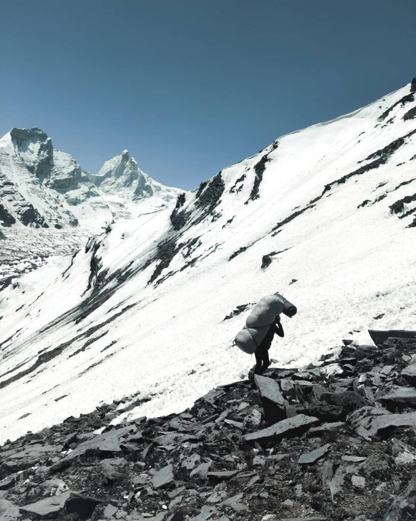
Next time if you happen to meet a porter when you’re in the mountains, give them a huge smile, ask them if they need something and pay them good. They are the most interesting fraternities one can find in mountains, having so many stories from the corners you and I only can imagine.
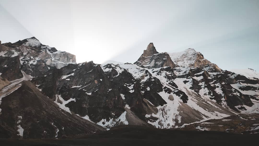
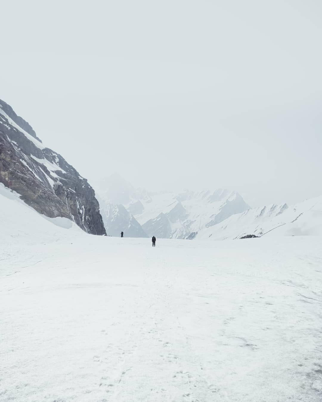
Kedartal to Kedar Kharak
Nature, the earth, this whole wide landscape can teach us what our school can’t, what our job can’t, what our everyday life can’t. They can make you realize certain things after which you can never think those things in the same way.
Being here, in the middle of this calamity-turned-magnanimity, watching a beautiful sunrise unfold over Mandakini Range, my tiny brain unable to comprehend nature.
But, when you realize you are just a small dot, you feel liberated. Liberated from the chains of life – job, bills, and everything. Even if for a moment, this feeling of liberation is most satisfying. You feel a sense of calmness.
To put things into perspective – the human eye is the widest ever lens – there is no other lens/ camera that can see as wide as we do in a single frame. Yet, my eyes could not see beyond 0.0001% of this Mandakini Range spread over till my eyes could see and beyond.
Every time you witness such magnanimity – watching a sunrise or a sunset, among most of these untouched regions, you come on terms with several unstated facts.
That you are just a speck in this entirety. You are even smaller. You are perhaps nothing.
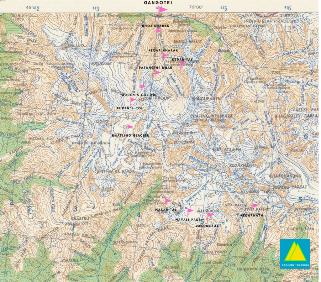
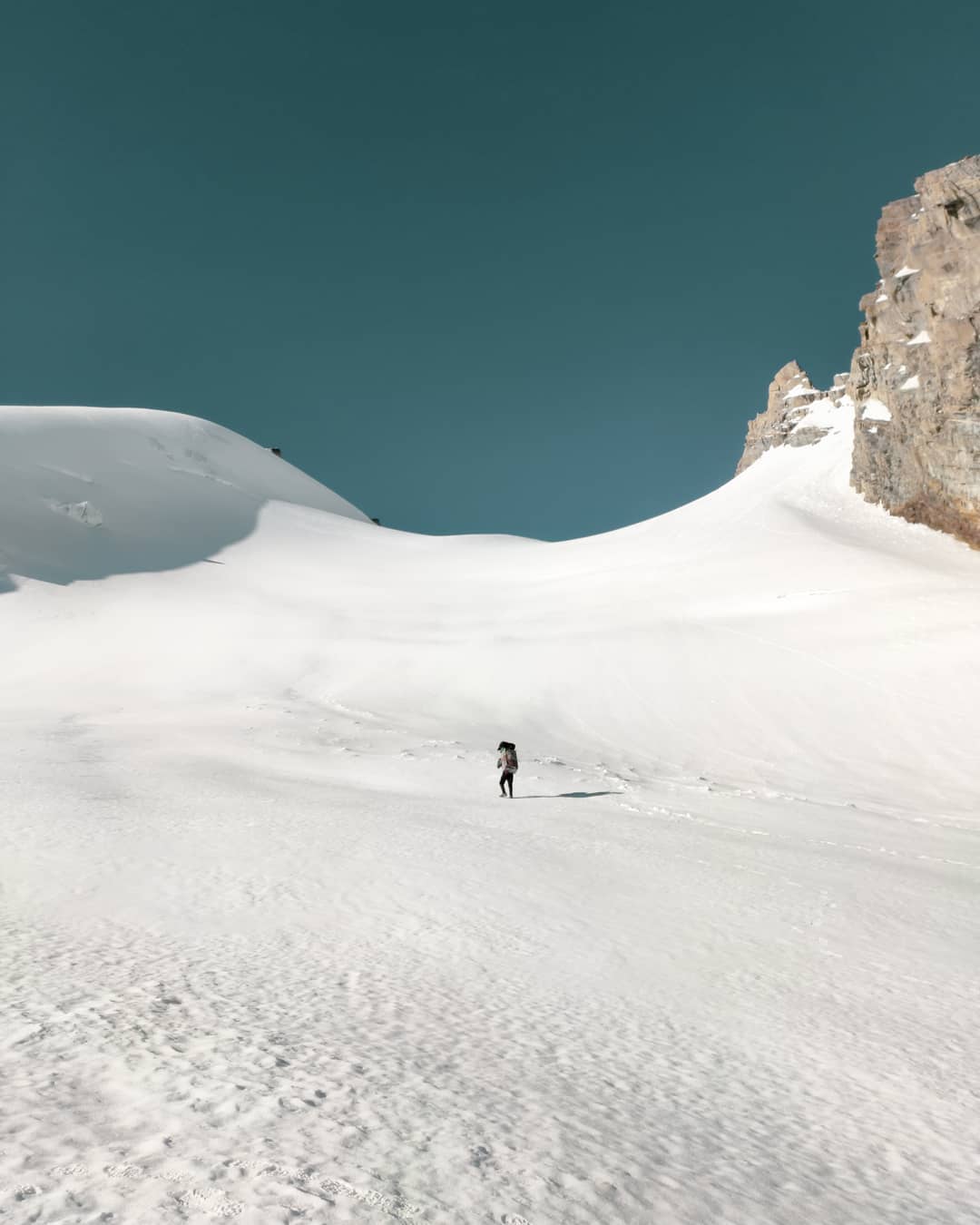
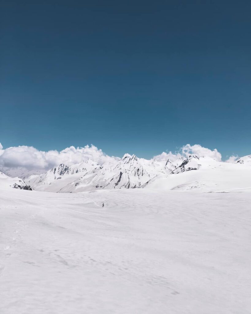
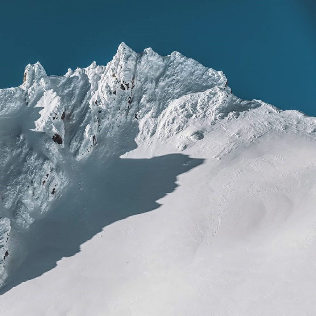
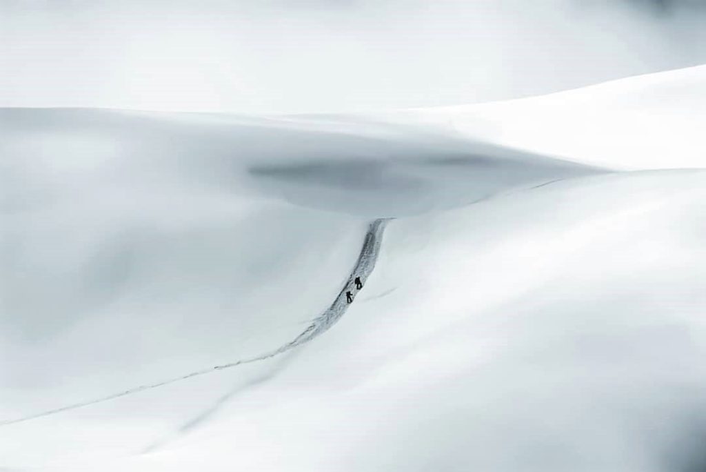
Patangini Dhar to Auden’s Col
This Col in the picture connects Gangotri range on the right to the Jogin range on the left, two of the biggest mountain massifs in the Uttarakhand region of Himalayas.
The approach to Auden’s Col was definitely exciting as hell because the infamous speculations about this Col stand really high amongst all the climbing sections across the globe.
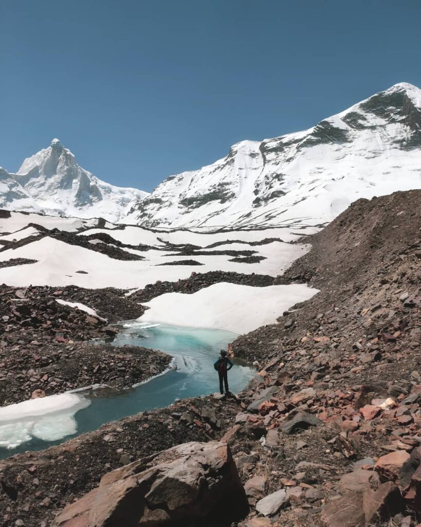
The last evening we have set up our camp right at the base, and it was scary because we faced a crazy snowstorm a day previous to this, we haven’t really seen the Col till the morning thy day and we weren’t really sure if we will be able to attempt it or not. But luckily the weather opened up to wonderful daylight and that soft snow made it an amazing ascent for us.
Bad weather at such high altitude in the mountains is literally a curse, you should do whatever to please the Mountain Gods and really hope for good weather windows while you are approaching the summit. Respecting the mountains is really the most important thing.
As you can totally see in this picture the scale of what we are in front of these huge mountains, bad weather can easily take your life in such hazardous situations. One should always be respectful to nature.
From my side, I sang a few songs to please Mountain Gods. We did face extreme snow blizzards and crazy bad weather when we were 2 camps prior to the Col but luckily it all went well on the day it mattered the most. I must say the Mountain Gods do enjoy my songs!
Final Ascent To The Auden’s Col: The D-Day
I was literally day-dreaming this moment for the last two and a half years.
So there I was, upon the base of Col. I could feel the clouds within my reach. Exhausted and exceeding my limits- physically and more importantly emotionally, in a blissful state of oblivion.
I woke up freezing in extreme cold, it was pitch dark outside, even after adjusting my eyes I couldn’t make out what’s going on outside my tent. I looked at my watch and it was about 2:30 at night. I could hear the wind blowing mercilessly outside my tent. Even after all the possible attempts of warming my body I just couldn’t stop shivering and it continued through the day until we camped on Khatling Glacier.
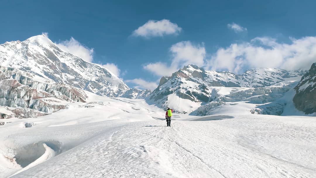
Seeking mountain’s permit, putting one step after another against the cold wind, crossing crevasse one by one slowly, only aiming to go higher towards the peak which seemed near but at the same time so far.
The battle was less outside and more inside. It took away almost everything from me. And there was not much left after hiking and climbing for many days, missing out on peaceful sleep due to spending many nights at an altitude above 5100 meters. Above all, one has no appetite, eating food was already an achievement at this height.
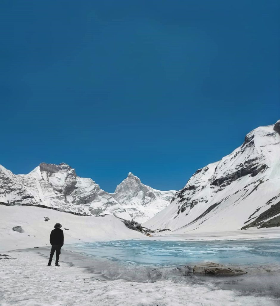
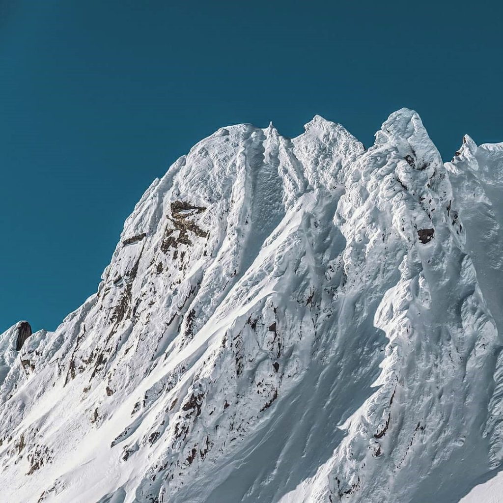
One can see a huge ridge at the distance in this picture, it’s Col. The Col connects Gangotri range- I II and III to Jogin Range I and II at the altitude of 18,200 ft.
Rabbit’s Ear
When the snowy, slippery and steep path opens up to this view, the best we can do is to cherish the moment in silence. We often fail to express true joy in words as it can only be felt and lived.
I invariably notice little flora and fauna during my expeditions, ask questions about every wonder of nature that falls on the way, but almost always fail to vocalize the feelings when I see the magnanimous and humbling vistas like these.
It is moments like these that keep inspiring you to climb more and more, venture into the absolute wilderness, see more and come back to the mountains. Because once you have lived with them, for any period of time, there is no going back.
This sharp rock face standing tall in the frame appears to be as a rabbit’s ear from a distance when you are approaching the Col and hence the name.
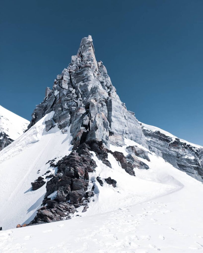
It does sound cute, but reaching this Col was one hell of an effort. We started at around 3:30 in the night from the base, which looked so close but it took us more than 7 hours to reach the top.
The snow was so soft that we almost went waist-deep in it at some patches, the oxygen levels are very low at the height of 18000 feet, so taking every step in that deep snow was way more than tiring, and to top it all the huge crevasses were hidden below us under this soft snow which was definitely the most dangerous part.
Suddenly reaching to this point unexpectedly was surely the highlight of that climb to the Rudrigiyara Valley.
Related: Exploring the Riskiest Trekking Routes in India: (Cases of Avoidable Accidents)
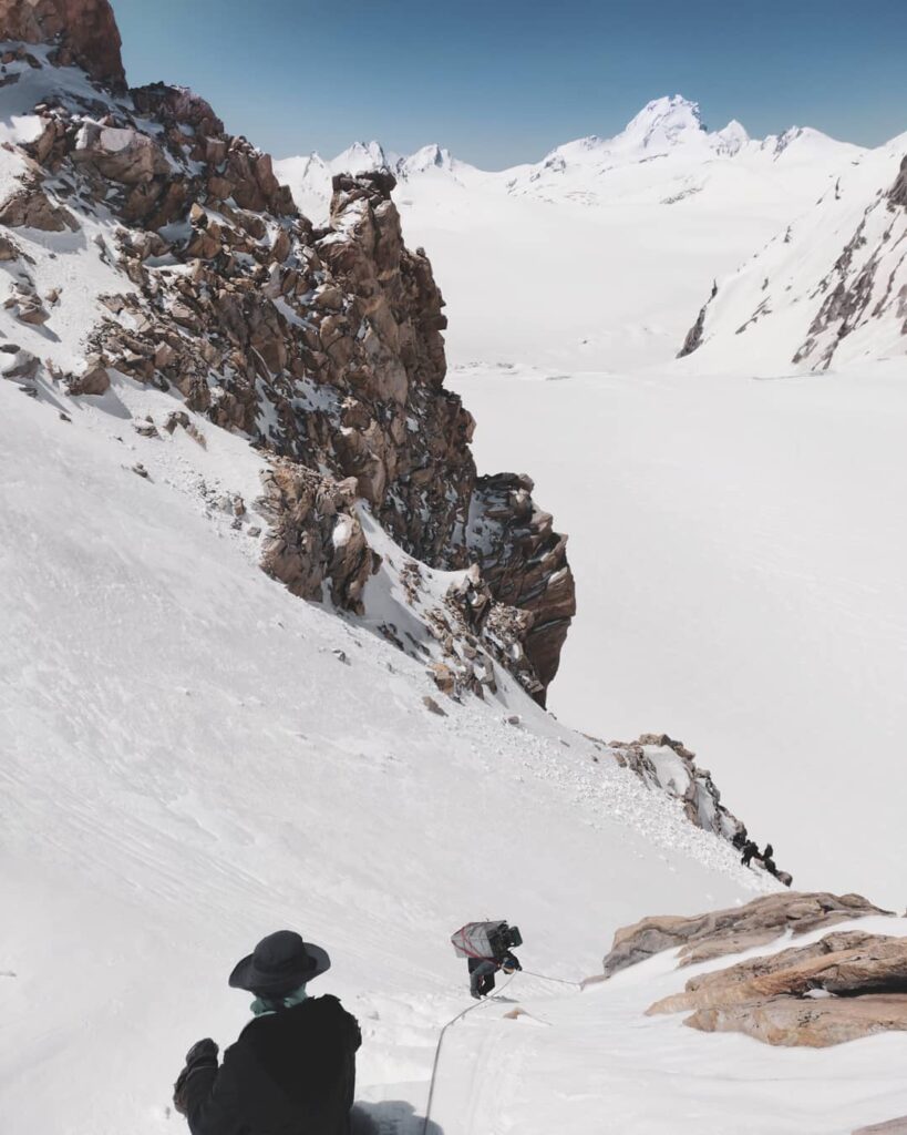
Descending Auden’s Col
The descent from the Auden’s col is among the most fascinating thing I have ever done in the Himalayas. I will keep this section right up with the likes of Pandu Pull crossing in Pin Parvati Expedition. But this section challenges you more technically due to its terrain.
Once you cross the Auden’s col and descent down, you encounter a steep vertical gully. One needs to negotiate this long vertical descend to enter into Rudragiyara Valley. Once you cross this gully, you straight away get exposed to gigantic Khatling Glacier.
Related: Auden’s Col (Rabbit is calling) 3-pass Trek Blog
The gradient of the gully is almost 70° so you just can not simply descend down using your crampons & microspikes and do rappelling straight away.
As this gully is almost a kilometer long, you have to fix a rope to get the support and make your way all the way down. In some cases, you have to use carabiniers to ensure extra safety if the snow level is higher.
You get the bird’s eye view of Khatling Glacier from here. The landscape was totally obscured by haze and the visibility had started decreasing slowly- notorious Himalayan weather after all!
Snowfields of Auden’s Col
After descending a steep 800m vertical gully after crossing the Auden’s Col, I finally set foot onto the snow covered Bhilangana Valley. Phew! I can feel my heart racing. Regaining my breath I start sliding down the initial steep section of the snow until I can start walking as if slopes out. Boy.. now lies the infamous snowfield of Khatling Glacier right in front of my eyes.
The initial descend into Khatling is a bit steep so I needed to use ice axe to open the route while sliding sideways into the soft late afternoon snow. Once into the valley one can easily walk upright into the snow. I make my way downstream into the Bhilangana river.
After 4 hours intense descent you are exposed to Bhialangana Valley and you get you beautiful views surrounded by the peaks of Jogin group (Jogin I, II & III), Sphetic Pristwar, and Barte Kauter.
Also territory of Khatling is 18ish km long and it’s very difficult to completely navigate the entire glacier in a single day. So finding a safe campsite is also a challenge.
Here and there the glacier is full of wide and open crevasses. I retrace my steps and keep searching for safer route to navigate the glacier. Trick here is to rope up yourself for extra safety.
This region throws two different kind of challenges at two different period of time. Somewhere in Sept the crevasses are very wide and open due to melting of snow. And in the month of June snow level is generally very high so this crevasses are hidden which is also very dangerous.
So next time when you want to “conquer the mountains” give it a second thought. Maybe!
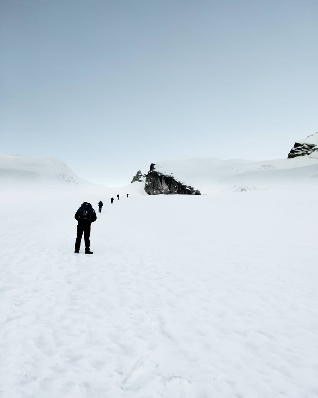
Auden’s Col to Khatling Glacier
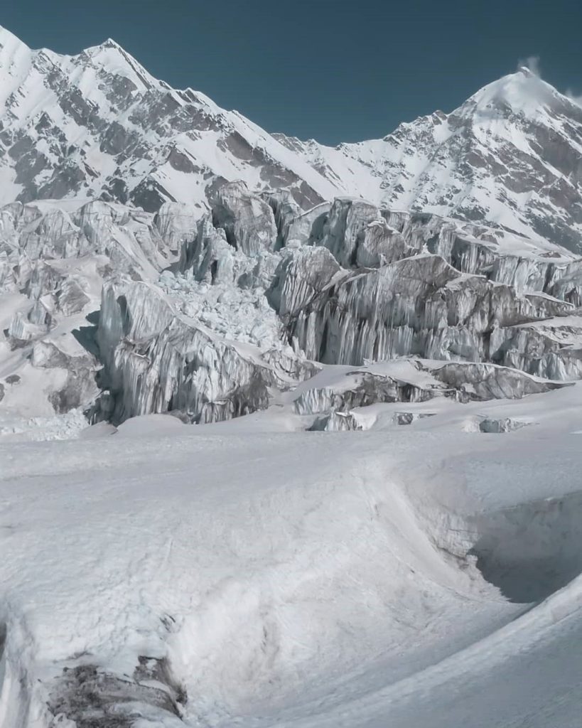
Khatling Glacier: An ocean of crevasses
Once you cross the Auden’s col, you enter into infamous Khatling Glacier. It resides on the south ridge of Bhilangana Valley which separates Rudurigiyara Valley from Kedarganga Valley.
Khatling Glacier is an ocean of snow terrain invaded with infinite (I mean it!) crevasses & hidden crevasses. It’s a long 19 km glacier with various challenges imposed with it.
If you’re on Auden’s col expedition, Khaltling Glacier is one of the biggest challenges because of its crevasses. And if the weather is bad and if it snows while you’re on it, it becomes more dangerous as fresh snow covers the crevasses and you absolutely can not spot where these crevasses are. It looks like a flat surface but once you step on it, it breaks rigorously.
With all these revolved around this, Khatling is also one of the prettiest regions in Garhwal Himalayas. Being completely out of the shadow of civilization, it has some of the most spectacular and mesmerizing landscapes to offer.
Only a handful of climbers have hiked to Khatling Glacier by now (and this secludes me to hike this) because of its remoteness, involvement of technical climb, and various risk involved in it. I genuinely feel very fortunate to be among these few.
Khaling Glacier and Crevasses
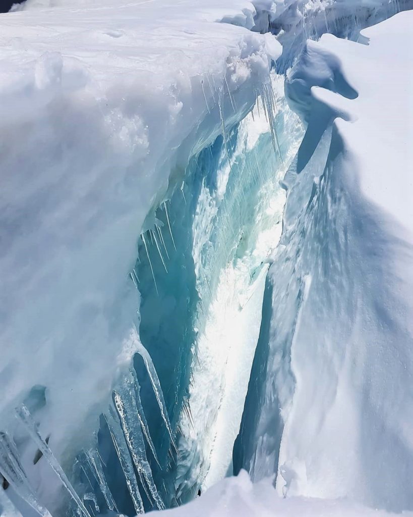
A crevasse is a very common term used specially in glacier navigation field. Crevasses form as a result of the stress generated when two semi-rigid pieces above a plastic substrate have different rates of movement.
Crevasses are a major safety concern, especially when traversing glaciers.
The Indian Himalayas is home to some of the giants and renowned glaciers of globe.
Khaltling glacier is one such long and deadly glaciers which connects Kadar Ganga Valley and Rudrigyara Valley.
Khatling Glacier is full of transverse and longitudinal crevasses which is a result of shear stress from the margin of the glacier and longitudinal compressing stress from the lateral extension.
Crevasses often have vertical or near-vertical walls, which can then melt and create seracs, arches, and other ice formations. crevasse may be as deep as 40 metres, as wide as 20 metres, and up to several hundred metres long.
The most tricky thing here is the hidden crevasses that are buried under the hefty amount of snow and many times very tricky to identify.
The Gateway of Bhilangana Valley: Khatling Glacier
The Bhilangna valley is situated in the Tehri district of Uttarakhand. This area falls under the bio geographic zone 2B-Northwest Himalaya (Rodgers et al. 2000). Ridges of Vasuki-Tal, Sahasra Tal, and Masar Tal surround this valley from east and west respectively.
Similarly, mighty Khatling glacier and Tharti division lie in north and south respectively.
The icy glacier of Khatling is surrounded by magnificent snow-capped Himalayan peaks such as Jogin group (6466m), Sphetic Pristwar (6905m), Barte Kauter (6579m) Kirti Stambh (6902m) and many unknown peaks.
Khatling is an important glacier of Garhwal Himalayas which is also the source of river Bhilangna.
This lateral glacier situated in Tehri district is the source of river Bhilangna. The moraines on the side of the glaciers look like standing walls of gravel mud.
Khatling glacier snowfields
This picture is of Khatling Glacier which situated in Rudrigiyara Valley. This glacier is also the source of Bhilangana river. There are many beautiful peaks like Gangotri group of peaks, Jogin group of peaks resides south west to the glacier.
Being among the most remote and secluded region of Indian Himalayas, Khatling glacier is also among the longest glacier crossing along with likes of Kang La (Zanskar) and Nandadevi (Uttrakhand) glacier.
Sometime it just make me wonder and make me think for hours that by any chance our next generation would be able to see all these natural wonders we’re witnessing (or destroying maybe)?
The Route To Bhilangana valley
There are several routes you take to reach this valley- the conventional route is to reach Ghuttu and ascend via Ree and Gangi another is via Mala Village, Uttarkashi but it’s a very long route takes additional 6-7 days of hiking.
This valley is the gateway to many secluded corners like Masar Tal, Vasuki Tal, Shastra Tal, Mayali Pass, and also the gateway to mighty Khatling glacier.
There are few Unnamed peaks in this region which are virgin and don’t have much information about it. One in the frame is among the same.
Turn back from Mayali Pass
The Art of Turning Around
The art of knowing when to turn around is a humble art.
And most important in my opinion. I understand the frustration of returning back especially when you have invested a lot into it. Not just the finance part but for your mental, emotional, and physical investment.
For instance, me being always stuck in my otherwise 9 to 5 world, it’s almost impossible to plan and execute such high altitude expeditions again.
Last year I had to turn back from Mayali Pass (Western Garhwal Himalayas, Uttrakhand) because of excessive snow conditions. The trail lead to the pass had more than 3 and a half feet of snow along with the very bad weather conditions which make the hike very difficult as well as dangerous.
When the “what ifs” seize to hijack your amygdala, when it stops feeding you with illusions like “ then these unwanted screams in your head start boggling.
The art of turning around is about taking control over that voice in your head that so desperately is trying to convince you that “the weather will change”, “it’s not that bad”, “you invested so much into this already”, “coming back another time is going to be so painful, so better get it over with now!”.
.
When you master the art of turning around then there is no doubt. It’s easier said then done, to be realistic in a situation where you have invested so much. Practice makes perfect and I heard this quote of Dalai Lama.
If you can do something about it, don’t worry. If you can’t do something about it, don’t worry.”
Dalai Lama
There are few clear cut indications when you need to turn around apart from special conditions like absolute scarcity of water resources, bad weather, physical injury, wrong gears for the terrain, and the list goes on. Maybe I’ll attempt this again in the coming years, just maybe.
[starbox]
- Lamkhaga Pass Trek Log—June 2014 Expedition
- Lamkhaga Pass Trek Log – June 2015 Expedition
![Night was the only time, when sky used to open up [Lamkhaga pass trek expedition 2015]](data:image/svg+xml;base64,PHN2ZyB4bWxucz0iaHR0cDovL3d3dy53My5vcmcvMjAwMC9zdmciIHdpZHRoPSIxNTAiIGhlaWdodD0iMTUwIiB2aWV3Qm94PSIwIDAgMTUwIDE1MCI+PHJlY3Qgd2lkdGg9IjEwMCUiIGhlaWdodD0iMTAwJSIgZmlsbD0iI2NmZDRkYiIvPjwvc3ZnPg==)
- Chitkul – Last Village On India-Tibet Border
- Lamkhaga Pass Trek Expedition (from Chitkul to Dumti)
- Baspa River Crossings (enroute Lamkhaga Pass)
![Night was the only time, when sky used to open up [Lamkhaga pass trek expedition 2015]](https://cdn.raachotrekkers.com/wp-content/uploads/2018/03/Lamkhaga-1-73-2-150x150.jpg)
Brijesh manages to find time for mountaineering, landscape photography, and music while writing code for a software company in Hyderabad. Some notable Himalayan passes he has climbed are Auden’s Col, Pin-Parvati, and Sar pass.
Leave a Reply