[From Chitkul: The last village of Kinnaur, Himachal to Harsil via Lamkhaga Pass (5284mtr)] [MAY-June 2015]
Trek Itinerary We Followed
28th May: Reach Base Camp Chitkul by road from Shimla
Trek Starts:
- Day #1 29th May: Chitkul (3435 meters) to Nagasthi – Rani Kanda (3700 meters) 10 km 5 hr trek.
- Day #2 30th May: Rani Kanda to Dumti (4050 meters) – 9 km/5 hr trek.
- Day #3 31st May: Dumti to Gundar (4450 meter) – 15km/7 hr trek
- Day #4 1st June: Gundar (4400 mtrs) to Lamkhaga Pass Base Camp (4400 meters)
- Day #5 2nd June: Lamkhaga Pass BC to Base Camp 2 (Kinnaur)
- Day #6 3rd June: Lamkhaga Pass BC(Kinnaur) to Lamkhaga Pass BC (Gangotri Side) via Lamkhaga Pass (5282 mts/17320 ft) / 14432 ft) 11 km/6 – 7 hr trek
- Day #7 4th June: Lamkhaga Pass Base Camp to Kyarkoti (3820 meter) – 16 km/7 – 8 hr trek
- Day #8 5th June: Kyarkoti to Harsil (2400 meter) – 14 km/6-7 hr trek
Day 1:
CHANDIGARH- SHIMLA:
Pahari Hospitality at its best: All restaurants were closed by the time we reached Shimla. After searching for food nearby passport office without any vehicle(our driver had left after dropping us at the hotel) we failed to get one. It was 12 am, the hotel manager and his assistant had to specially prepare rice and dal for us from their own personal kitchen.
Day 2:
SHIMLA-KALPA
Enchanting Kinnaur, Irritating hydro-projects, awesome curvy drive, and the humble driver:
First of all, thank you Vikas for arranging the car. Will make sure to recommend him to my friends if needed at all in the future.
Today’s journey began with Aloo paranthas and a glass of bournvita just on the outskirts of Shimla. While eating parathas, we never thought that we will be hating paranthas so much at the end of our journey and we still do while I type this, however you will come to know as the Tlog progresses. Weather was pleasant and eating fresh Narkanda cherries was surely a ‘cherry on top’ to add in this journey.
The tea and the mischievous kids playing at Wangtoo tea house was fun. One layer of cloth comes out of the bag at this place.Brrrrr! Though we were driving on NER, the vistas were getting more beautiful. We reached Rakpa regency at Kalpa @10pm passing through muddy Karcham-Powari stretch to the beautiful dark town of Reckong Peo, through clouds and rains which got vanished later when we entered our room. The moonlit Kinner Kailash range was the most beautiful vista ever and the long tiring journey was totally worth it for this.
![Near Chaura Check post [Lamkhaga pass expedition 2015]](https://cdn.raachotrekkers.com/wp-content/uploads/2018/03/Lamkhaga-1-25.jpg)
![Boundary gate of Kinnaur district [Lamkhaga pass expedition 2015]](https://cdn.raachotrekkers.com/wp-content/uploads/2018/03/Lamkhaga-1-42.jpg)
![View across Satluj valley [Lamkhaga pass expedition 2015]](https://cdn.raachotrekkers.com/wp-content/uploads/2018/03/Lamkhaga-1-87.jpg)
![Tranda Dhank kinnaur [Lamkhaga pass expedition 2015]](https://cdn.raachotrekkers.com/wp-content/uploads/2018/03/Lamkhaga-1-47.jpg)
Tranda Dhank, Hindustan Tibet road, Kinnaur.
![National Highway 5 [Chaura - Bhabanagar stretch , Lamkhaga pass expedition 2015]](https://cdn.raachotrekkers.com/wp-content/uploads/2018/03/Lamkhaga-1-43.jpg)
![Satluj river choked by numerous Hydro electric project built on the river [Lamkhaga pass expedition 2015]](https://cdn.raachotrekkers.com/wp-content/uploads/2018/03/Lamkhaga-1-44.jpg)
![Places in Kinnaur and their altitude [Lamkhaga pass expedition 2015]](https://cdn.raachotrekkers.com/wp-content/uploads/2018/03/Lamkhaga-1-46.jpg)
Day 3
KALPA – Hike to CHAKKA KANDA (~4000mtr)- KALPA and drive to CHITKUL
Chakka is a small peak which lies behind and above Kalpa town. Though a small hike for a little bit more than 1000mtr, it is a very good place for acclimatization for all the trekkers/travelers in that region. Just below the peak, lies Chakka Kanda, a lake that is culturally important for Kinnauris. It takes 2 -3 hours to reach.
We hired a car to Chitkul at 4 pm from Kalpa after descending down from Chakka Kanda.
Hotel in Kalpa: Rakpa Regency & Hotel in Chitkul:Shenshah/Shahenshah/Shen Sha or whatever you call it. Both the properties are run by Mr. Sandeep Karar.
All the rooms were charged 1500 INR/room after immense bargaining in advance as we did not have any options left. The stay at Kalpa has to be the best for its hospitality and views.
Hotel to Chakka Kanda
Time taken: 2 1/2 hours
Height gained: 800 meters. Just before lake, we stopped due to time restrictions.
![Night Landscape , Kalpa [Lamkhaga pass expedition 2015]](https://cdn.raachotrekkers.com/wp-content/uploads/2018/03/Lamkhaga-1-5-2.jpg)
![Night Landscape view of Kinner Kailash range , Kalpa [Lamkhaga pass expedition 2015]](https://cdn.raachotrekkers.com/wp-content/uploads/2018/03/Lamkhaga-1-3.jpg)
![That Morning , Kalpa [Lamkhaga pass expedition 2015]](https://cdn.raachotrekkers.com/wp-content/uploads/2018/03/Lamkhaga-1-9-2.jpg)
![Chaka meadows can be seen from our hotel, Kalpa [Lamkhaga pass trek expedition 2015]](https://cdn.raachotrekkers.com/wp-content/uploads/2018/03/Lamkhaga-1-18-2.jpg)
![Chaka stream , en route Chaka meadows , Kalpa [Lamkhaga pass trek expedition 2015]](https://cdn.raachotrekkers.com/wp-content/uploads/2018/03/Lamkhaga-1-31-2.jpg)
![Walking along Chaka stream , en route Chaka meadows , Kalpa [Lamkhaga pass trek expedition 2015]](https://cdn.raachotrekkers.com/wp-content/uploads/2018/03/Lamkhaga-1-30-2.jpg)
![Chaka stream , en route Chaka meadows , Kalpa [Lamkhaga pass trek expedition 2015]](https://cdn.raachotrekkers.com/wp-content/uploads/2018/03/Lamkhaga-1-29-2.jpg)
![Walking along Chaka stream , en route Chaka meadows , Kalpa [Lamkhaga pass trek expedition 2015]](https://cdn.raachotrekkers.com/wp-content/uploads/2018/03/Lamkhaga-1-28-2.jpg)
![Pebbled path , en route Chaka meadows trek [Lamkhaga pass trek 2015]](https://cdn.raachotrekkers.com/wp-content/uploads/2018/03/Lamkhaga-1-27-2.jpg)
![Chaka stream , en route Chaka meadows , Kalpa [Lamkhaga passChaka stream , en route Chaka meadows , Kalpa [Lamkhaga pass trek expedition 2015] trek expedition 2015]](https://cdn.raachotrekkers.com/wp-content/uploads/2018/03/Lamkhaga-1-16-3.jpg)
![Chaka meadows , Kalpa [Lamkhaga pass trek expedition 2015]](https://cdn.raachotrekkers.com/wp-content/uploads/2018/03/Lamkhaga-1-11-3.jpg)
![Somewhere above ~500 metres is the last house enroute , Chaka meadows trek [Lamkhaga pass trek expedition 2015 ]](https://cdn.raachotrekkers.com/wp-content/uploads/2018/03/Lamkhaga-1-17-3.jpg)
![View from the hotel room , Kalpa [Lamkhaga pass trek expedition 2015]](https://cdn.raachotrekkers.com/wp-content/uploads/2018/03/Lamkhaga-1-25-2.jpg)
![View from the hotel room , Kalpa [Lamkhaga pass trek expedition 2015]](https://cdn.raachotrekkers.com/wp-content/uploads/2018/03/Lamkhaga-1-24.jpg)
![The hotel where we stayed at Kalpa , [Lamkhaga pass trek expedition 2015]](https://cdn.raachotrekkers.com/wp-content/uploads/2018/03/Lamkhaga-1-18-3.jpg)
![The weather that night in Chitkul was luckily clear , Chitkul [Lamkhaga pass trek expedition 2015]](https://cdn.raachotrekkers.com/wp-content/uploads/2018/03/Lamkhaga-1-37-2.jpg)
Day 4:
Starting our day with super hot chai with amazing clouds in the sky. Parathas and Omelette were the only options for breakfast. It was an acclimatization day for all, and we decided to start it by 11 am. Our guide and the support team reached at Chitkul at 5 pm. There were 8 porters and 1 cook along. They camped on the banks of river Baspa.
Meanwhile, we unpacked and packed our rucksacks again, just to make sure the weight is balanced accordingly that day.
Time taken: 2 hours
Height Gained: 130mtr, towards Nagasthi ITBP and a small hill on the left.
![Camping by the Baspa river , Chitkul [Lamkhaga pass trek expedition 2015]](https://cdn.raachotrekkers.com/wp-content/uploads/2018/03/Lamkhaga-1-2.jpg)
![That morning at Chitkul [Lamkhaga pass trek expedition 2015]](https://cdn.raachotrekkers.com/wp-content/uploads/2018/03/Lamkhaga-1-25-3.jpg)
![Dhaula peak locally called aka P6465m. [Lamkhaga pass trek expedition 2015]](https://cdn.raachotrekkers.com/wp-content/uploads/2018/03/Lamkhaga-1-15.jpg)
![A home in the Himalaya [Lamkhaga pass trek expedition 2015]](https://cdn.raachotrekkers.com/wp-content/uploads/2018/03/Lamkhaga-1-29-3.jpg)
![[Lamkhaga pass trek expedition 2015]](https://cdn.raachotrekkers.com/wp-content/uploads/2018/03/Lamkhaga-1-30-3.jpg)
![Indigenous livestock , Chitkul [Lamkhaga pass trek expedition 2015]](https://cdn.raachotrekkers.com/wp-content/uploads/2018/03/Lamkhaga-1-31-3.jpg)
![Chitkul Landscapes , Baspa valley [Lamkhaga pass trek expedition 2015]](https://cdn.raachotrekkers.com/wp-content/uploads/2018/03/Lamkhaga-1-32-2.jpg)
![Kitchen in the woods , Chitkul [Lamkhaga pass trek expedition 2015]](https://cdn.raachotrekkers.com/wp-content/uploads/2018/03/Lamkhaga-1-33-2.jpg)
![Kinnauri Sheepdog, Chitkul [Lamkhaga pass trek expedition 2015]](https://cdn.raachotrekkers.com/wp-content/uploads/2018/03/Lamkhaga-1-6.jpg)
![Hiking around Chitkul [Lamkhaga pass trek expedition 2015]](https://cdn.raachotrekkers.com/wp-content/uploads/2018/03/Lamkhaga-1-19.jpg)
![Hiking around Chitkul [Lamkhaga pass trek expedition 2015]](https://cdn.raachotrekkers.com/wp-content/uploads/2018/03/Lamkhaga-1-21.jpg)
![An evening in Chitkul [Lamkhaga pass trek expedition 2015]](https://cdn.raachotrekkers.com/wp-content/uploads/2018/03/Lamkhaga-1-14.jpg)
![An evening in Chitkul [Lamkhaga pass trek expedition 2015]](https://cdn.raachotrekkers.com/wp-content/uploads/2018/03/Lamkhaga-1-13.jpg)
![An evening in Chitkul [Lamkhaga pass trek expedition 2015]](https://cdn.raachotrekkers.com/wp-content/uploads/2018/03/Lamkhaga-1-34-2.jpg)
![That night in Chitkul [Lamkhaga pass trek expedition 2015]](https://cdn.raachotrekkers.com/wp-content/uploads/2018/03/Lamkhaga-1-36-2.jpg)
Who was Marco Pallis and why Lamkhaga?
- A Greek-British author and mountaineer who was famous for his writings on Tibetan Buddhism. He made the first ascent of Leo Pargial(6790m), one of the highest in Kinnaur Himal(not be confused with Reo Purgyal) starting from Harsil all the way via unexplored/climbed LAMKHAGA PASS and then into Sutlej-Spiti valley to climb the peak in 1933. Well, we are doing the right opposite to him what he did.
Can this trek done from both the sides?
- Yes. It takes ~7 to 10 days from both sides depending on the weather.
What is the route?
From Chitkul :
Chitkul-Nagasthi-Ranikanda-Dumti-Nithal Thatch- Base camp(Baspa Glacier)-Advance base camp- Lamkhaga pass- Base camp(Harsil side)-Kyarkoti-Harsil
From Harsil :
Harsil-Banswari nalla- Gangnani -Kyarkoti-Base camp(Sukha thal)-Advance base camp(aka Pass ke neeche)- Lamkhaga pass-Base camp(Chitkul side)-Dumti-Ranikanda or Chitkul.
Personally, I feel the ascent from Harsil is more daunting. Continuous ascent! unlike gradual incline at many places from the Chitkul side. But both are equal in difficulty.
Do we need an Inner line Permit for this trek and from where to get it?
- DC office in Reckong Peo for people starting from the Chitkul side.
- DC office in Uttarkashi for people starting from the Harsil side.
Porters are easily available from Uttarkashi or Gangotri(UK) and Reckong Peo(HP) and NOT HARSIL OR CHITKUL.
Must Equipment:
Ropes, Ice Axe, Gaiters, Alpine tents(neither t3, nor t2 please) and yes Microspikes will be helpful in the month of May-June.
Altitude:
I am still confused with its altitude. According to our altimeter (G-shock) which was well calibrated, showed up 5300 metres on the pass. Old maps say 5284 metres and some source says 5326 metres.
Best Time:
There is no best time to visit higher regions, the weather takes a toll on any day/anytime. Still, it is doable from Mid-May till Mid-October.
Grade:
Difficult
Lamkhaga Trek, Day #1
Chitkul -Nagasthi(ITBP Checkpost) -Ranikanda.
A simple walk for 4 hours takes us to the beautiful Ranikanda camp site at 3700m which is situated just few metres away from Baspa river. Where we faced rain, a little headache, cold and dramatic sky.
Had the most delicious Khichdi and the soup for the lunch and Roti- Sabji-Salad for the dinner.
![Bye bye Chitkul [Lamkhaga pass trek expedition 2015]](https://cdn.raachotrekkers.com/wp-content/uploads/2018/03/Lamkhaga-1-38-2.jpg)
![Camping at Ranikanda , Trekking Day 1 [Lamkhaga pass trek expedition 2015]](https://cdn.raachotrekkers.com/wp-content/uploads/2018/03/Lamkhaga-1-51-2.jpg)
![View of upper Baspa Valley [Lamkhaga pass trek expedition 2015]](https://cdn.raachotrekkers.com/wp-content/uploads/2018/03/Lamkhaga-1-40-2.jpg)
![Reaching Ranikanda , View of upper Baspa Valley [Lamkhaga pass trek expedition 2015]](https://cdn.raachotrekkers.com/wp-content/uploads/2018/03/Lamkhaga-1-42-2.jpg)
![Reaching Ranikanda , View of upper Baspa Valley [Lamkhaga pass trek expedition 2015]](https://cdn.raachotrekkers.com/wp-content/uploads/2018/03/Lamkhaga-1-43-2.jpg)
![Camping at Ranikanda meadows , View of upper Baspa Valley [Lamkhaga pass trek expedition 2015]](https://cdn.raachotrekkers.com/wp-content/uploads/2018/03/Lamkhaga-1-44-2.jpg)
![Camping at Ranikanda meadows [Lamkhaga pass trek expedition 2015]](https://cdn.raachotrekkers.com/wp-content/uploads/2018/03/Lamkhaga-1-45-2.jpg)
![Teatime , Camping at Ranikanda [Lamkhaga pass trek expedition 2015]](https://cdn.raachotrekkers.com/wp-content/uploads/2018/03/Lamkhaga-1-45.jpg)
![Camping at Ranikanda [Lamkhaga pass trek expedition 2015]](https://cdn.raachotrekkers.com/wp-content/uploads/2018/03/Lamkhaga-1-46-2.jpg)
![Mangsu sub-range in Great Himalayan range. Charang village is situated behind this, Camping at Ranikanda [Lamkhaga pass trek expedition 2015]](https://cdn.raachotrekkers.com/wp-content/uploads/2018/03/Lamkhaga-1-39-2.jpg)
![Cook serving warm water , Camping at Ranikanda [Lamkhaga pass trek expedition 2015]](https://cdn.raachotrekkers.com/wp-content/uploads/2018/03/Lamkhaga-1-47-2.jpg)
Trek Day #2
Ranikanda – Lal Dhank – Dumti
8am:- AP’s struggle with rucksack weight and severe AMS.
It was a long hike that day going up to 4050m. Though the weather was clear, we had no trust in it either. Soon AP informed us he was having a mild headache but was okay to continue. But from the previous evening, it did not get any better, even after acclimatization walk up to 500ft nearby. He was walking slowly along with few members and porters. He gave up just before Lal Dhang at 10:30 am. His headache remained the same. VB who was walking along with him and me took his heavy rucksack, which he was carrying and in return gave his small camera bag to AP. Meanwhile, our guide Negi saw us from the edge, which was far away on Lal Dhank. He knew something was wrong and waited for us to cross the tricky part. Things were getting serious at that moment.
Negi’s views on AP:- Returning back to Chitkul did not make any sense as it is already at 3450m. It would take 5 -6 hours to reach from where we stood and descending further till Sangla (2800m) after that was completely out of the question. Continuing all the way till Dumti, which is at 4050m is again a threatening act to do. But Dumti had an ITBP camp. It had medical facilities. It had oxygen tanks but nothing in Chitkul. The only struggle was that tough scary walk from Lal Dhang till Dumti for 4 hours in the worst weather with poor visibility, wind, snow, and drizzle along. On one side it was Baspa river which was invisible and ferociously flowing down below and on the other side falling tiny rocks and slippery slopes to negotiate. All team members were separated and were just following the broken trail.
Negi was taking care of AP and was slowly walking far behind holding his hands.
We reached Dumti at 2:30 pm and along with Negi reached at 3:30 pm. But soon, he started hallucinating!
![That morning! Ranikanda meadows [Lamkhaga pass trek expedition 2015]](https://cdn.raachotrekkers.com/wp-content/uploads/2018/03/Lamkhaga-1-54.jpg)
![Kitchen tent can be seen far away in middle. Mangsu Charang range behind. [Lamkhaga pass trek expedition 2015]](https://cdn.raachotrekkers.com/wp-content/uploads/2018/03/Lamkhaga-1-53-2.jpg)
![Baspa river, near Ranikanda ITBP post. [Lamkhaga pass trek expedition 2015]](https://cdn.raachotrekkers.com/wp-content/uploads/2018/03/Lamkhaga-1-54-2.jpg)
![2 team members can be seen here. A wide horizontal angle image could have worked here to show the actual steepness of terrain. [Lamkhaga pass trek expedition 2015]](https://cdn.raachotrekkers.com/wp-content/uploads/2018/03/Lamkhaga-1-55-2.jpg)
![Well, I hope I did good with 18-55mm here ?[Lamkhaga pass trek expedition 2015]](https://cdn.raachotrekkers.com/wp-content/uploads/2018/03/Lamkhaga-1-5.jpg)
![Our porter Gopal at work. [Lamkhaga pass trek expedition 2015]](https://cdn.raachotrekkers.com/wp-content/uploads/2018/03/Lamkhaga-1-56.jpg)
![Our guide Negi waiting for us. [Lamkhaga pass trek expedition 2015]](https://cdn.raachotrekkers.com/wp-content/uploads/2018/03/Lamkhaga-1-57-2.jpg)
![VB & Gopal helping AP. [Lamkhaga pass trek expedition 2015]](https://cdn.raachotrekkers.com/wp-content/uploads/2018/03/Lamkhaga-1-58-2.jpg)
![Taking a breath [Lamkhaga pass trek expedition 2015]](https://cdn.raachotrekkers.com/wp-content/uploads/2018/03/Lamkhaga-1-2-1.jpg)
![Views of upper Baspa valley [Lamkhaga pass trek expedition 2015]](https://cdn.raachotrekkers.com/wp-content/uploads/2018/03/Lamkhaga-1-3-1.jpg)
3:30pm: AP Hallucinations at Dumti
Our cook, Rathiji prepared “sheera“(they call it halwa) after a small darshan at Karu temple. We served a tiny portion to AP in the tent. It took him 20 minutes to gulp 2 serves. He did not know what he was eating, neither he was responding to anyone. His oxygen levels started deteriorating. We immediately took him to the ITBP camp which had medical facilities as I have mentioned above. We made him sit in one of the bunkers for the warmth, but soon he started dozing off. Meanwhile, we literally requested the medical personnel to give him supplementary oxygen as soon as possible. He was made to lay down by holding his hands on the medical bed. We played music in the background so that he won’t sleep which would turn out to be fatal in such conditions. It took 15 minutes for him to get back to normal, which stayed temporary.
Well, when we asked him how was he feeling? He did not remember how and what had happened. He did not remember anything, neither the “sheera” nor the supplementary oxygen. Every half an hour, he was given supplementary oxygen till 6:00 pm for 5 minutes and some medicines(NOT DIAMOX).
Meanwhile, few members from our team had won the cricket game against the ITBP team.
AP was my tent mate. I kept on checking his oxygen levels throughout that cold night. Luckily he was OK the next morning but had to send back with one of the porters.
![Playing cricket at 4050 meter altitude [Lamkhaga pass trek expedition 2015]](https://cdn.raachotrekkers.com/wp-content/uploads/2018/03/Lamkhaga-1-61-2.jpg)
![Always maintain distance, so that snoring sounds wont clash [Lamkhaga pass trek expedition 2015]](https://cdn.raachotrekkers.com/wp-content/uploads/2018/03/Lamkhaga-1-62-2.jpg)
![Cricket field of Dumti ITBP camps [Lamkhaga pass trek expedition 2015]](https://cdn.raachotrekkers.com/wp-content/uploads/2018/03/Lamkhaga-1-63-2.jpg)
![We remember them everyday for the courage and for their hospitality [Lamkhaga pass trek expedition 2015]](https://cdn.raachotrekkers.com/wp-content/uploads/2018/03/Lamkhaga-1-64-2.jpg)
![A peak arise just towards the back of ITBP camp. [Lamkhaga pass trek expedition 2015]](https://cdn.raachotrekkers.com/wp-content/uploads/2018/03/Lamkhaga-1-66-2.jpg)
![Night was the only time, when sky used to open up [Lamkhaga pass trek expedition 2015]](https://cdn.raachotrekkers.com/wp-content/uploads/2018/03/Lamkhaga-1-73-2.jpg)
![Our strength [Lamkhaga pass trek expedition 2015]](https://cdn.raachotrekkers.com/wp-content/uploads/2018/03/Lamkhaga-1-57.jpg)
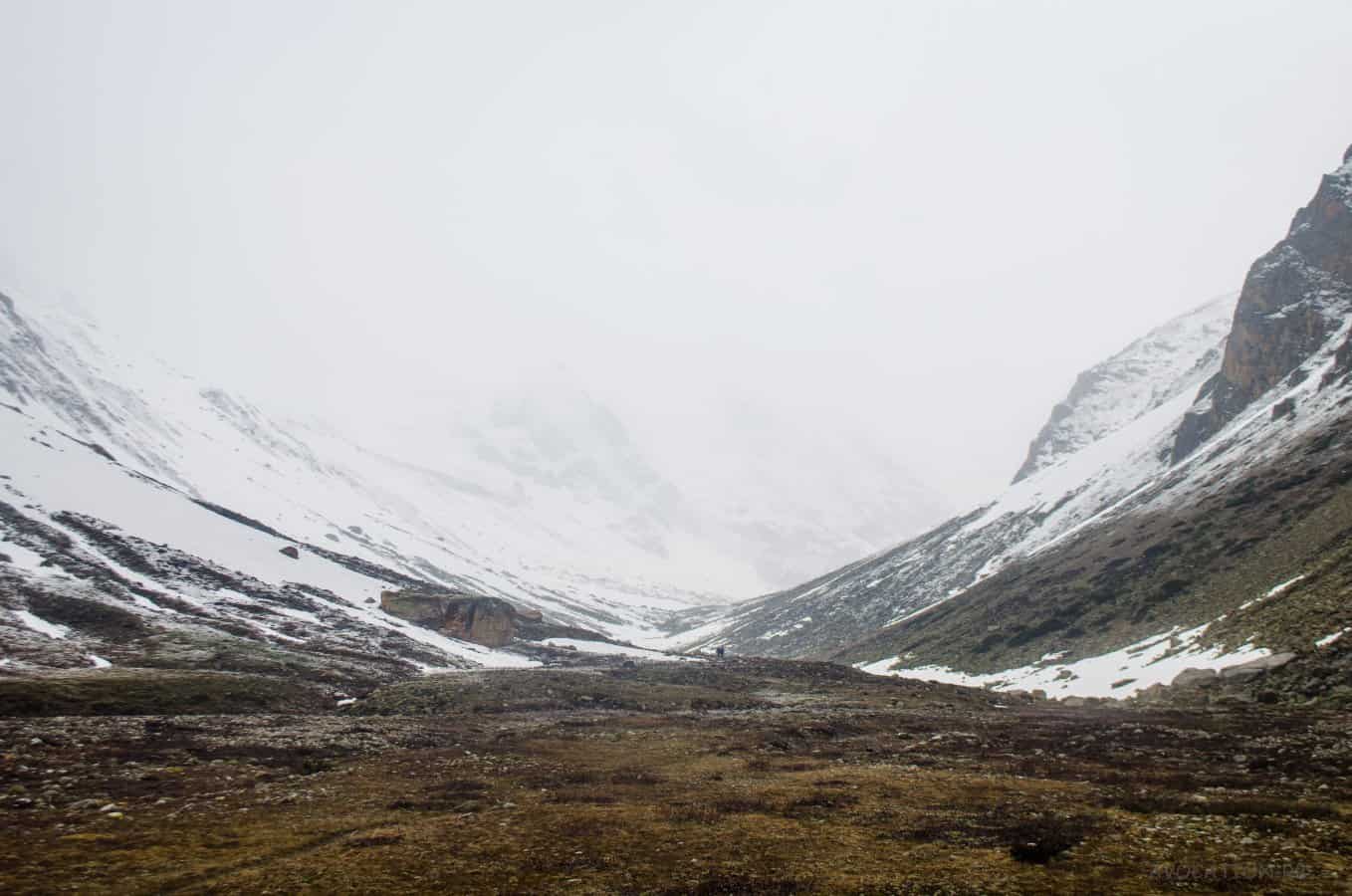
Trek Day #3
Dumti-Nithal Thatch- Gundar
The day began with Parathas and Bhindi subzi for breakfast following with the small pooja at Karu temple. A walk by banks of River Baspa all the way till Gundar Camp at 4450m. It was an easy but long walk over rocks and slight height gain. We reached around 2:00 pm. SC fell in the water while crossing it just before the camp and while rescuing her, Nishchay fell too. Quite a tough moment for both of them.
By 3:30 pm, we hiked up 1000ft for acclimatization. Due to the weather, things got worse again.
And it was again Parathas for lunch.
![Dumti expanse [Lamkhaga pass trek expedition 2015]](https://cdn.raachotrekkers.com/wp-content/uploads/2018/03/Lamkhaga-1-13-1.jpg)
![Dumti - Nithal Thach expanse [Lamkhaga pass trek expedition 2015]](https://cdn.raachotrekkers.com/wp-content/uploads/2018/03/Lamkhaga-1-1.jpg)
![Nithal Thach meadows [Lamkhaga pass trek expedition 2015]](https://cdn.raachotrekkers.com/wp-content/uploads/2018/03/Lamkhaga-1-2-2.jpg)
![Thola peak as seen from Dumti.... From the ITBP loo to be precise [Lamkhaga pass trek expedition 2015]](https://cdn.raachotrekkers.com/wp-content/uploads/2018/03/Lamkhaga-1-68-2.jpg)
![Boulder stretch en route Gundar [Lamkhaga pass trek expedition 2015]](https://cdn.raachotrekkers.com/wp-content/uploads/2018/03/Lamkhaga-1-71.jpg)
![Balancing act! [Lamkhaga pass trek expedition 2015]](https://cdn.raachotrekkers.com/wp-content/uploads/2018/03/Lamkhaga-1-72-2.jpg)
![Hiking nearby while the camp was being set up [Lamkhaga pass trek expedition 2015]](https://cdn.raachotrekkers.com/wp-content/uploads/2018/03/Lamkhaga-1-59-2.jpg)
![Waiting for the sunshine [Lamkhaga pass trek expedition 2015]](https://cdn.raachotrekkers.com/wp-content/uploads/2018/03/Lamkhaga-1-4-3.jpg)
![Hiking nearby while the camp was being set up [Lamkhaga pass trek expedition 2015]](https://cdn.raachotrekkers.com/wp-content/uploads/2018/03/DSC_0857.jpg)
![Baspa Glacier in the background. [Lamkhaga pass trek expedition 2015]](https://cdn.raachotrekkers.com/wp-content/uploads/2018/03/DSC_0858.jpg)
![Towards Tibet [Lamkhaga pass trek expedition 2015]](https://cdn.raachotrekkers.com/wp-content/uploads/2018/03/DSC_0866.jpg)
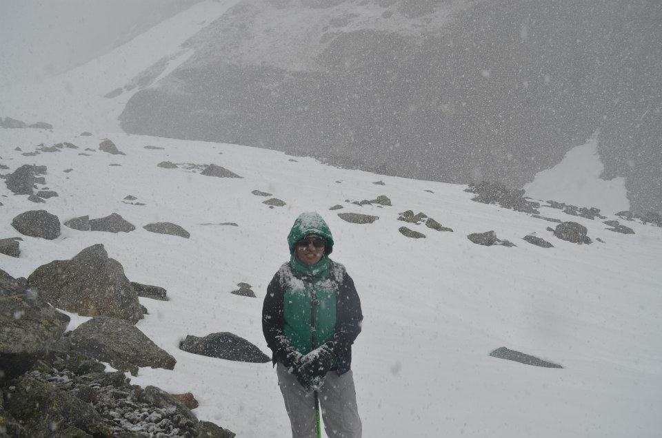
![Nithal Thatch grounds and ITBP post is just to the right. The time when we started enjoying the vistas around, snowfall began..[Lamkhaga pass trek expedition 2015]](https://cdn.raachotrekkers.com/wp-content/uploads/2018/03/DSC_0877.jpg)
The time when we started enjoying the vistas around, the snowfall began.
![Utro Utro Niche!!!!!.....The actual trek begins from here. The poor visibility and weather follows us all the way till Kyarktoti for next 3 days. [Lamkhaga pass trek expedition 2015]](https://cdn.raachotrekkers.com/wp-content/uploads/2018/03/Lamkhaga-1-82.jpg)
![Snowfall at Nithal Thach , [Lamkhaga pass trek expedition 2015]](https://cdn.raachotrekkers.com/wp-content/uploads/2018/03/Lamkhaga-1-81.jpg)
![Nischay doing some Jugaad with his wet boots... tough times ahead [Lamkhaga pass trek expedition 2015]](https://cdn.raachotrekkers.com/wp-content/uploads/2018/03/Lamkhaga-1-80.jpg)
Trek Day #4
Gundar to Immediate Camp( 2 hours before Baspa Glacier/Lamkhaga Base camp).
Probably the most beautiful morning we witnessed here. The night was just out of the world with millions of stars and the bright moon and the lit on high peaks, but it was freezing at the same time. It was difficult for me to remove the camera from the bag and tripod at that time. However, I would like to say that, those irregular nature calls in the middle of the night have given us a lot of positive opportunities to see the actual beauty through naked eyes. Words are less to describe, so does the camera.
We woke up at 4 am and had Chapatis for breakfast with Achar and papaya porridge. It had snowed a lot. The first step of the day was snow. There were pug marks of some kind of animals parallel to us. First, we presumed it to be snow leopards……LOL. But it may have been wild fox’s, we partially confirmed after immense discussion with each other. A few days after looking at the photographs, we thought that it would be some bird’s footsteps. Maybe!!!
We had to cross the Baspa stream that day. There was an icy and slippery layer on the stones. So balancing on top of stones and crossing would make us fall in the bone freezing water. It took us half an hour to cross it. But Karan fell in the water while helping out RS and she was all fine. It was a funny but frustrating situation. Snowfall increased as we move further, when Negiji finally had to stop. Because going further in that bad weather and pitching tents on glacier camp would be dangerous.
Related: Trekking Mishaps in India: What We Can Learn from Tragic Accidents?
It took 2 hours for the porters who were behind us. Finally, at 1:00 pm, we pitched our tents with all the wet boots and wet bags.
![To the East of Nithal Thach camp [Lamkhaga pass trek expedition 2015]](https://cdn.raachotrekkers.com/wp-content/uploads/2018/03/Lamkhaga-1-21-1.jpg)
![To the North of Nithal Thach Camp [Lamkhaga pass trek expedition 2015]](https://cdn.raachotrekkers.com/wp-content/uploads/2018/03/Lamkhaga-1-70.jpg)
![To the South of Nithal thach camp site [Lamkhaga pass trek expedition 2015]](https://cdn.raachotrekkers.com/wp-content/uploads/2018/03/Lamkhaga-1-77.jpg)
![And us in the center of Nithal Thach Camp site [Lamkhaga pass trek expedition 2015]](https://cdn.raachotrekkers.com/wp-content/uploads/2018/03/Lamkhaga-1-13-2.jpg)
![And us in the center of Nithal Thach Camp site [Lamkhaga pass trek expedition 2015]](https://cdn.raachotrekkers.com/wp-content/uploads/2018/03/Lamkhaga-1-74.jpg)
![Our guide mending the way [Lamkhaga pass trek expedition 2015]](https://cdn.raachotrekkers.com/wp-content/uploads/2018/03/Lamkhaga-1-17.jpg)
![Rashmi had brought Kasim's old shoes on her trek. She managed to cross the pass successfully with it.[Lamkhaga pass trek expedition 2015]](https://cdn.raachotrekkers.com/wp-content/uploads/2018/03/Lamkhaga-1-15-1.jpg)
![Looks more like trekking poles marks... lol, BUT IT'S NOT.[Lamkhaga pass trek expedition 2015]](https://cdn.raachotrekkers.com/wp-content/uploads/2018/03/Lamkhaga-1-4.jpg)
![Gundar camp site [Lamkhaga pass trek expedition 2015]](https://cdn.raachotrekkers.com/wp-content/uploads/2018/03/Lamkhaga-1-49.jpg)
![Gundar camp site [Lamkhaga pass trek expedition 2015]](https://cdn.raachotrekkers.com/wp-content/uploads/2018/03/Lamkhaga-1-27.jpg)
![Looking back towards Gundar.[Lamkhaga pass trek expedition 2015]](https://cdn.raachotrekkers.com/wp-content/uploads/2018/03/Lamkhaga-1-39.jpg)
![The views around Gundar .[Lamkhaga pass trek expedition 2015]](https://cdn.raachotrekkers.com/wp-content/uploads/2018/03/Lamkhaga-1-51.jpg)
![Gundar camp site [Lamkhaga pass trek expedition 2015]](https://cdn.raachotrekkers.com/wp-content/uploads/2018/03/Lamkhaga-1-22.jpg)
![In the evening, things used to get normal.[Lamkhaga pass trek expedition 2015]](https://cdn.raachotrekkers.com/wp-content/uploads/2018/03/Lamkhaga-1-49-1.jpg)
![This was the situation, where we decided not to move further.[Lamkhaga pass trek expedition 2015]](https://cdn.raachotrekkers.com/wp-content/uploads/2018/03/Lamkhaga-1-53.jpg)
![Waiting for the storm to subside , Gundar [Lamkhaga pass trek expedition 2015]](https://cdn.raachotrekkers.com/wp-content/uploads/2018/03/Lamkhaga-1-20.jpg)
![In the evening, things used to get normal. Gundar camp site [Lamkhaga pass trek expedition 2015]](https://cdn.raachotrekkers.com/wp-content/uploads/2018/03/Lamkhaga-1-37.jpg)
![In the evening, things used to get normal. Gundar camp site [Lamkhaga pass trek expedition 2015]](https://cdn.raachotrekkers.com/wp-content/uploads/2018/03/Lamkhaga-1-30.jpg)
![In the evening, things used to get normal. Gundar camp site [Lamkhaga pass trek expedition 2015]](https://cdn.raachotrekkers.com/wp-content/uploads/2018/03/Lamkhaga-1-29.jpg)
![In the evening, things used to get normal. Gundar camp site [Lamkhaga pass trek expedition 2015]](https://cdn.raachotrekkers.com/wp-content/uploads/2018/03/Lamkhaga-1-40.jpg)
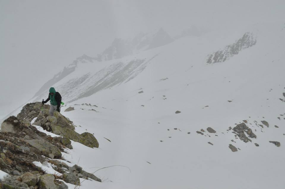
Trek Day #5
Immediate Camp – Baspa Glacier -Lamkhaga Base camp – Lamkhaga Advance Base Camp( aka Pass ke neeche)-5100m
We were already running behind the schedule( say 5 hours time). We started to climb at 4am. It was freezing and the weather was deteriorating again. Rathiji our cook, lead the team members, whereas our guide led the team of porters. In no meantime, all porters overtook us and waited on the snowy slopes.
![Rangrik Rang assumed -6553m after checking out Leomann maps. [Lamhaga pass expedition]](https://cdn.raachotrekkers.com/wp-content/uploads/2018/03/20150601-IMG_8437.jpg)
![Near Baspa glacier snout [Lamkhaga pass expedition 2015]](https://cdn.raachotrekkers.com/wp-content/uploads/2018/03/Lamkhaga-1-52-1.jpg)
![Near Baspa glacier snout [Lamkhaga pass expedition 2015]](https://cdn.raachotrekkers.com/wp-content/uploads/2018/03/Lamkhaga-1-104.jpg)
![Close up of Rangrik Rang -6553m [Lamkhaga pass expedition]](https://cdn.raachotrekkers.com/wp-content/uploads/2018/03/20150601-IMG_8436-2.jpg)
![Lamkhaga gully [Lamkhaga pass expedition 2015]](https://cdn.raachotrekkers.com/wp-content/uploads/2018/03/Lamkhaga-1-99.jpg)
![Inside Baspa Glacier snout. Looks so small, but it was too scary and large to even stand here and click. [Lamkhaga pass expedition 2015]](https://cdn.raachotrekkers.com/wp-content/uploads/2018/03/Lamkhaga-1-61-2-1.jpg)
![Baspa glacier snout [Lamkhaga pass expedition 2015]](https://cdn.raachotrekkers.com/wp-content/uploads/2018/03/Lamkhaga-1-60.jpg)
![Baspa glacier snout [Lamkhaga pass expedition 2015]](https://cdn.raachotrekkers.com/wp-content/uploads/2018/03/Lamkhaga-1-62-1.jpg)
![Baspa glacier [Lamkhaga pass expedition 2015]](https://cdn.raachotrekkers.com/wp-content/uploads/2018/03/Lamkhaga-1-55-1.jpg)
![Baspa glacier snout [Lamkhaga pass expedition 2015]](https://cdn.raachotrekkers.com/wp-content/uploads/2018/03/Lamkhaga-1-59.jpg)
![Climbing the Lamkhaga gradient [Lamkhaga pass expedition 2015]](https://cdn.raachotrekkers.com/wp-content/uploads/2018/03/Lamkhaga-1-11-1.jpg)
![Start of the climb [Lamkhaga pass expedition 2015]](https://cdn.raachotrekkers.com/wp-content/uploads/2018/03/Lamkhaga-1-103.jpg)
![Climbing the Lamkhaga gradient [Lamkhaga pass expedition 2015]](https://cdn.raachotrekkers.com/wp-content/uploads/2018/03/Lamkhaga-1-108.jpg)
![Climbing up to the advance base camp [Lamkhaga pass expedition 2015]](https://cdn.raachotrekkers.com/wp-content/uploads/2018/03/Lamkhaga-1-8.jpg)
We reached Lamkhaga Base Camp at 7 am for a short hungry break of dry fruits and water, as it was not easy to digest Parathas early in the morning. We took some rest and started climbing on a 50-degree incline with deep snow.
Plan of the day was to reach the Advance Base camp, just below the pass which was 7 hours far from where we were standing on that snowy conditions. We managed to cover it without much headache. Few people were too fast on snow, while others were the opposite of that. Finally, microspikes came into use. There were many steep patches which itself was a task to negotiate, but we managed somehow.
We reached at 2 pm. It was a task to beat the soft snow of 2ft, so that our tent could easily be pitched on hard snow. That day, one porter suffered from Hypothermia and he went mute. He was shifted to the kitchen tent as soon as the tent was ready and was made to rest near the cooking stove for the warmth. We gave him the warmee self-heating pouch. He felt okay later after gulping hot soup and hot water. So white-out conditions, freezing wind, Porter’s health, Highest Camp at 5100m, wet sleeping bags, frozen tents, snow melted “yuckk” water, etc. made it totally worth.
![You climb up and again you go down several times. That was really hectic to be frank. [Lamkhaga pass expedition 2015]](https://cdn.raachotrekkers.com/wp-content/uploads/2018/03/Lamkhaga-1-121.jpg)
![going down.. [Lamkhaga pass expedition]](https://cdn.raachotrekkers.com/wp-content/uploads/2018/03/Lamkhaga-1-120.jpg)
![Climbing up.. Sonu mending Rashmi's shoe[Lamkhaga pass expedition]](https://cdn.raachotrekkers.com/wp-content/uploads/2018/03/Lamkhaga-1-131.jpg)
![Lamkhaga traverse [Lamkhaga pass expedition 2015]](https://cdn.raachotrekkers.com/wp-content/uploads/2018/03/Lamkhaga-1-116.jpg)
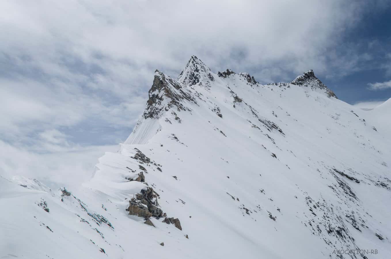
![Chotkhaga Pass (left) - Unnamed pass(middle)- Lamkhaga Ridge Pass(Right) Lamkhaga cannot be seen untill you reach its base, its so remote. [Lamkhaga pass expedition 2015]](https://cdn.raachotrekkers.com/wp-content/uploads/2018/03/Lamkhaga-1-124.jpg)
Lamkhaga cannot be seen untill you reach its base, its so remote.
![Near the advance base camp [Lamkhaga pass trek expedition 2015]](https://cdn.raachotrekkers.com/wp-content/uploads/2018/03/Lamkhaga-1-126.jpg)
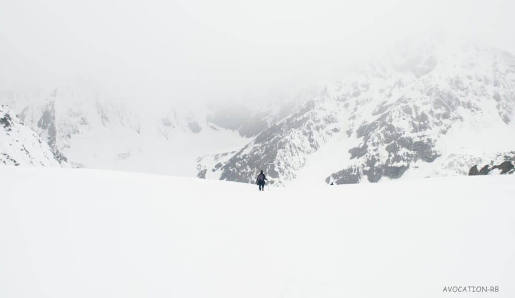
Trek Day #6 (Lamkhaga Pass, Summit)
Plan: Advance Base camp to Lamkhaga Pass to Lamkhaga base camp( Harsil side)
What did we do? : Advance Base camp to Lamkhaga Pass to Lamkhaga base camp(Harsil side) to Kyarkoti
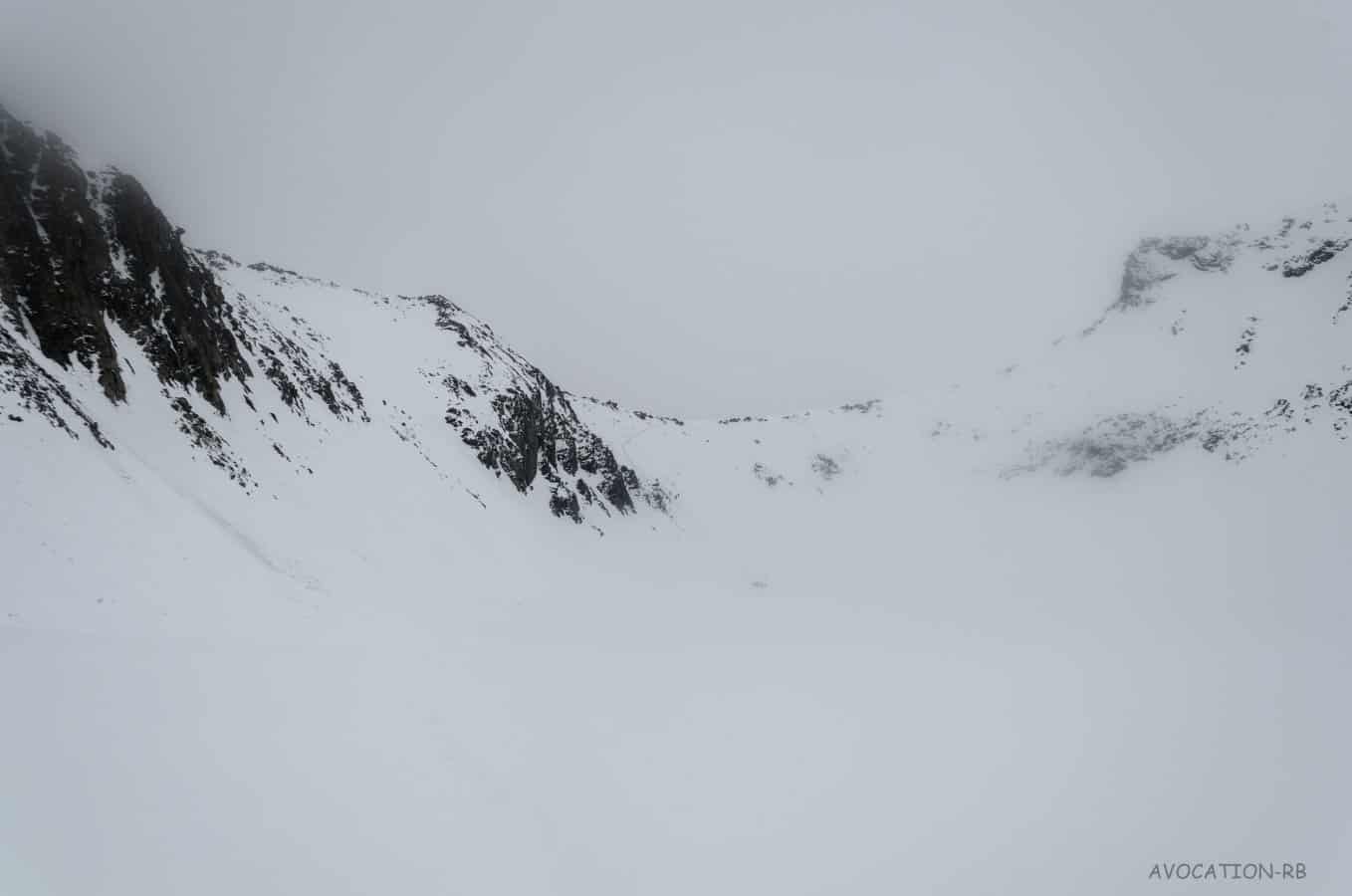
When we woke up at 6 in the morning, it was all white-out outside. Soon, we started discussing on to pass the cross or not. After a lot of arguments, we planned to go ahead. Waiting back did not make any sense. Descending to Chitkul was against our wishes. It was just a matter of 3 hours of the climb to the pass and it descended all the way down to Kyarkoti – Gangnani – Harsil. If anything worse happens within these 3 hours, nobody had an idea to escape it, except our guide Negi. He was confident about it and he leads us in a Pro way. We stood at the top at 9:00 am on 3rd June.
![Looking towards HP unnamed peaks as seen from Abc at 5120m at 530am. [Lamkhaga pass expedition 2015]](https://cdn.raachotrekkers.com/wp-content/uploads/2018/03/Lamkhaga-1-71-1.jpg) Looking towards HP unnamed peaks as seen from Abc at 5120m at 530am.
Looking towards HP unnamed peaks as seen from Abc at 5120m at 530am.
![P5810m [Lamkhaga pass expedition 2015]](https://cdn.raachotrekkers.com/wp-content/uploads/2018/03/bappi.jpg)
![Pitching the tent in raging snow storm [Lamkhaga pass trek expedition 2015]](https://cdn.raachotrekkers.com/wp-content/uploads/2018/03/bappi-2.jpg)
![After 7am, shot from Digicam. [Lamkhaga pass expedition 2015]](https://cdn.raachotrekkers.com/wp-content/uploads/2018/03/bappi-1.jpg)
![Chotkhaga Hidden behind. [Lamkhaga pass expedition 2015]](https://cdn.raachotrekkers.com/wp-content/uploads/2018/03/Lamkhaga1of1-3.jpg)
![Walking towards the pass [Lamkhaga trek expedition 2015]](https://cdn.raachotrekkers.com/wp-content/uploads/2018/03/Lamkhaga-1-153.jpg)
![Lamkhaga glacier [Lamkhaga pass expedition 2015]](https://cdn.raachotrekkers.com/wp-content/uploads/2018/03/Lamkhaga-1-151.jpg)
![The traverse [Lamkhaga pass trek expedition 2015]](https://cdn.raachotrekkers.com/wp-content/uploads/2018/03/Lamkhaga-1-147.jpg)
![The glacier [Lamhaga pass trek]](https://cdn.raachotrekkers.com/wp-content/uploads/2018/03/Lamkhaga-1-146.jpg)
![View of Kinnaur - Garhwal range [Lamkhaga pass trek 2015]](https://cdn.raachotrekkers.com/wp-content/uploads/2018/03/Lamkhaga-1-139.jpg)
![Unnamed peak on Kinnaur - Garhwal range [Lamkhaga pass trek]](https://cdn.raachotrekkers.com/wp-content/uploads/2018/03/Lamkhaga-1-137.jpg)
![If you see exactly in the middle, there is a cornice. That is gateway to Harsil [Lamkhaga pass trek 2015]](https://cdn.raachotrekkers.com/wp-content/uploads/2018/03/Lamkhaga-1-2-1-1.jpg)
Negi ji had made a zigzag route to the top, due to soft snow and the light was bright. In a meanwhile, a huge layer of ice like a mini avalanche came on our way and took Aditya down a few meters on the slope. Luckily he arrested himself on the gentle slopes and began climbing much faster. It was a horrifying scene when it happened. Somehow we all reached at 9 am on the top.
The pass is located at one of the greatest water source region which divides two great rivers, where one flows into the Arabian sea and other in Bay of Bengal.
All we could see is tears of joy in each and every member. It started snowing heavily from the Garhwal side and it was bright in the Kinnaur side. Realising, who was the culprit behind bad weather, we started our deadly descend soon.
![Unnamed Kinnaur peaks, some slightly above 6000m. You can see our kitchen tent(peach color) to the left hand side down. [Lamkhaga pass trek]](https://cdn.raachotrekkers.com/wp-content/uploads/2018/03/bappi-8.jpg)
![Sonu negi opening the route [Lamkhaga pass trek]](https://cdn.raachotrekkers.com/wp-content/uploads/2018/03/Lamkhaga-1-156.jpg)
![Looking up to the pass [Lamkhaga pass trek]](https://cdn.raachotrekkers.com/wp-content/uploads/2018/03/Lamkhaga-1-161.jpg)
![Small avalanche [Lamkhaga pass trek]](https://cdn.raachotrekkers.com/wp-content/uploads/2018/03/Lamkhaga-1-158.jpg)
![Waiting for rest of the team [Lamkhaga pass trek]](https://cdn.raachotrekkers.com/wp-content/uploads/2018/03/Lamkhaga-1-163.jpg)
![Tiding the prayer flags on Lamkhaga pass [Lamkhaga pass trek 2015]](https://cdn.raachotrekkers.com/wp-content/uploads/2018/03/Lamkhaga-1-of-1-4-1024x683.jpg)
![“We don't live to eat and make money. We eat and make money to be able to enjoy life. That is what life means, and that is what life is for.” ―George Mallory [Lamkhaga pass trek]](https://cdn.raachotrekkers.com/wp-content/uploads/2018/03/Lamkhaga-1-167.jpg)
―George Mallory
![Welcome to the land of gods- Devbhoomi and huge snowfield looking towards Garhwal side. [Lamkhaga pass trek]](https://cdn.raachotrekkers.com/wp-content/uploads/2018/03/Lamkhaga-1-165.jpg)
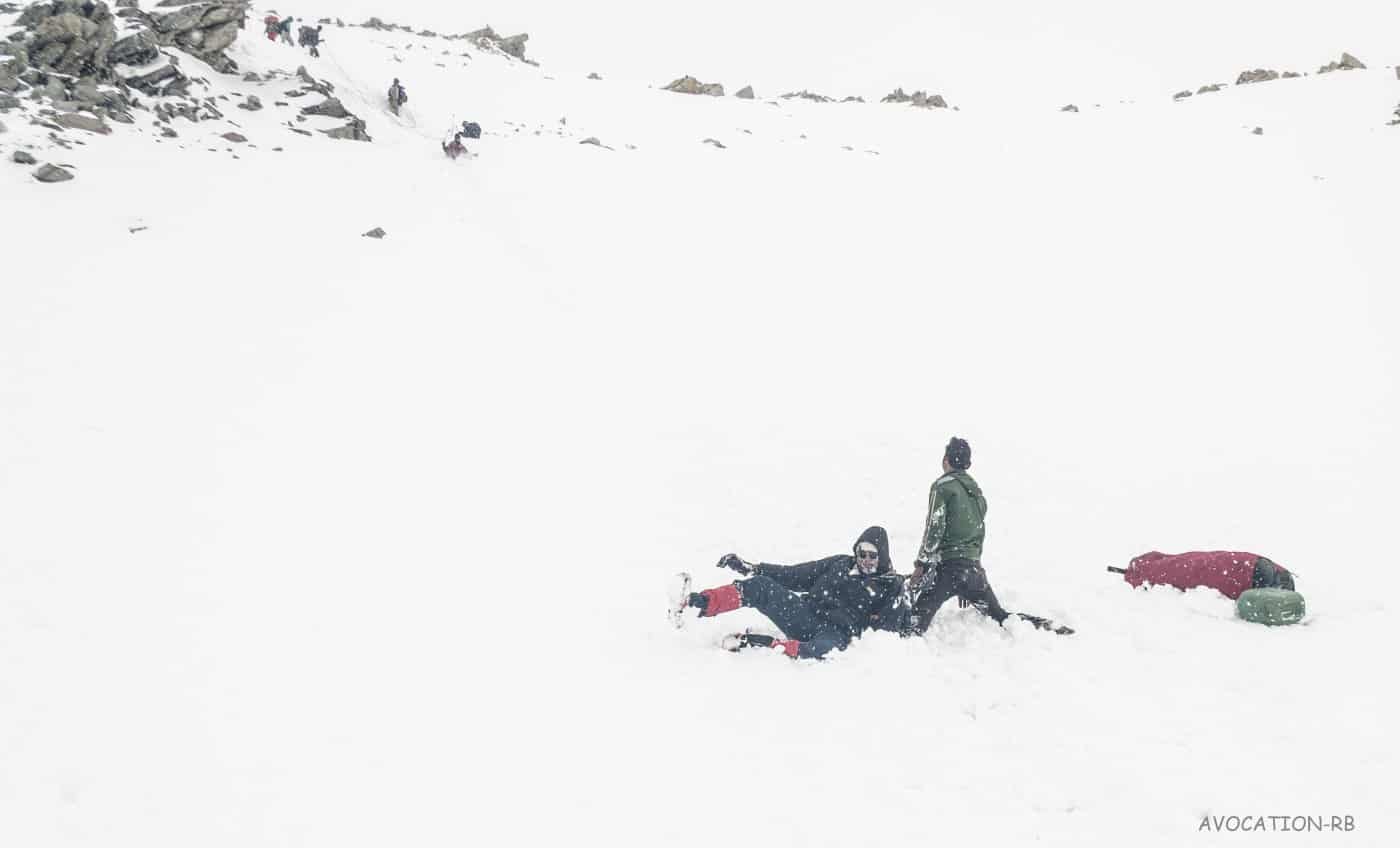
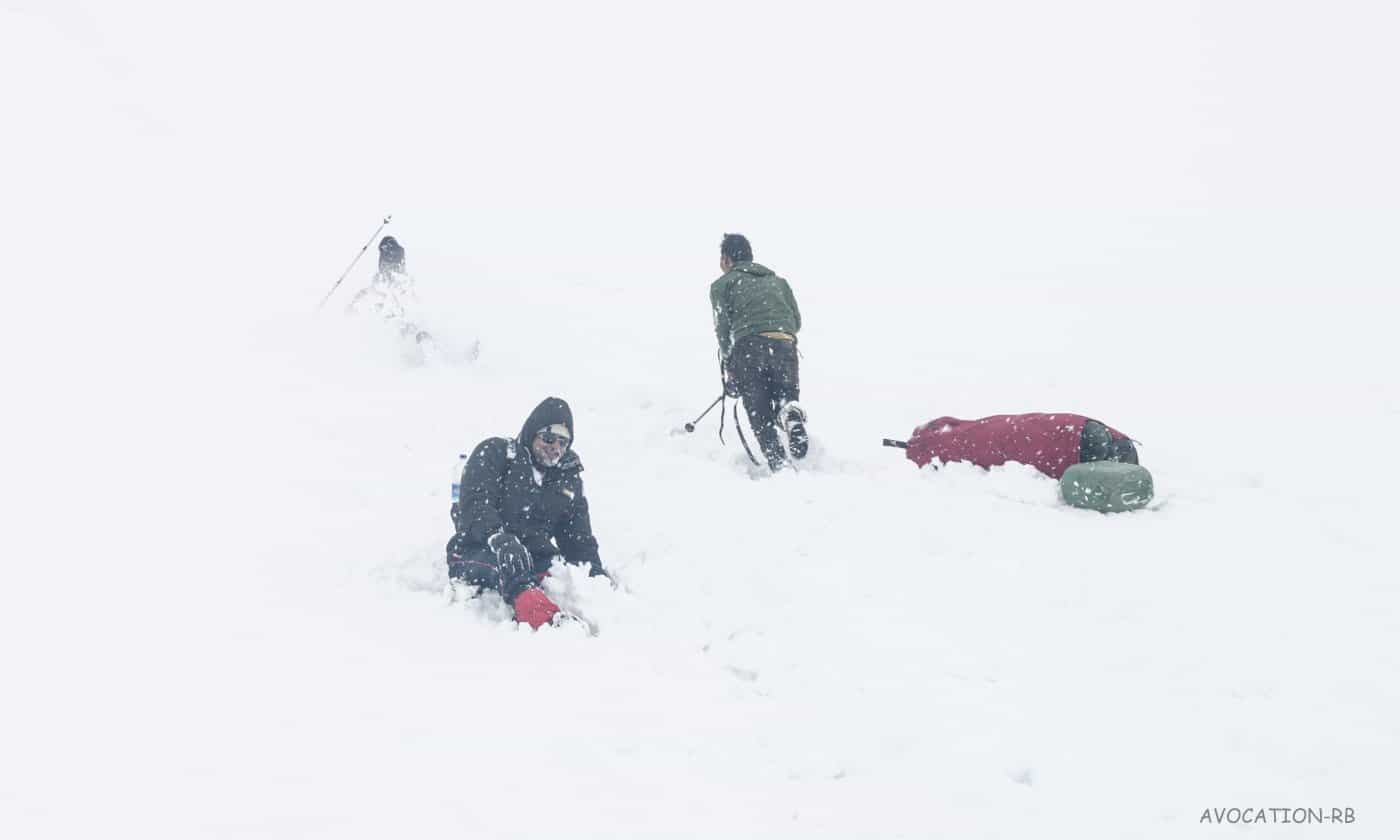
The glissading was fun and risky too. Few members had many rolls, with the bags falling on one side and trekking poles to the others. The weather deteriorated and it was white out. This time, it did not stop for the next 8 hours of daunting descent. There was a huge gap of distance among members, a few of us were climbing down slowly with INFINITE no. of falls and breaking trekking sticks. The plan was to descend until the snowline. We reached Upper Kyarkoti, passing through Sukha Tal at 5:30 pm and threw our bags aside our tents.
![Descending down the pass [Lamkhaga pass trek]](https://cdn.raachotrekkers.com/wp-content/uploads/2018/03/11060004_10153058634592602_3333473478239411867_n.jpg)
![Glissading the slope [Lamkhaga pass trek]](https://cdn.raachotrekkers.com/wp-content/uploads/2018/03/Lamkhaga-1-3-1-2.jpg)
![Glissading the slope [Lamkhaga pass trek]](https://cdn.raachotrekkers.com/wp-content/uploads/2018/03/Lamkhaga-1-178.jpg)
![Upper Kyarkoti(Jalandhari Gad valley ~~~4000mtr) [ Lamkhaga pass trek ]](https://cdn.raachotrekkers.com/wp-content/uploads/2018/03/Lamkhaga-1-3-2.jpg)
![Glissading the slope [Lamkhaga pass trek]](https://cdn.raachotrekkers.com/wp-content/uploads/2018/03/Lamkhaga-1-173.jpg)
![Glissading the slope [Lamkhaga pass trek]](https://cdn.raachotrekkers.com/wp-content/uploads/2018/03/Lamkhaga-1-176.jpg)
![Camping at Kyarkoti [Lamkhaga pass trek]](https://cdn.raachotrekkers.com/wp-content/uploads/2018/03/Lamkhaga-1-6-1.jpg)
That evening, our porters went hunting some of the juniper bushes/woods for a bonfire. They excelled in getting a large bunch of wet junipers and some wet trunk of the unknown tree which was lying down on high slopes. There was an excitement within the team on the accomplishment of the trek. We sipped many teas that evening, as most of the things were wet and ferocious bonfire by the side.
I was the last one to sleep after taking a few night shots of heaven, Kyarkoti. In fact, all the nights at every camp have been beautiful for us, but this place beats all. As soon as I entered my sleeping and locked the chains of the tent, there was a scratching sound outside the tent. As if, someone/thing is scratching with hands on the outer layer of the tent. Initially, I thought someone was doing mischief among us, but everyone had slept by that time. I woke up and I switched on my tent light, no sounds! Again, I did not bother to wake up my tent mates as they all were snoring too loud. The sound of scratching continued for 2-3 hours that night and that was my last sleepless night of the entire journey.
![This has to be best alpine tents (though bit heavy) on high altitudes. [Lamkhaga pass trek]](https://cdn.raachotrekkers.com/wp-content/uploads/2018/03/bappi-6.jpg)
![Definition of Relaxation is this! [Lamkhaga pass trek]](https://cdn.raachotrekkers.com/wp-content/uploads/2018/03/Lamkhaga-1-10-2.jpg)
![Burning juniper shrubs [Lamkhaga pass trek]](https://cdn.raachotrekkers.com/wp-content/uploads/2018/03/Lamkhaga-1-8-2-1.jpg)
![This is a shortcut to Chotkhaga Pass but very technical. NO! you actually cant see the Chotkhaga Ridge from here but this is the route.[Lamkhaga pass trek]](https://cdn.raachotrekkers.com/wp-content/uploads/2018/03/Lamkhaga-1-12-2.jpg)
![It was full moon, my 18-55mm lens could only do this much. [Lamkhaga pass trek]](https://cdn.raachotrekkers.com/wp-content/uploads/2018/03/bappi-4-1.jpg)
[starbox]
Rohit is an avid trekker and the “Himalaya digger”. His love of the Himalayas has inspired him to trek Stok Kangri, Lamkhaga Pass (5300 m), Darma valley, twin passes of Yangchar Dhura (4750 m) & Ralam Dhura (5630 m). He has also exlored the Western Ghats extensively. Rohit lives in Mumbai, and he is the moderator of Himalayan Club Facebook group.
Leave a Reply