Temso (also spelled as Tem Tso) is a sacred glacier fed lake located high (4979 meters) above Lippa and Labrang villages of Kinnaur. Each year, on 20 bhado, a flower festival — called Fluiach/Ukhayang/Minthko — is celebrated by the villagers of Lippa, Labarang, Kanam and Ropa valley at the shores of this Lake.
The Tibetan word “tso” (མཚོ་) means “lake”. It is a common suffix in Tibetan place names, such as Namtso (Nam Lake), Yamdrok Tso (Yamdrok Lake), and Pangong Tso (Pangong Lake).
Google Bard.
The word “tso” is also used in other languages of the Tibetan cultural sphere, such as Ladakhi and Balti. In Ladakhi, it is pronounced “tso” or “tsho”, while in Balti, it is pronounced “tsho”.
This mystical glacier-fed lake has a profound significance in the local culture and traditions.
Bhādo or Bhadraba is the sixth month of the Hindu calendar, which falls in August and September of the Gregorian calenda
Wikipedia.
On the 20 Bhado day, people from nearby villages hike to this lake, perform Buddhist rituals/rites and local customs, cook food, dance, and return to their villages.
The villagers also collect Loskar (Delphinium brunonianum/Musk Larkspur) flowers, make a garland out of it and decorate their local deities with the garland made from Temso lake flowers.
Itinerary
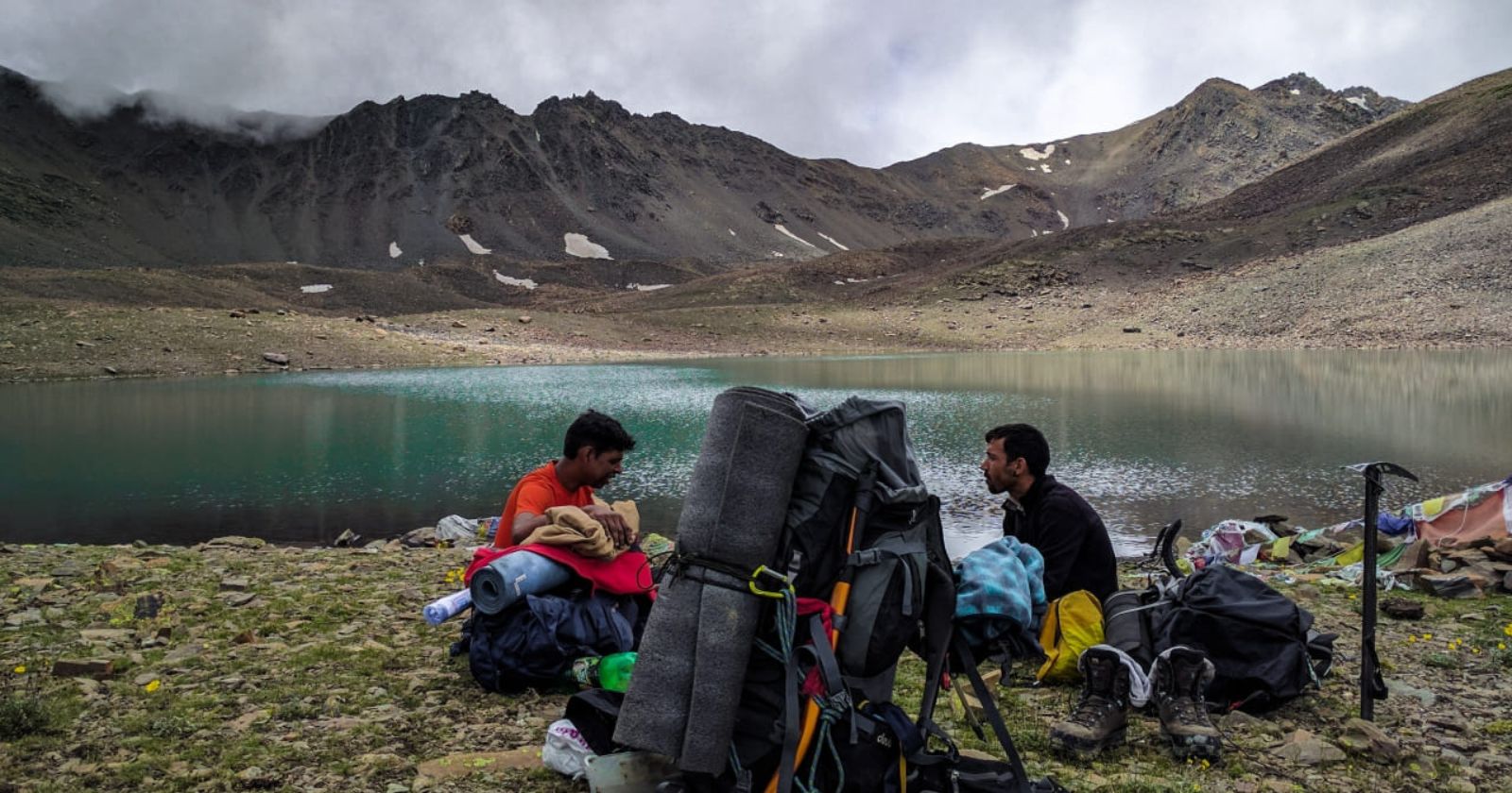
- 28th July: Lippa village to Shepherd’s hut beside Waling Nala (31.68126 North / 78.39366 East / altitude 3517 meters)
- 29th July: Shepherd’s hut to Tem Tso Lake Base camp (altitude ~4800 M)
- 30th July: Base camp of Tem Tso Lake to Giabong via Tem Tso Lake (31.73245 North / 78.40015 East / altitude 4827 meters) and unnamed pass above Tem Tso (31.72288 North / 78.39357 East / altitude 4979 meters)
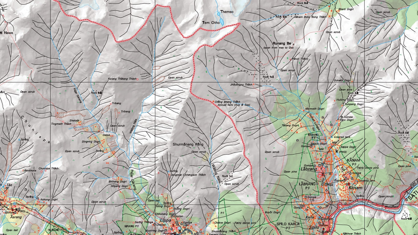
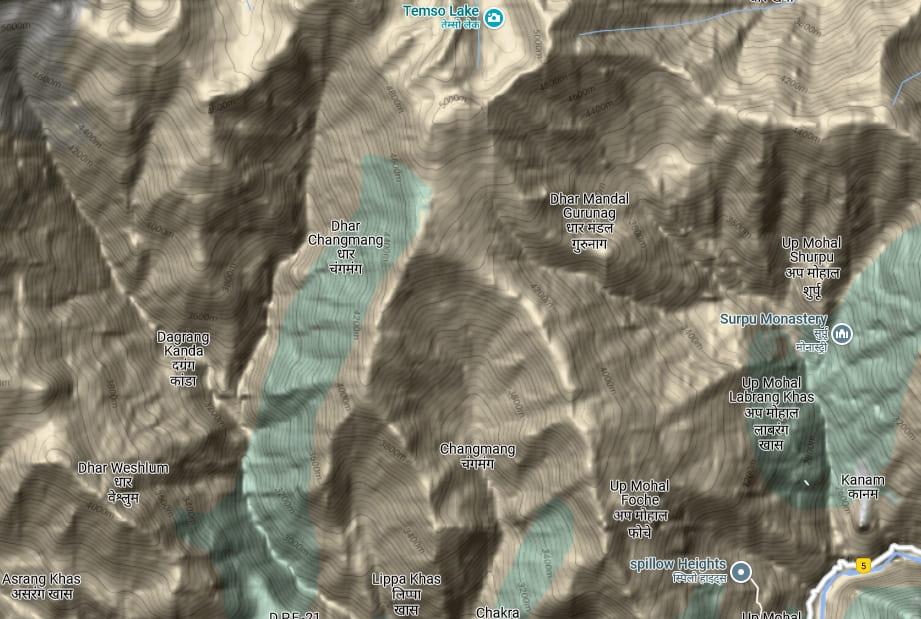
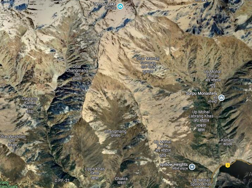
Reference Maps
Survey of India Maps (Scale 1:50000)
Google Maps
Getting To Lippa Village
One can catch a HRTC bus from Reckong Peo, which departs at approximately 9:00AM, heading towards Asrang village. Lippa is located along the route to Asrang.
There is another HRTC bus that departs from Reckong Peo bus stop at 2:30PM and takes about 2 hours to reach Lippa village.
Although there are many day buses running from Shimla towards Rampur Bushahr and Reckong Peo, to save time, I took an evening bus from Shimla.
I took a deluxe night bus of HRTC from Shimla to Reckong Peo. It left Shimla at around 6 p.m and arrived at Reckong Peo by at 6AM the next day.
A more adventurous way to reach Lippa village would be to hike from Reckong Peo or Rarang or Jangi.
Temso Lake Trail
There are two major routes to reach the Temso Lake shore. First route is from Lippa and the other one is from Labrang village.
Labrang-Lippa route
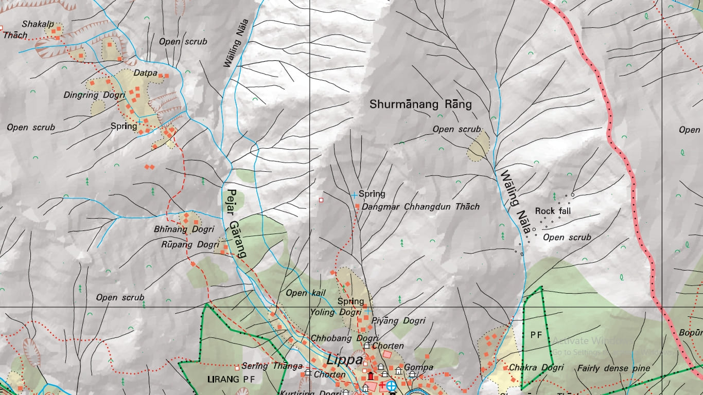
It is a two-day and ~17 km long moderate hike. Starting with relatively gentle gradient till Tapang Kandey, the terrain becomes steeper as you progress towards Raachoksen.
The villagers of Ropa valley (Gaibong, Sunnam) reach Temso through Runang We (4320 meters) pass. Runang We is a 3 to 4 hour diagonal ascent from Tapang Kandey.
There are many good campsites at Tapang Kandey and Gyumsra. Labrang villagers have built some rudimentary stone huts at Gyumsra meadows, a workable solution to spend the night in case you have not carried tents with you.
From Gyumsra, it is about 4-5 hour hike to the lake.
If you start your hike early in the morning, you can reach the lake before noon and return to Labrang on the same day.
Here is the usual route that the people of Labrang follows to hike the lake:
Labrang >>Raachoksen >> Tapang Kandey >> Gudgudang >> Gyumsra >> Temso Lake.
Lippa-Temso route
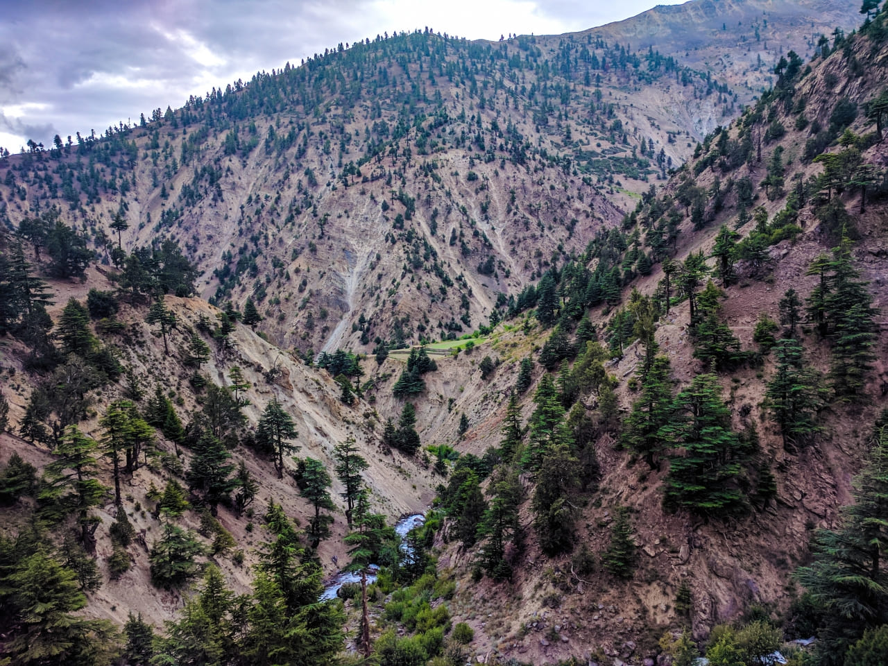
The traditional route followed by the villagers of Lippa for Ukhayang/Minthko festival goes through Chakra Dogri (Apple orchard fields)- Changmang- Shurmanang. This route is relatively less texting than the one I followed.
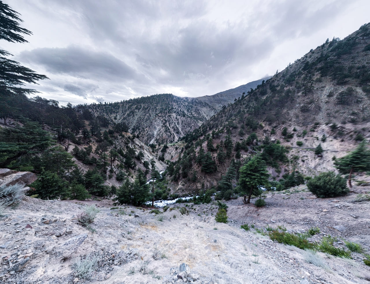
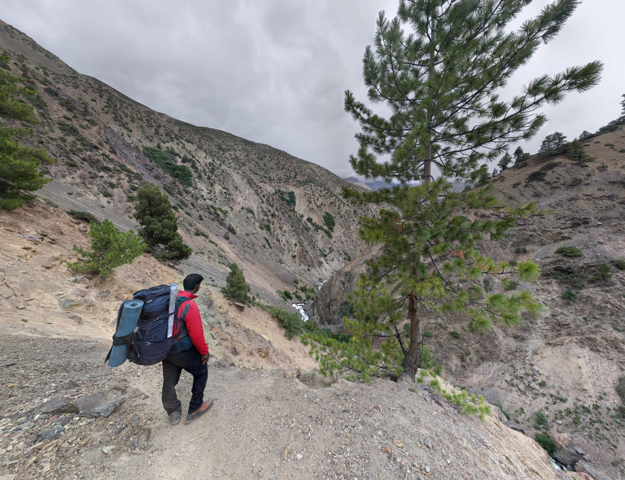
The trail I followed leads from Lippa village, and it follows along the Waling Nala. There are a few good campsites/shepherd encampments a short distance (about an hour or so) from where the fields of Lippa villagers end.
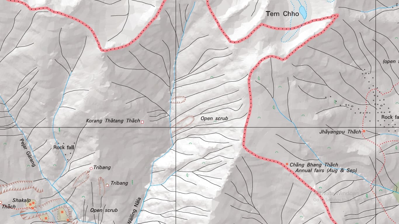
The route to the Tem Tso Lake is not marked on any maps. So, we got local info from a shepherd about the route.
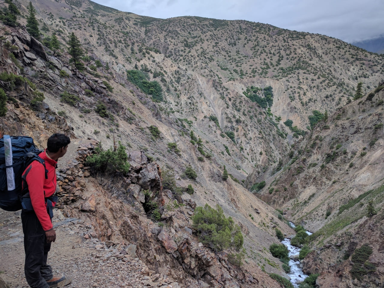
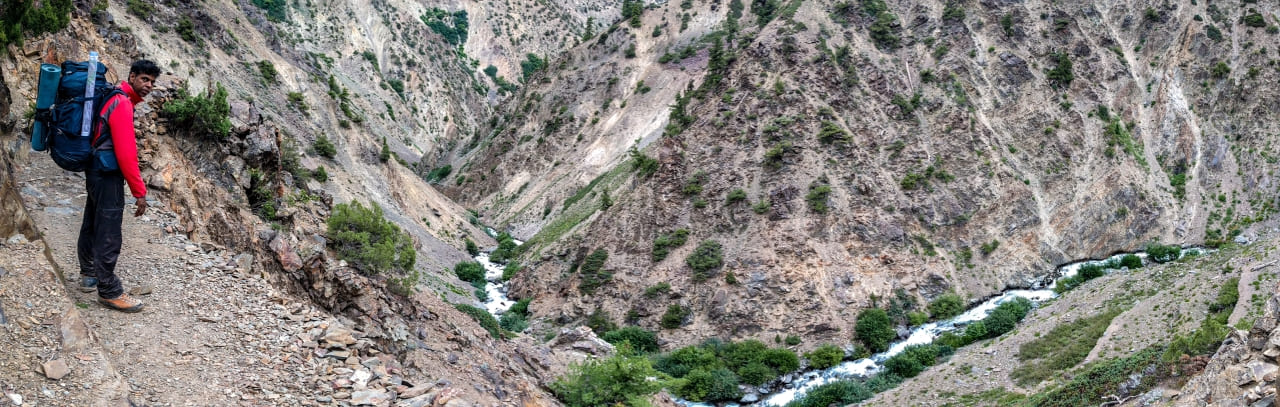
The route ascends to the ridge along the Nala (maybe dry) towards the north.
The top of the ridge is marked by cairns. The route proceeds along the ridge towards the left side of the ridge line (as one heads north). There are remnants of a Kul (waterway) that was in the process of being built a few years back.
One will see wire meshes, that prevent landslides, on this route. We made the mistake of heading in the north-eastern direction from the cairns on the ridge.
It is very easy and logical to make this error, as the north-eastern route also has huge cairns – which are there for marking a campsite.
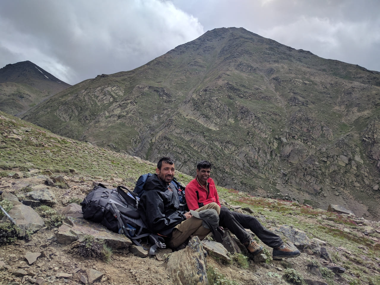
Once we took the incorrect route, we also tried to find a shorter way to get back to the right route and lost more time in the process on the 2nd day. The 3rd day we got back to the right route and ascended to an unnamed pass (31.72288 N / 78.39357 E / at 5000 meters altitude).
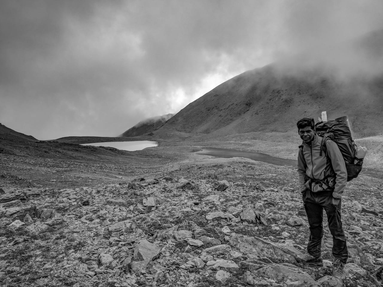
From the pass one has to descend in an easterly direction and then head in a Northerly direction till one sight the Tem-Tso lake (31.73245 N / 78.40015 E / at ~ 4800 meters) lake.
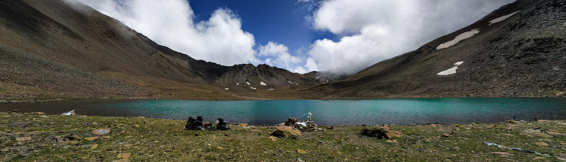
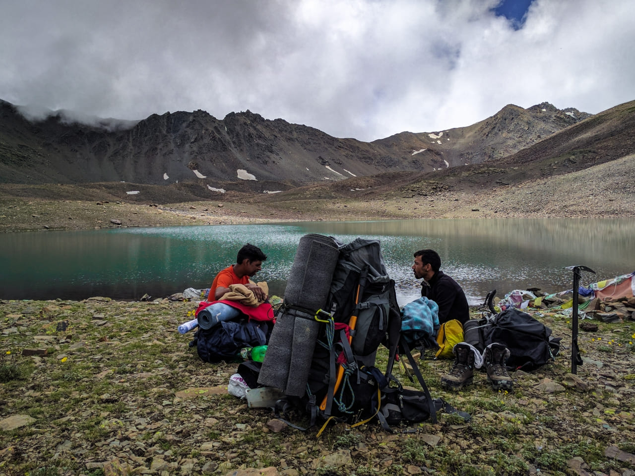
The clear azure water of the serene lake, surrounded by high peaks, makes for beautiful viewing.
From the lake there are supposed to be 2 routes. We took the route along the true right of the Nala draining northwards from the lake.
This Nala feeds into the Ranam Khad at Chango village. There is no proper track till the confluence of this Nala with Ranam Khad. Near the confluence there are shepherd’s huts.
One has to detour high above the Nala (31.75612 N / 78.39525 E) and then descend along a track to the Ranam Khad. Right above the Ranam Khad the track has been eroded through landslide and the descent can be very tricky.
We crossed the Ranam Khad over a snow bridge. One can see the fields & some huts of the Giabong Villagers towards the Kumche Nala on the true left bank of the Ranam Khad.
There is a well trodden track used by the locals on the true left bank of the Ranam Khad to Giabong.
However, that track is very narrow and dangerous looking as it cuts across a steep gorge face. Giabong is a beautiful village with a PWD guest house to stay in.
Wrapping Up
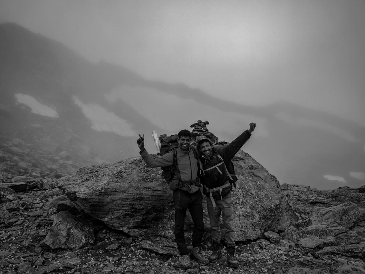
This was a 3-day trek in Kinnaur starting from Lippa village. We were aiming visiting Tem (or Them) Tso and going to the village of Giabang (in Ropa Valley). An annual village fair near Lake Tem Tso is held on “bees bhado” (20th day of Bhado month – roughly about first week of September) where people from the neighboring villages like Lippa, Giabong, Ropa, Labrang etc gather to celebrate the Phuliach festival.
This hiking log was written by Sathya in September 2017. Details about Lippa-Temso and Labrang-Temso route have been corroborated and added to this post by Ganga Negi and Amita Chhorgia Negi (Tribal Girl).
Sathyanarayan was a Bangaluru based solo trekker acclaimed for his recces and exploratory treks in north-western Nepal, Sikkim, Garhwal, Kinnaur, Spiti valley, Zanskar. In July 2018, on an exploratory trek from Kafnu to Ropa valley via Surcho-Listigarang-Yulla Kanda-Kashang Pass, Sathyanarayan disappeared somewhere near Surcho in Bhaba valley of Kinnaur. Sathya orginally planned for Pin Valley to Bhaba Nagar trek via Rupi and Sorang valley but changed his mind at the last minute. Before taking a sabbatical from working at Texas Instruments, Sathya did Advance Mountaineering Course (AMC) from Nehru Institute of Mountaineering, Uttarkashi. Sathya was pioneering in exploring the remotest regions of the Himalayas in the alpine trekking style using geo-referenced maps—a technique of assigning the coordinate system to the raster data obtained from a satellite or topographic image of a region.
Leave a Reply