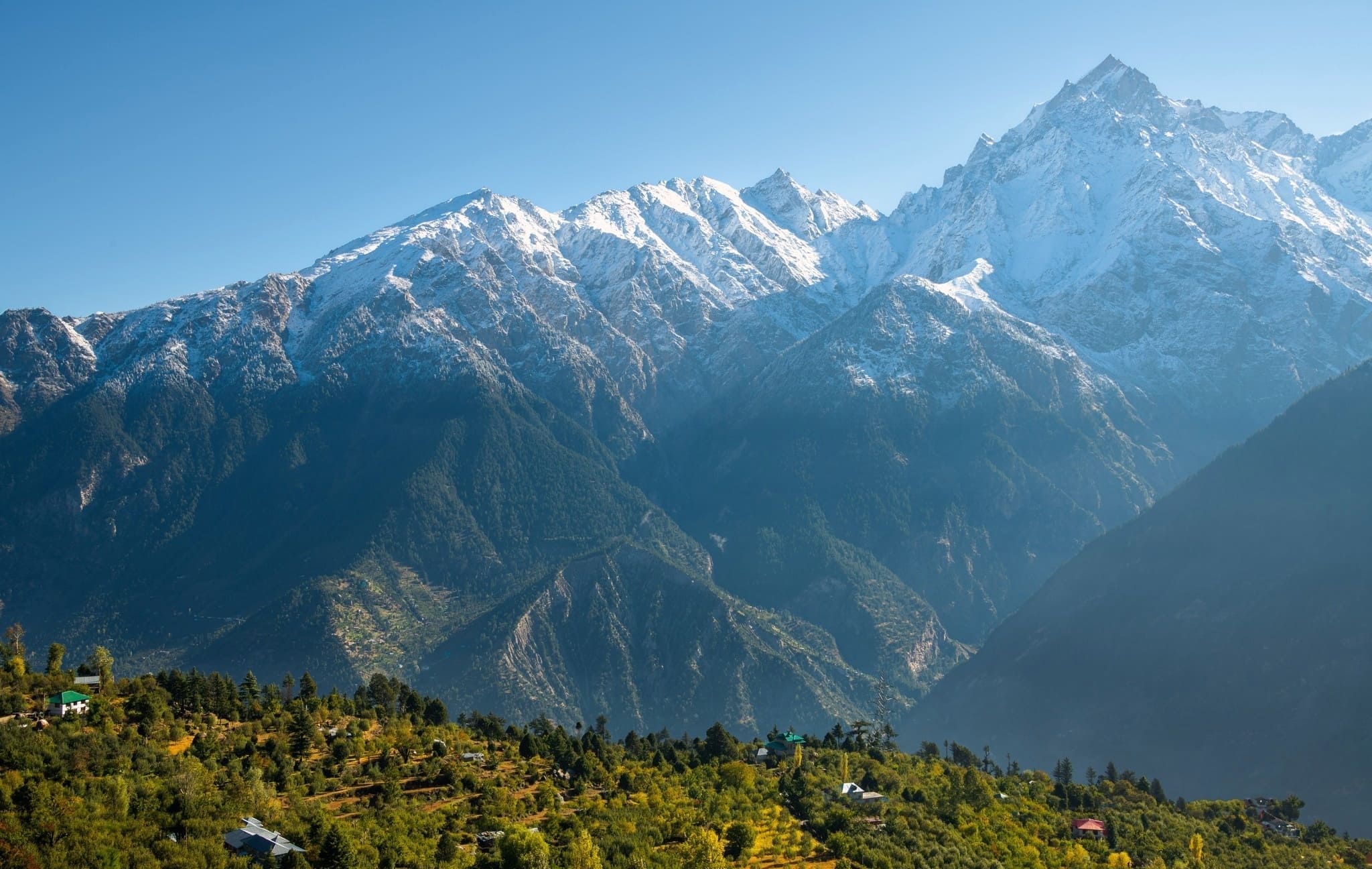
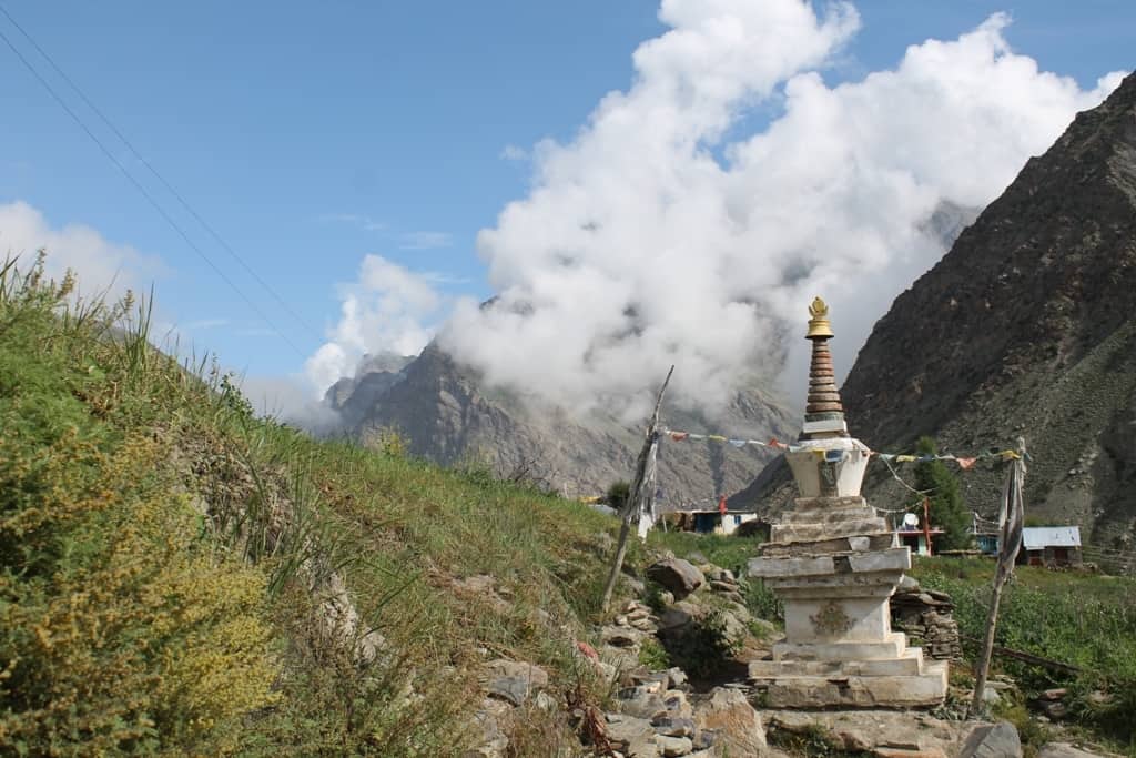
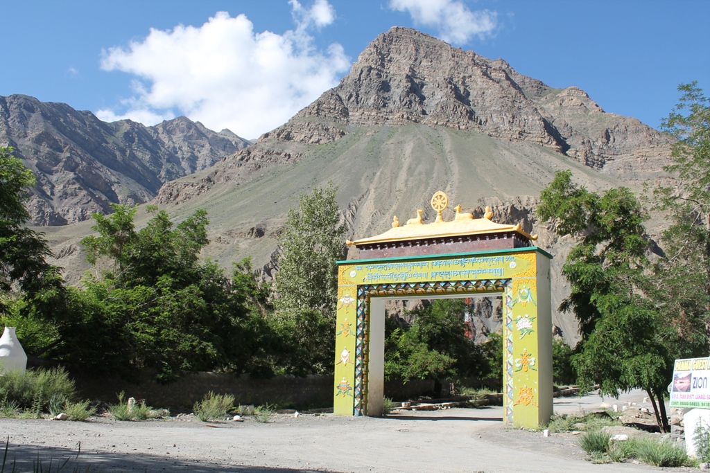
Spiti Valley is UNESCO designated India’s first Cold Desert Biosphere Reserve (a protected region under Man and the Biosphere Programme) located in the rain shadow region of the Greater Himalayan ranges. It is snuggled up in the north-eastern part of Himachal Pradesh.
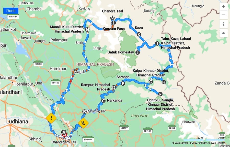
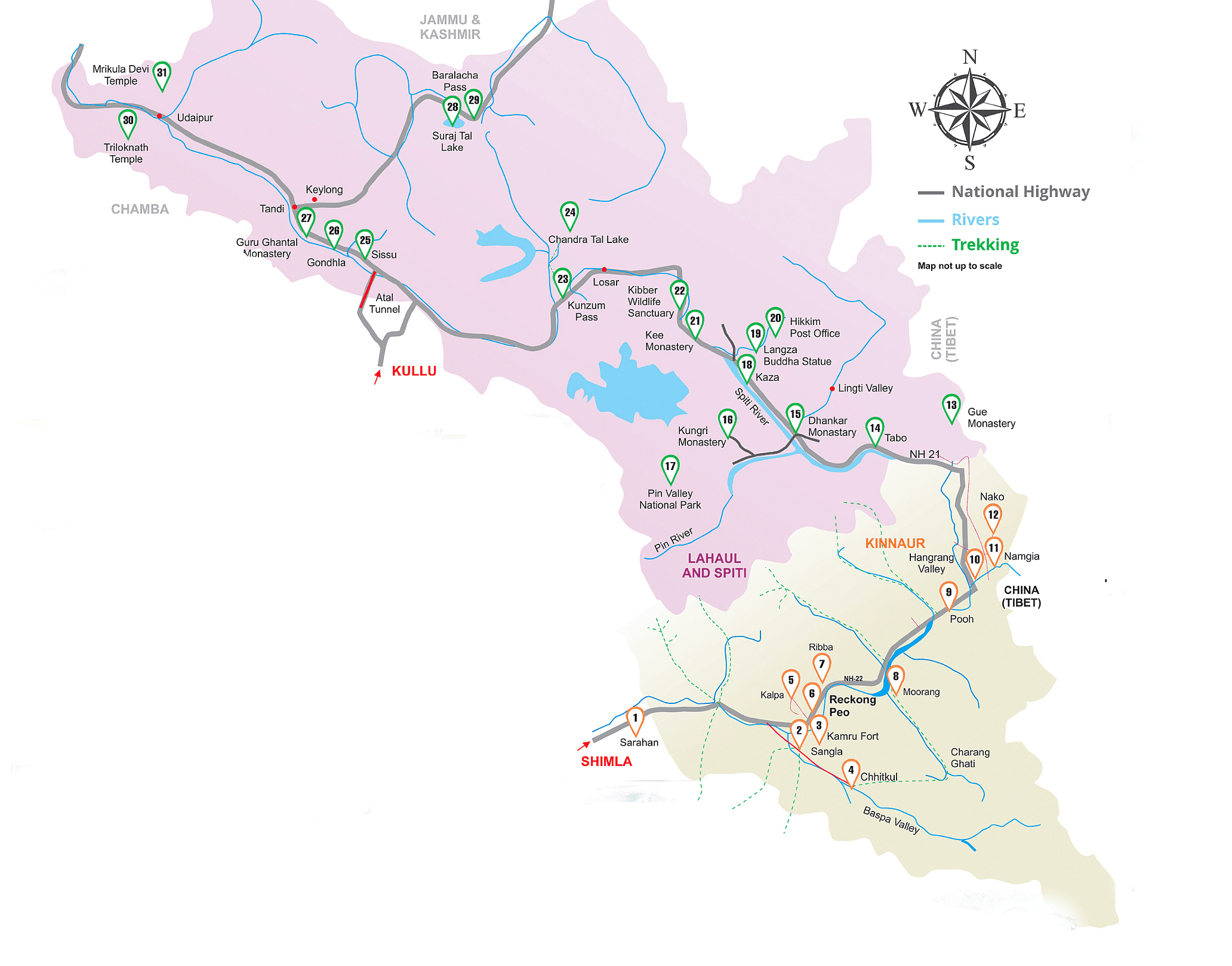
Starting from Chandigarh, the Spiti Valley Circuit route winds counterclockwise through Solan, Shimla, Narkanda, Rampur Bushahr, Sarahan, Chitkul, Kalpa, Nako, Tabo, and Kaza on National Highway 5 (NH5) and its peripherals.
To close the loop, the circuit follows the Spiti River, crosses Kunzum Pass, and meets the Chandrabhaga near Batal. From there it passes through the Atal/Rohtang Tunnel and Manali, before the 266 km Manali–Chandigarh section of National Highway 3 completes the full circuit.
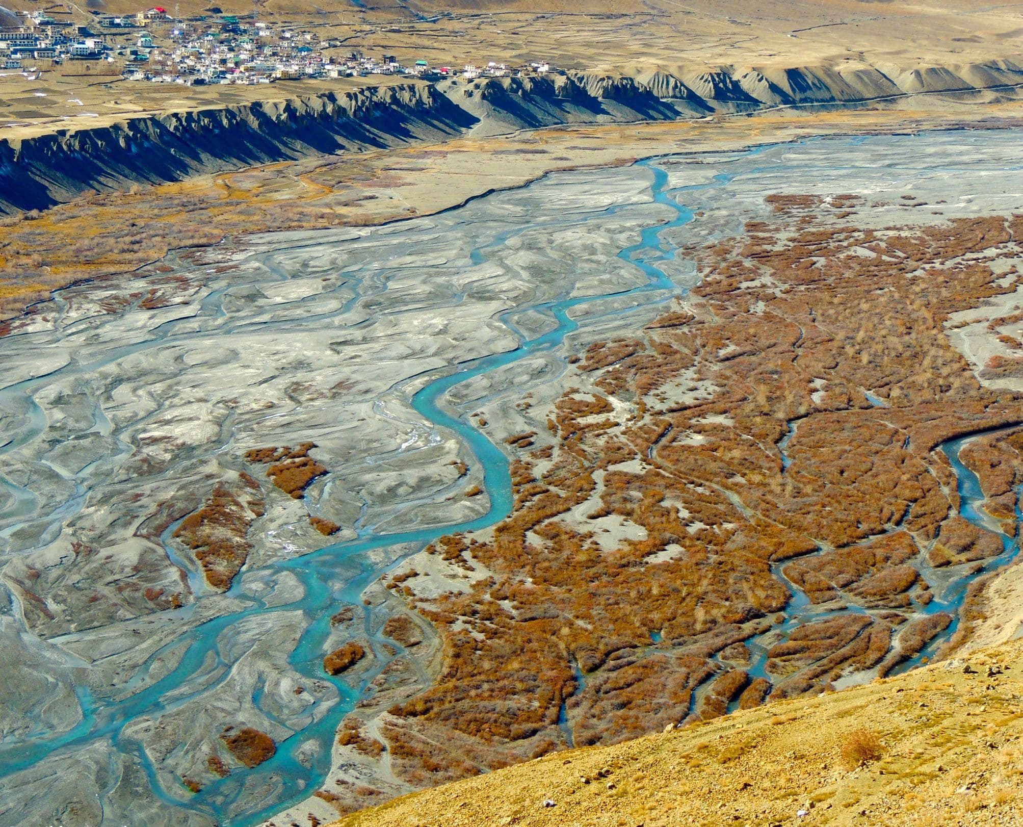
The valley is bordered by the districts of Kinnaur in the south-east, Kullu in the south, the valleys of Zanskar and the Union Territory of Ladakh in the north. In the east, Spiti shares its boundary with Tibet (China).
The name Spiti or Piti — as it is known among the locals— means ‘The Middle Land’ that is the land between India and Tibet.
⚡Rundown of Spiti Circuit Road Trip
| Days | 12 |
| Vehicle | Force Urbania Van or Toyota Innova Crysta/Toyota Rumion (2026 model) car |
| Stay | Camping + Hotels + Homestays |
| Highest Place | Kunzum-La (pass) 4551 meters |
| Highest Village | Komic 4513 meters |
| Best time to hit the road | May to October |
| Route | Chandigarh-Shimla-Kinnaur-Spiti-Manali-Chandigarh |
| Road distance to cover | ~ 1200 km |
| Departure dates | May 29, June 6 & 20, 28 August, and between September 1 and 15 |
| Group size | Max 8 |
| Event Category | Road trip, sightseeing & cultural experiences |
| Package Type | Personalized or Standard (Fixed itinerary) |
📅Scheduled events and personalized trips in 2026
The scheduled departure dates for our Spiti Valley circuit are fixed for the second and third weeks of June and second week of September 2026. We prefer running personalized trips — tailored to your interests and travel plans — for smaller groups (lesser than 4 people) and for people willing to incur additional costs. Trip dates are subject to weather and road conditions, as determined by Shimla, Kinnaur, Kullu, and Lahaul-Spiti District Administration.
🚘 Spiti Valley Tour Starting From Chandigarh
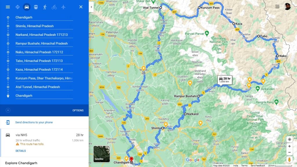
Chandigarh→Shimla→Kinnaur→Kaza→Manali route for Spiti Valley Road Trip
This route is recommended for several reasons:
- Manali to Solang Valley and Atal Tunnel (north portal) are busy during the peak summer season (i.e. June-August). You may get stuck in a traffic jam.
- Gramphu to Batal Road is riddled with waterfalls, glacial water melts streams, and water crossings. It is easier and more convenient to drive from the Kaza side through this part of the road.
- There is a gradual increase in altitude (barring Narkanda-Rampur Road segment) when driving on the Chandigarh-Shimla-Kaza route. This gradual rise in altitude is helpful for acclimatization, especially for people coming from the Indian plains.
What Does it Cost?
All-inclusive price of Spiti valley tour starts from 25,500 INR. The final price will be determined by variables, such as:
- Vehicle (4WD SUV or standard)
- Hotel and stay preferences
- Group size.
- Pick-up location (Delhi, Chandigarh, Shimla or Manali)
- Travel time (June, September, or early October)
- Add-ons availed such as driver, camping gear and guide, photographer, or drop locations (Shimla, Manali, Chandigarh, or Delhi) etc.
To receive a personalised Spiti Circuit tour quote, please let us know the following details:
- Group size
- Arrival city
- Preferred month and travel dates
- Trip days
- Preferred vehicle
- Standard or premium travel preference
- Major interest in taking this guided tour (sightseeing with road trip or any specific themes)
Spiti Valley and Upper Kinnaur is a remote region with rugged and difficult terrain at high altitudes. Expect stunning and spectacular vales with dreamy views, instead of fancy hotels or road tracks similar to F1 Grand Prix circuits.
Drop an email to avail group and early bird offers.
⛗ Spiti Circuit Itinerary From Chandigarh
Day 1: Chandigarh → Shimla → Narkanda Drive
Drive Time: 6-7 hours on NH5 | Distance: 175 km. | Altitude: 8885 feet (Narkanda)
Bucketlist Experiences
- Timber trail.
- Kasauli detour.
- Shimla colonial architecture heritage walk.
- Experience 360° view from Hatu peak.
- Detour to Tani Jubbar Lake.
- Stokes Farm, Thanedar village.
Arrive at Chandigarh Airport and take a scenic drive to the Shivaliks and Lesser Himalayas. Halt at Shimla for lunch and sightseeing.
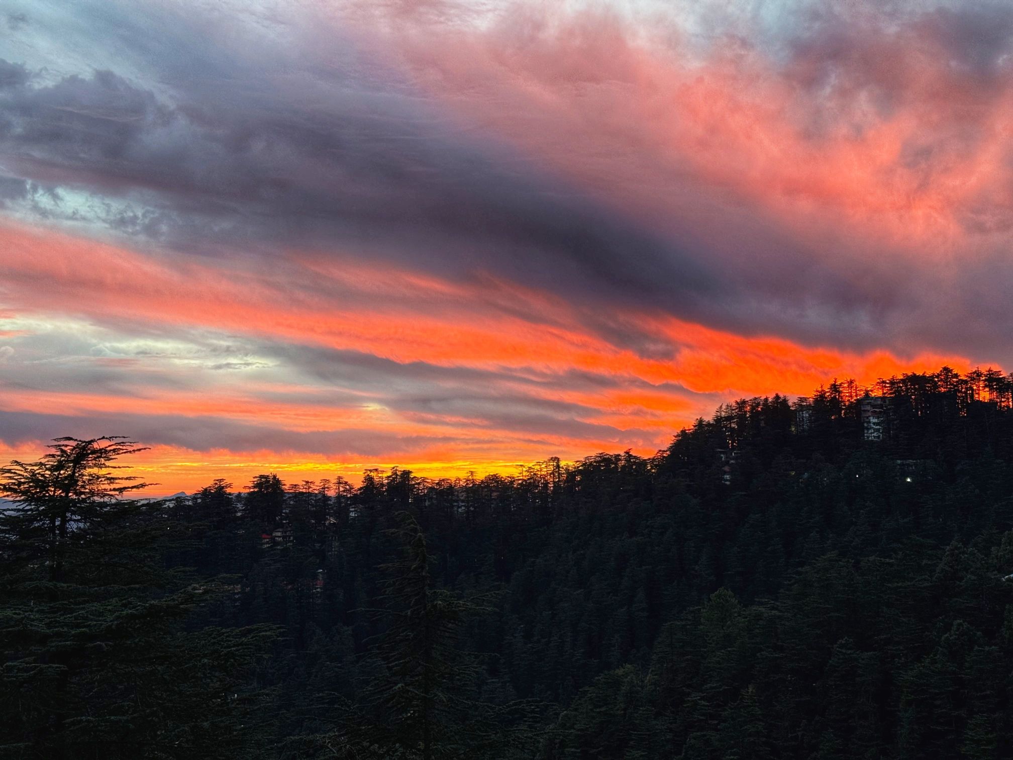
Resume the drive to Narkanda (8885 feet). For your overnight stay, you can choose either HPTDC hotel Narkanda or a similar property that offers comparable amenities and services.
Tip
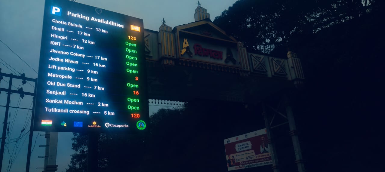
Municipal Corporation of Shimla has installed an LED screen at Shimla Welcome Gate, Taradevi (about 6km before Shimla), showing real time parking availibility in Shimla city. Visitors can check the status of empty parking lots before entering the city to plan their road trip efficiently.
Day 2: Narkanda → Rampur Bushahr → Sarahan Drive
Drive Time: 4 hours on NH5 | Distance: 100 km. | Altitude: 7590 feet (Sarahan)
Bucketlist Experiences
- Visit Padam palace of erstwhile Bushahr dynasty.
- Explore Rampur Bushahr town.
- Explore Sarahan town.
Sightseeing & Day Trips
- Detour to Tani Jubbar Lake.
- Hatu temple.
- Visit Sarahan Pheasantry.
Drive from Narkanda to Sarahan (altitude 2313 meters). Visit the Hatu temple on the way and enjoy photographing the mountains of Dhauladhar and Kinnaur-Garhwal from there. Drive to Sarahan. Overnight at the HPTDC Sarahan hotel.
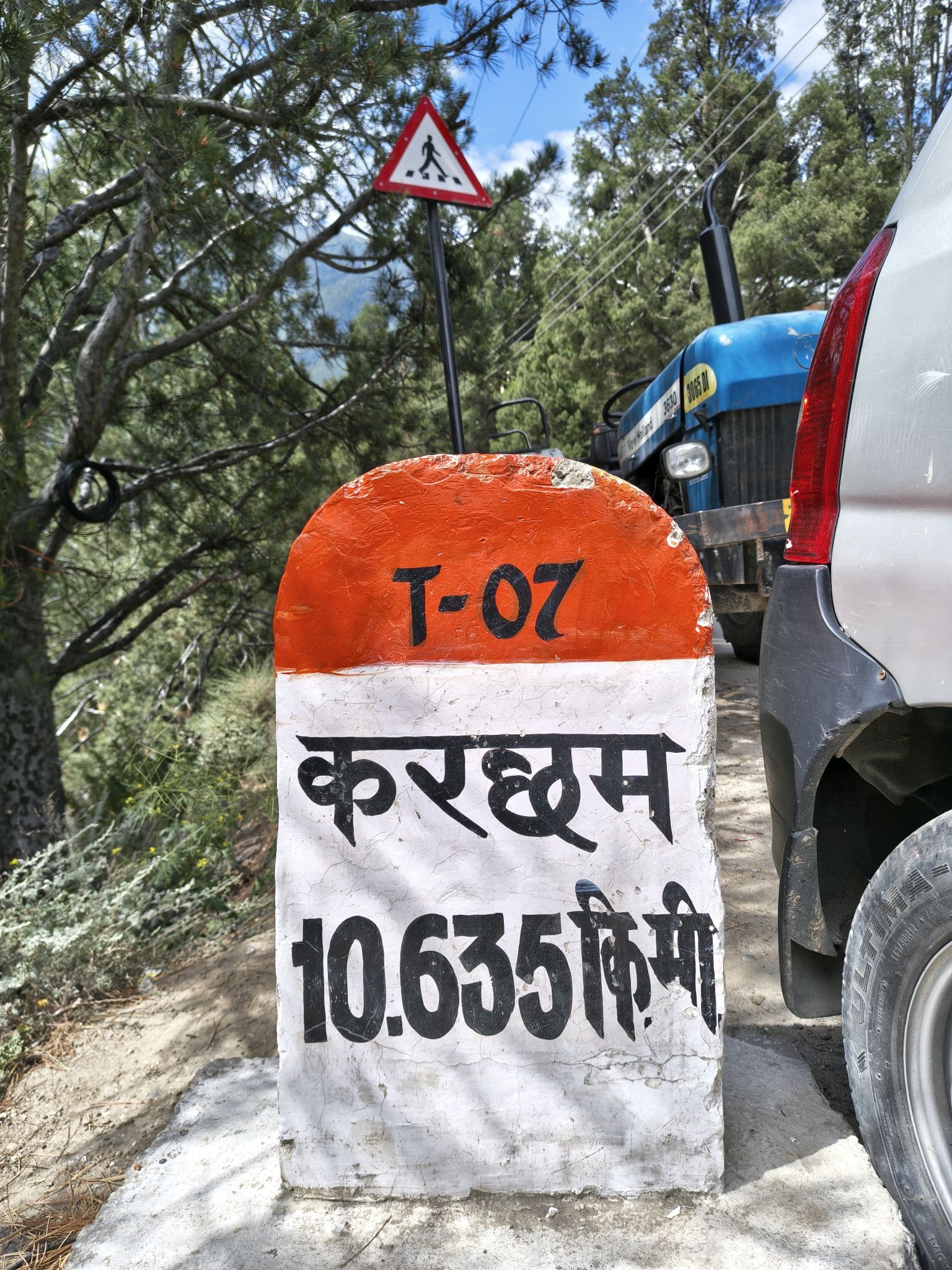
Day 3: Sarahan → Karcham → Sangla→ Chitkul Village
Drive Time: 5 hours on Jeori-Sarahan connecting road, NH5 and Karcham-Sangla-Chitkul Road | Distance: 106 km. | Altitude: 11,320 feet (Chhitkul village)
Bucketlist Experiences
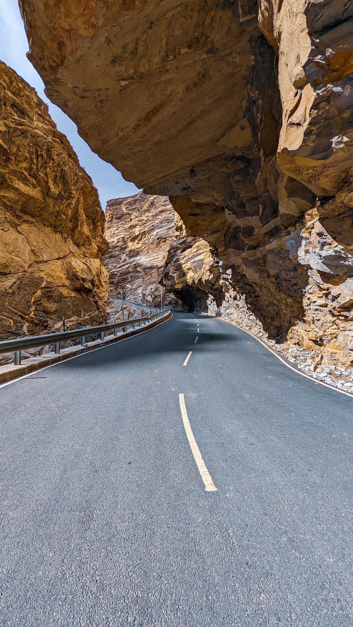
- Drone photography at Tranda Dhank (built by Governor General Dalhousie in 1850s.
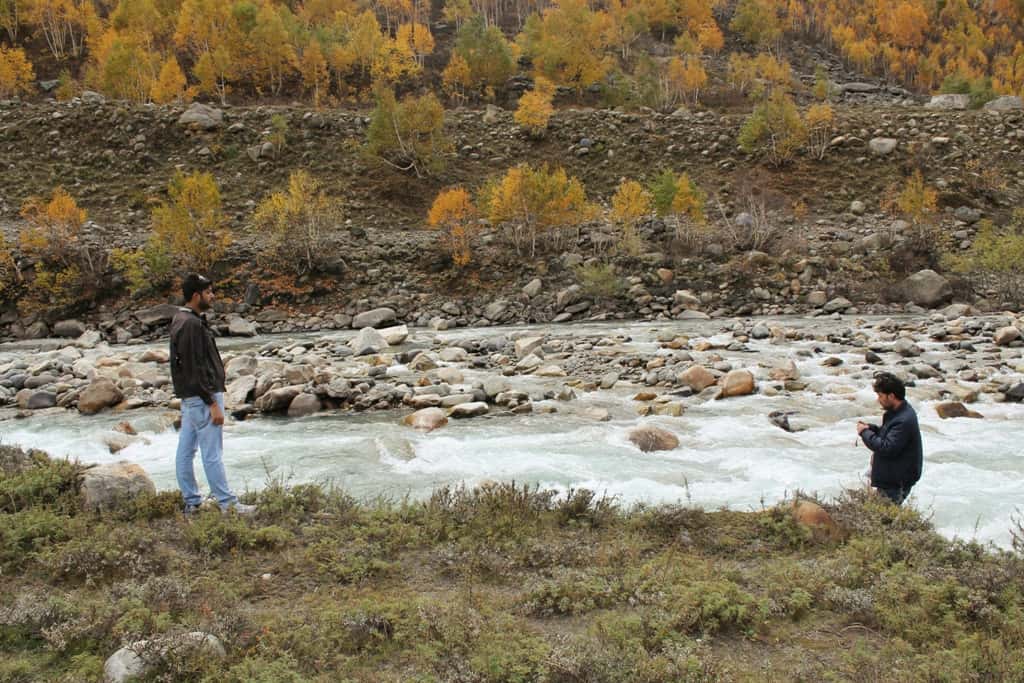
- Experience driving by steep Satluj river gorge and through Tranda Dhank (cliff) ― Old Hindustan–Tibet Road section that is carved into a rock face.
- Angling in Baspa river.
- Birdwatching at Sarahan Pheasantry. See Western Tragopan (Jajurana), Himalayan Monal and other native Himalayan birds.
Sightseeing & Day Trips
- Visit Sarahan Palace (Shanti Kunj) of Bushahr dynasty.
- Bhimakali temple visit.
- Sarahan Western Tragopan Pheasantry visit.
Sarahan is a beautiful village famous for the architecturally and historically significant Bhimakali temple, which has a history of more than 1500 years. One can take in the stunning views of the Srikhand Mahadev peak (5150 meters) from there.
Although it is not actually close enough, the spectacular Srikhand Mahadev mountain range seems to be just one arm away. We strongly recommend taking a trip to the bird sanctuary to see the beauty and rarity of near-extinct bird species such as Western Tragopan – the state bird of Himachal Pradesh.
Begin the day with a visit to the Bhimakali Temple, followed by a drive along the treacherous Tranda Dhank stretch of Old Hindustan-Tibet Road, marked by its overhanging rock roof and sheer drops to the Satluj River flowing at the base of the narrow valley below.
Chaura Checkpost Toll Barrier
About 9km before Tranda Dhank, a new toll/entry barrier has come up. The new toll barrier was introduced in June 2025 just before the Chaura Police Checkpost (on the National Highway 5) by the Special Area Development Authority (SADA), Reckong Peo. According to a notification issued on June 6, all vehicles not registered with the Transport Department of Himachal Pradesh were required to pay a toll/entry fee when entering Kinnaur district.
A subsequent notification on July 7 modified the terms: the toll fee was halved, and now all commercial vehicles registered in Himachal Pradesh (except those registered by the Registering and Licensing Authority district Kinnaur) and all vehicles from other states—including private vehicles—must pay an entry toll.
The entry fee/toll charges are as under:
| # | Type of Vehicle | Entry Fee |
| 1. | Two wheelers | ₹50 |
| 2. | Cars/Hatchbacks | ₹100 |
| 3. | Pickup, SUVs and MUVs | ₹150 |
| 4. | Buses, Trucks and Tempos | ₹200 |
After paying the toll fee, we’ll drive to Chitkul village and stay there in a hotel. Drive distance is about 106 Kms.
Day 4: Chitkul → Sangla → Reckong Peo → Kalpa drive
Drive Time: 3.5 hours on Chitkul-Sangla-Karcham road, NH5 and Powari-Kalpa connecting road | Distance: 72 km. | Altitude: 9712 feet (Kalpa)
Bucketlist Experiences
- See temple architecture of Kamru Badri Vishal deity temple.
- See Kamru fort.
- Angling in Baspa River.
- Tibetan wood carving center.
- Sangla monastery.
- Temple architecture of Sangla Bering Nag Temple.
- Hike to Sangla Kanda Lake
- Chitkul village walk.
- Explore Sangla town and village.
- Rakcham village.
- Photography in Buckwheat fields of Rakcham village.
Sightseeing & Day Trips
- Chitkul Mata Devi temple and monastery visit.
- Kamru temple and fort.
- Ranikanda meadows visit.
- Sangla village and Bering Nag temple visit.
Chitkul (at 11,320 feet above sea level), is the last civil habitation on the Indo-Tibet border (from the India side). It is the most frequented destination in the Baspa Valley of Kinnaur.
We will visit Chitkul Mata temple and then drive back to Sangla. When we reach Sangla, we can visit the Bering Nag temple on our return journey. Visit the ancient fort at Kamru village.
As we continue on our journey, we will reach Kalpa, a well-known place – both among travellers and locals – for breathtaking sunrises over the Kinnaur Kailash mountain range.
After breakfast, drive (for about 65 km) to Kalpa that is located at 9712 feet above mean seal level. Visit Chini village monastery and temple, Roghi cliff point and Roghi village. Overnight stay at the HPTDC Kalpa hotel.
Shilti-Reckong Peo-Kalpa Slip Road
The Shilti road is a short alternative connecting Karcham to Reckong Peo and Kalpa. The longer route via Shontong–Powari–Khawangi runs 23 km — on NH5 as far as Powari, after which a connecting road with three or four hairpin bends climbs to Reckong Peo.
The Shilti route, by contrast, covers the same distance in roughly 10 km on a comparatively straight route. The road is single-lane with some uneven sections, and crash barriers are present only on parts of the route. En route, a roadside natural spring makes for a convenient — and free — car wash stop.
The Shilti route is best suited for clear weather days. During the monsoon, falling rocks and shooting stones make it significantly more treacherous than the traditional NH5 route via Powari–Shontong, and it is best avoided on rainy or overcast days.
Day 5: Kalpa → Moorang → Thangi → Charang village
Drive Time: 4 hours on Kalpa-Powari connecting road, NH5 and Moorang-Thangi-Charang road | Distance: 65 km. | Altitude: 11220 feet (Charang)
Bucketlist Experiences
- Explore Chini heritage village.
- Explore Kalpa Market.
- Take in the stunning views of Kinner Kailash group of mountains (morning and evening views are unparalleled) from Kalpa.
- Spend time with local people of Kalpa and Roghi villages.
- Visit 170+ year old Roghi Forest Rest House built by Governor General Dalhousie.
- Sunrise view of Kinnaur Kailash from Brelengi Gompa
Sightseeing Day Trips
- Rolla Dokhang (infamous suicide point), and Roghi village visit.
- Roghi village and Narayan temple visit.
- Kalpa Vishnu Narayan temple and monastery visit.
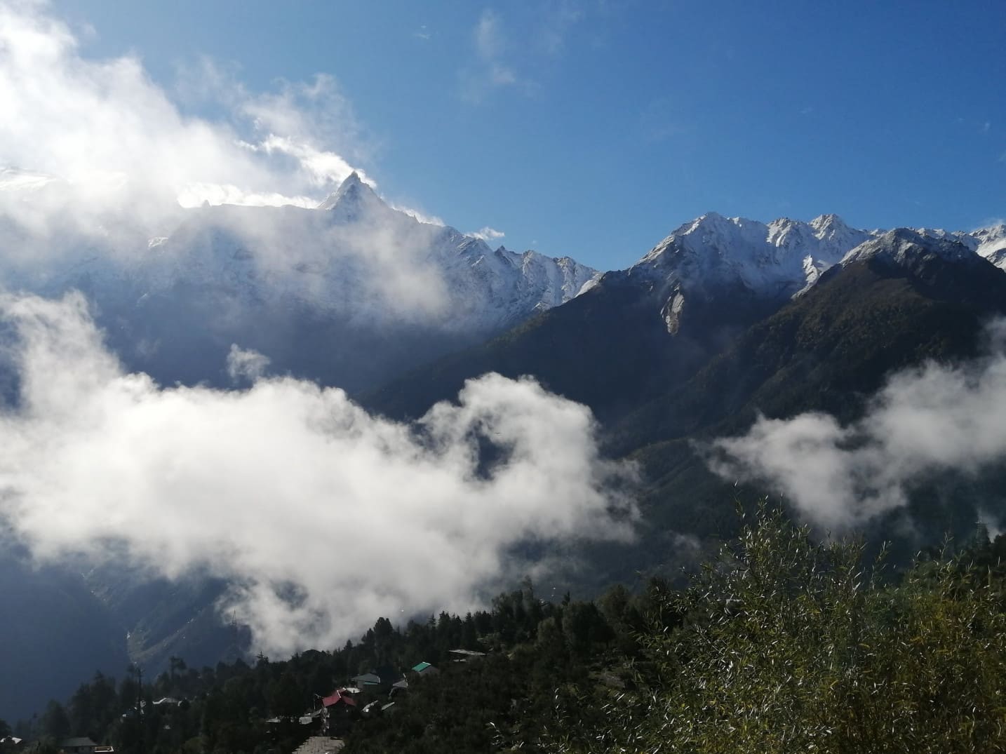
Kalpa (altitude 9712 feet). Kalpa offers splendid views of Kinner Kailash mountain range. One can take in the visceral views of Kinner Kailash peak & Shivlingam, Raldang peak & Jorakanden peak.
Explore places around Kalpa like Chini market and village, monastery and Kalpa Narayanes & Vishnu temple. Drive to Charang village and camp on the meadows near the village.
Day 6: Charang → Nako → Tabo monastery drive
Drive Time: 5 hours on Charang-Thangi-Moorang road, NH5 and NH505 (Khab – Sumdo Checkpost – Tabo) | Distance: 160 km. | Altitude: 10,760 feet (Tabo village)
Bucketlist Experiences
- Visit one of the oldest Buddhist monasteries in Kinnaur, Charang Rangrik Tsungma monastery.
- Visit Moorang village fort and Buddhist monastery.
- Visit Rapuk Shankras Temple of Thangi village.
- Explore Nako village and Nako Lake.
- Gue village detour to see 500+ years old mummy and Gue Mummy Stupa.
- Leo-Chango-Hango village (Hangrang Valley) detour.
Sightseeing & Day Trips
- Charang village walk.
- Rangrik Tsungma Monastery visit.
- Visit the last ITBP check post on Indian border.
Village walk in Charang (altitude ~3400 mtr) and visit Rangrik monastery which is more than thousands of years old. Charang has Zanskar kind of landscape and houses and similar to houses built by the people of Zanskar region.
Drive to Thangi and visit to Lochwa monastery located in the middle of Thangi village. Visit Moorang fort and Moorang village.
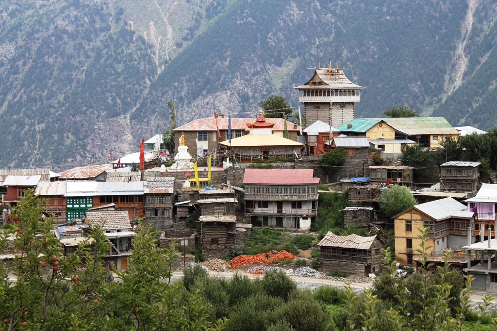
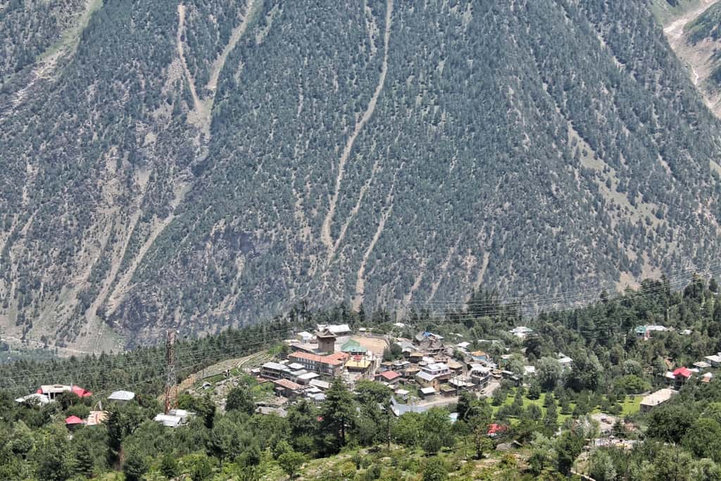
After lunch, head toward Nako. Nako is located at an altitude of 10496 feet in the barren Hangrang valley of Kinnaur. Visit Nako Lake and monastery and drive to Sumdo check post and the oldest monastery in Himachal Pradesh, Tabo. Overnight at a hotel/homestay.
Sumdo Check Post
Due to ever-increasing footfall of the tourists — and the resultant increase in their carbon footprint — in Lahaul and Spiti district, the district administration has started levying SADA (Special Area Development Authority) fee/toll at Sumdo Indian Army Check Post from 1 January 2024.
It was discussed (at a meeting of the Special Area Development Authority) that the tourist traffic is increasing day by day in the Spiti valley. Due to this, there is a financial shortage for solid waste management and sewage management in the Kaza and Tabo areas of Spiti block.
— Harsh Negi, SDM, Kaza
Here are the details of the SADA fee charged for different type of vehicles entering in Lahual & Spiti district.
| Type of vehicle | SADA fee |
| Two-wheelers | ₹100 |
| Cars | ₹200 |
| SUVs | ₹300 |
| Heavy Vehicles | ₹400 |
On February 13, 2026, the office of the Additional Deputy Commissioner cum SADA, Kaza & Tabo, issued an order imposing a ₹500 entry fee on all four-wheel-drive vehicles entering the Spiti Valley through the Sumdo Indian Army Check Post. All four-wheel-drive vehicle owners are now required to obtain prior permission from the Additional Deputy Commissioner Kaza office before entering the Spiti Valley.
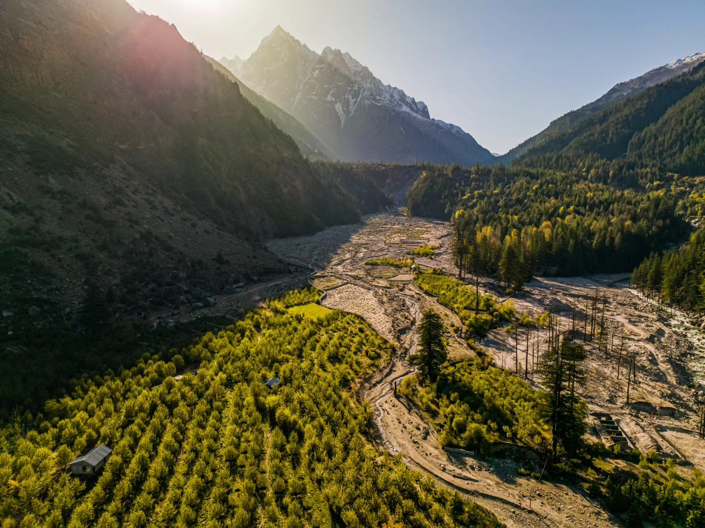
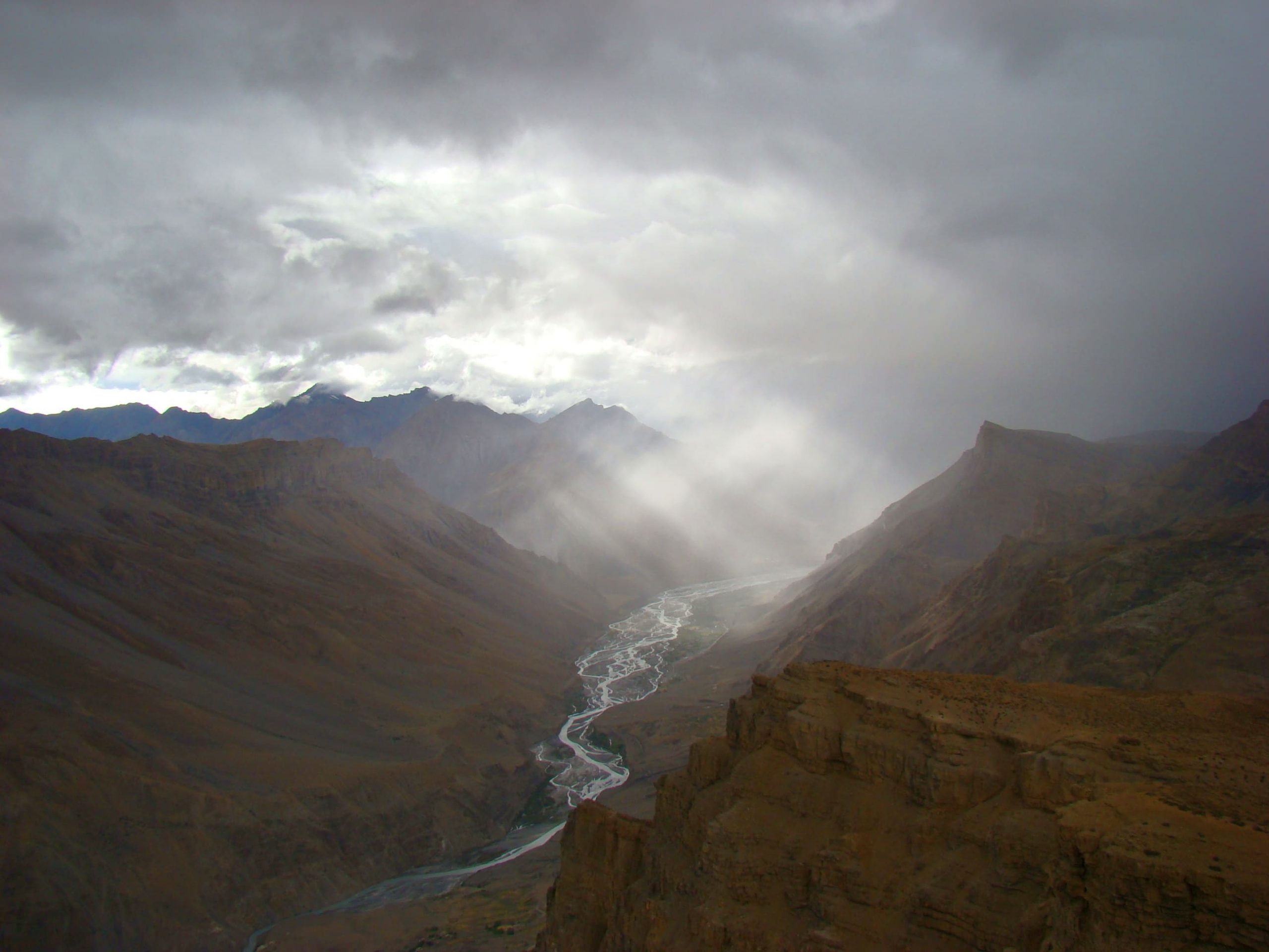
Day 7: Tabo → Dhankar → Attargo Bridge → Pin Valley drive
Drive Time: 3 hours on NH505 (Tabo-Attargo bridge) and Attargo-Mud village road | Distance: 65 km. | Altitude: 12,500 feet (Mud village)
Bucketlist Experiences
- See Thangka scroll paintings, frescos and mural paintings inside Tabo monastery.
- See the mud stupas built around the monastery.
- Hike to Tabo caves (which were used by Buddhist monks of Tabo monastery for meditation).
- Visit Stupas and chortens, monastery museum and library.
- See the rock carvings near Tabo village government school.
- Visit over 1000-year-old Dhankar monastery and fort – A cliff fort and the erstwhile capital of Spiti Nono Kings. Dhankar monastery was listed as the 100 most endangered sites in the world by World Monuments Fund (WMF) in 2006. WMF is a New York based non-government and non-profit organization dedicated to the preservation of historic architecture and cultural heritage sites around the world.
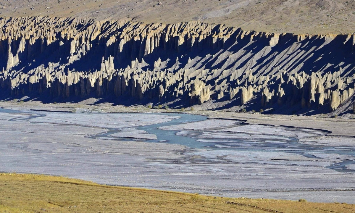
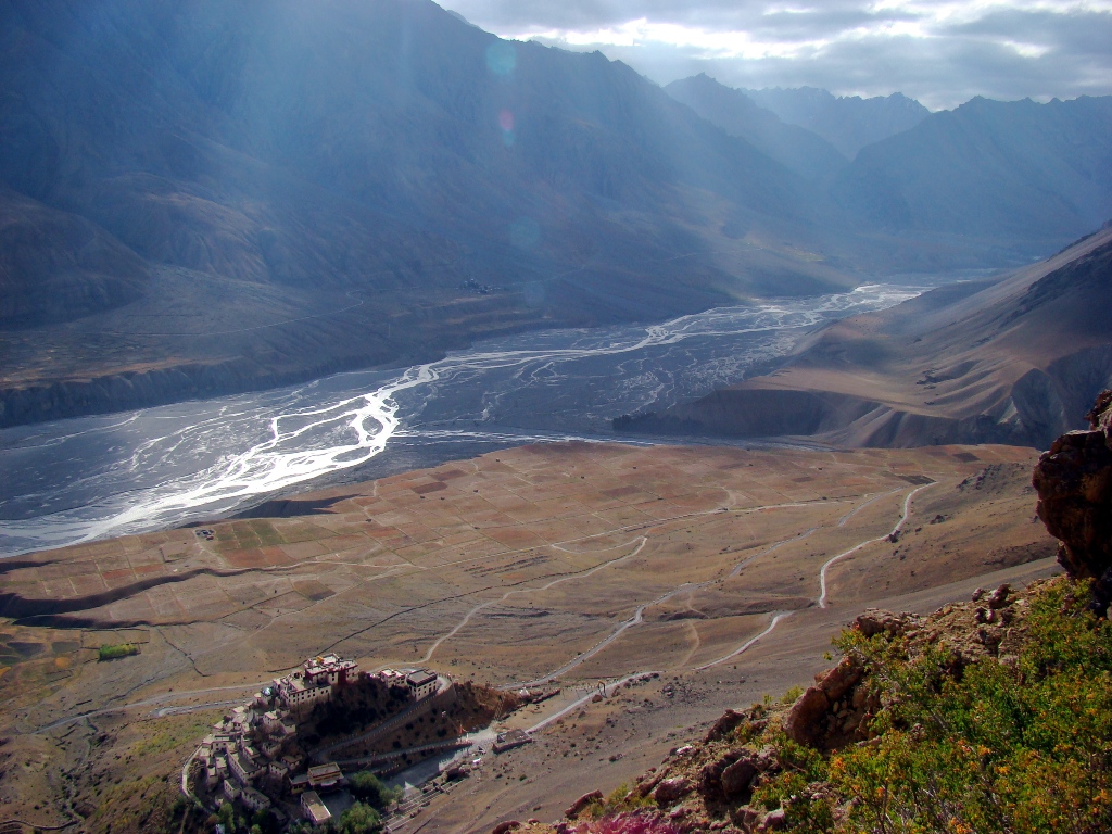
- See the confluence of Spiti and Pin River and panoramic view of Spiti and Pin valley from Dhankar fort roof.
- Dhankar Lake hike.
- See gold-leaf Buddhist sculptures at Serkhang Monastery in Lhalung village.
Sightseeing Day Trips
- Tabo monastery visit.
- Hike to caves above the village.
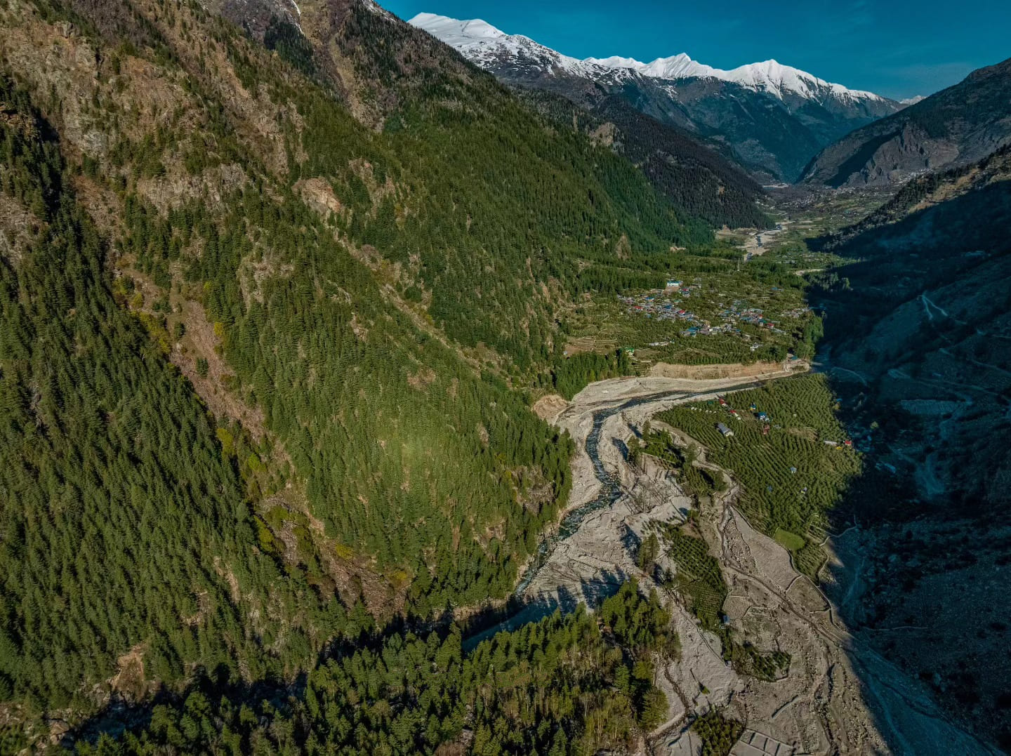
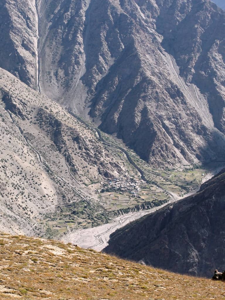
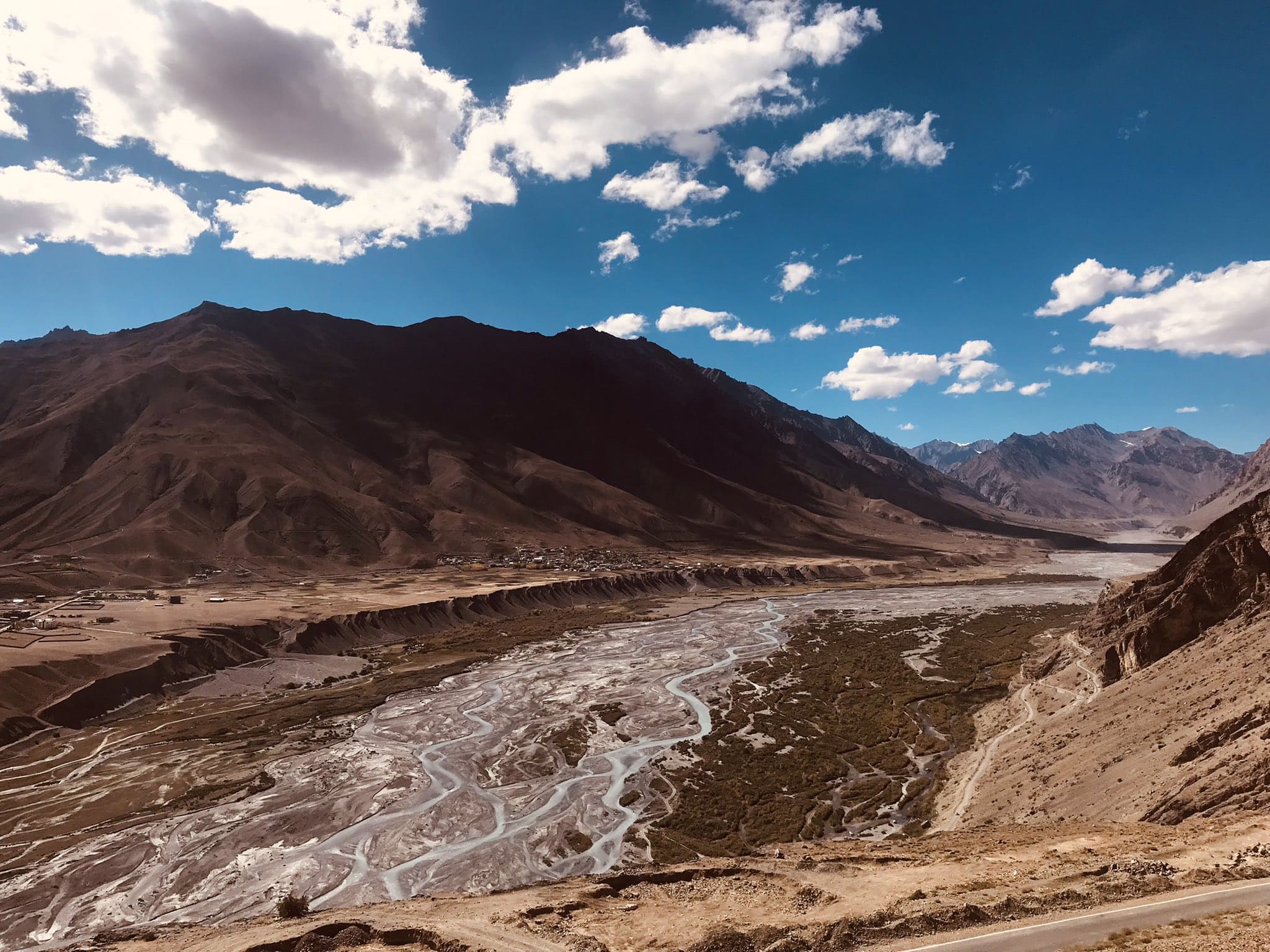
On day 7 of Spiti circuit itinerary, we leave Tabo after breakfast and drive to Mudh village, the last village in Pin valley. Pin Valley is the least explored valley in Himachal Pradesh’s Spiti region.
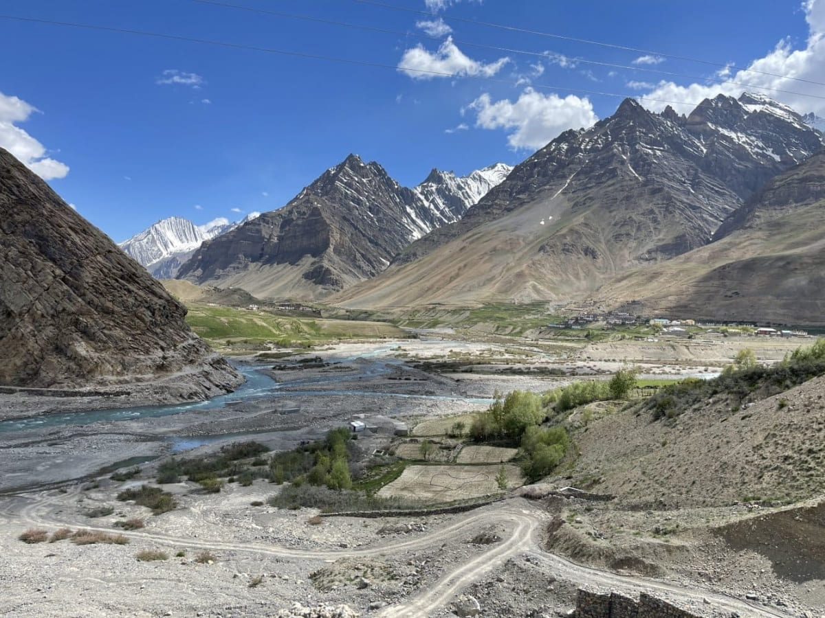
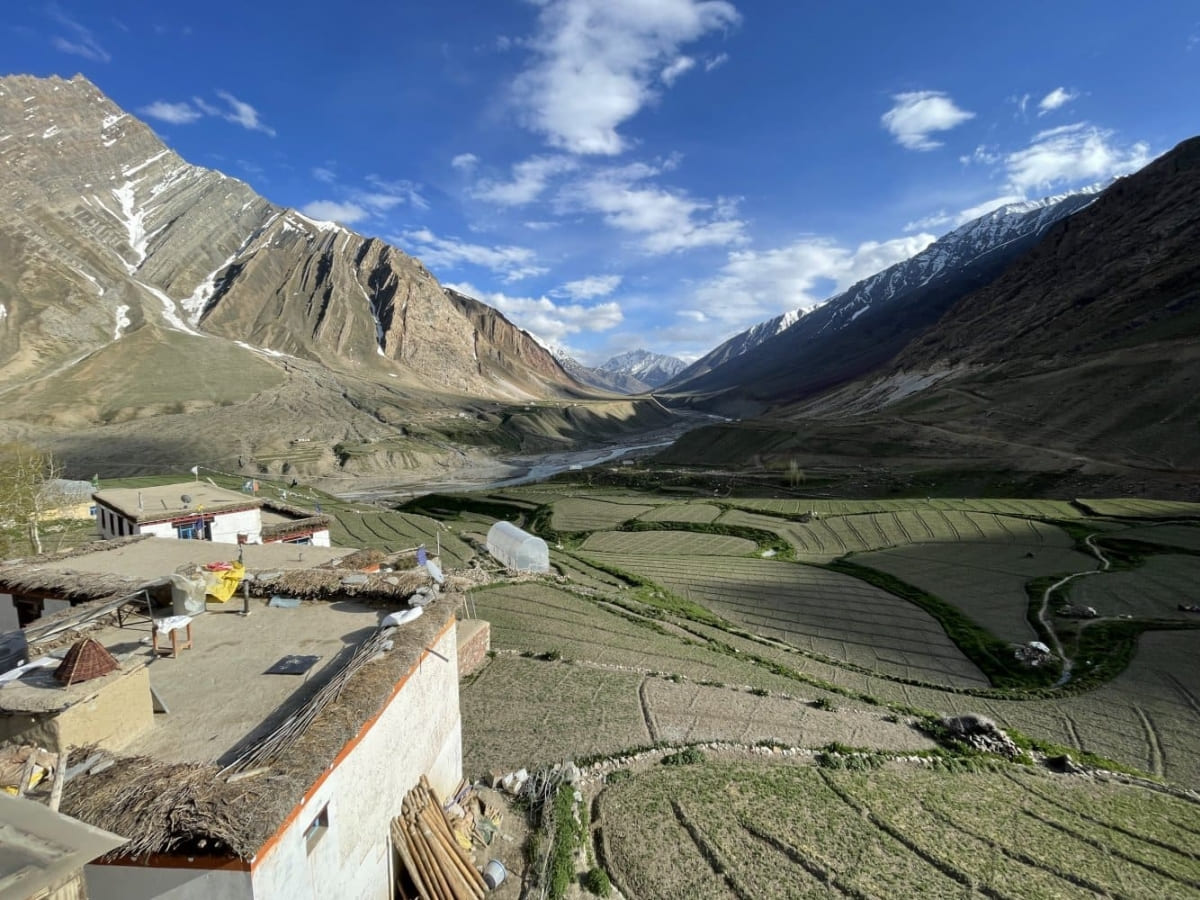
Explore Mikkim and the village of Sangnam. Visit the Kungri Monastery and then the charming hamlet of Mudh — the Pin Valley’s last motorable village.
Stay at Mud for the night (12000 feet above sea level).
Day 8: Mud village → Dhankar Monastery → Kaza
Drive Time: 3 hours on on Mud-Attargo bridge and NH505 (Attargo-Kaza road) | Distance: 55 km.| Altitude: 11,975 feet (Kaza town)
Bucketlist Experiences
- Watch stone breaking ceremony, ritual and drama performance by Buchen (shaman of Spiti Himalaya) in Mud village of Pin Valley.
- Sight rare Himalayan wildlife in Pin Valley National Park
- Visit Stupas and chortens, monastery museum and library.
- Photography on the beautiful banks of Pin River (right side tributary of Spiti river).
- Experience Spitian hospitality in Homestays.
- Taste local dishes and beverages in Homestay.
- See sangam (confluence) of a stream coming from Parvati Pass and Pin River and Sagnam village.
- Walk on Tailing village bridge. A wooden suspension bridge built over Pin river.
Sightseeing Day Trips
- Mud village walk.
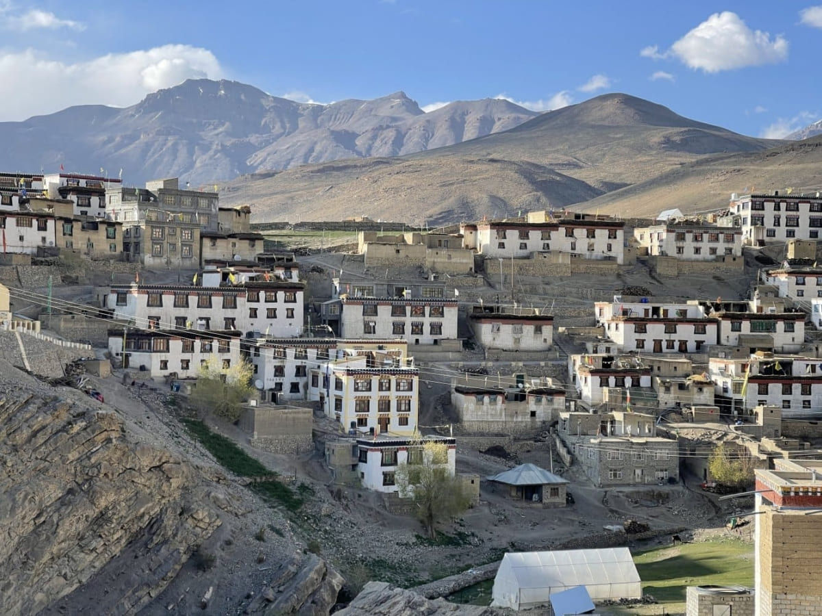
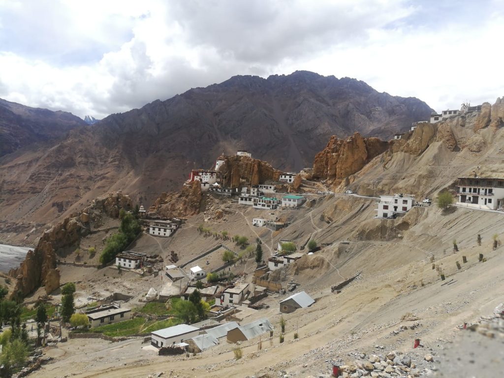
Drive to the eye-catching and imposing monastery of Dhankar. Perched on a riverfront cliff, Dhankar was the former capital of the Spiti Valley (when the valley was ruled by Nono kings).
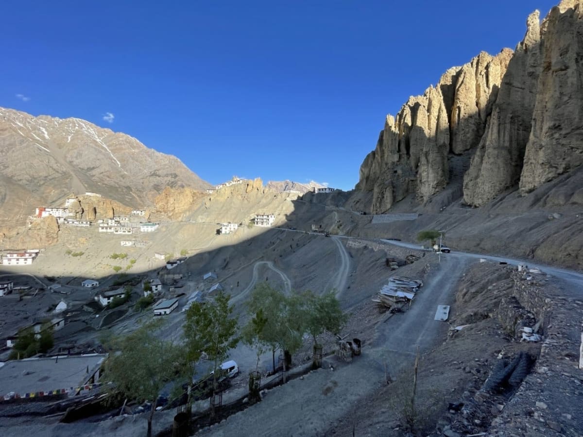
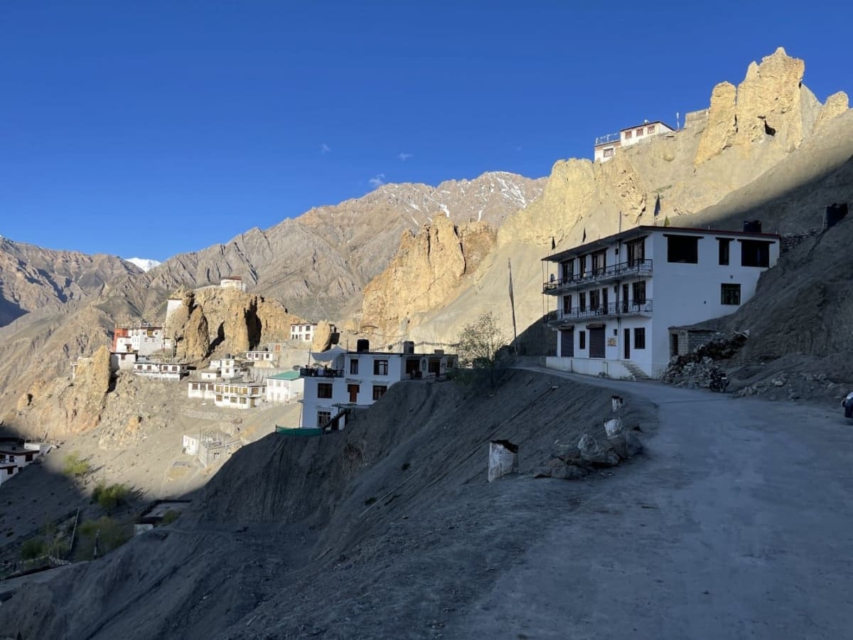
Overlooking the Spiti river, it offers panoramic views of the river valley. Visit one of the oldest Gompa in the Spiti Valley. Overnight in a hotel in Kaza.
Day 9: Kaza-Hikkim-Lalung-Langza-Key-Kibber-Chicham loop (5 – 6 hours drivetime)
Bucketlist Experiences
- Visit Komic (or Komik) village – the highest altitude village of Asia accessible by road.
- Send postcards to your friends and family from highest altitude post office in the world from Hikkim post office by India Post.
- Sight rare Himalayan wildlife in Pin Valley National Park
- Tangyud monastery of Komic.
- See Snow leopard mannequin made with snow leopard skin.
- Take drone shots of Buddha statue at Langza hill.
- Kibber village drive.
- Key (or Ki) monastery visit.
- See Cham dance of buddhist monks at Key monastery during the Guitor festival.
- See murals and Thangka paintings inside the Ki monastery complex.
- Take drone shot from Chicham suspension bridge.
Sightseeing Day Trips
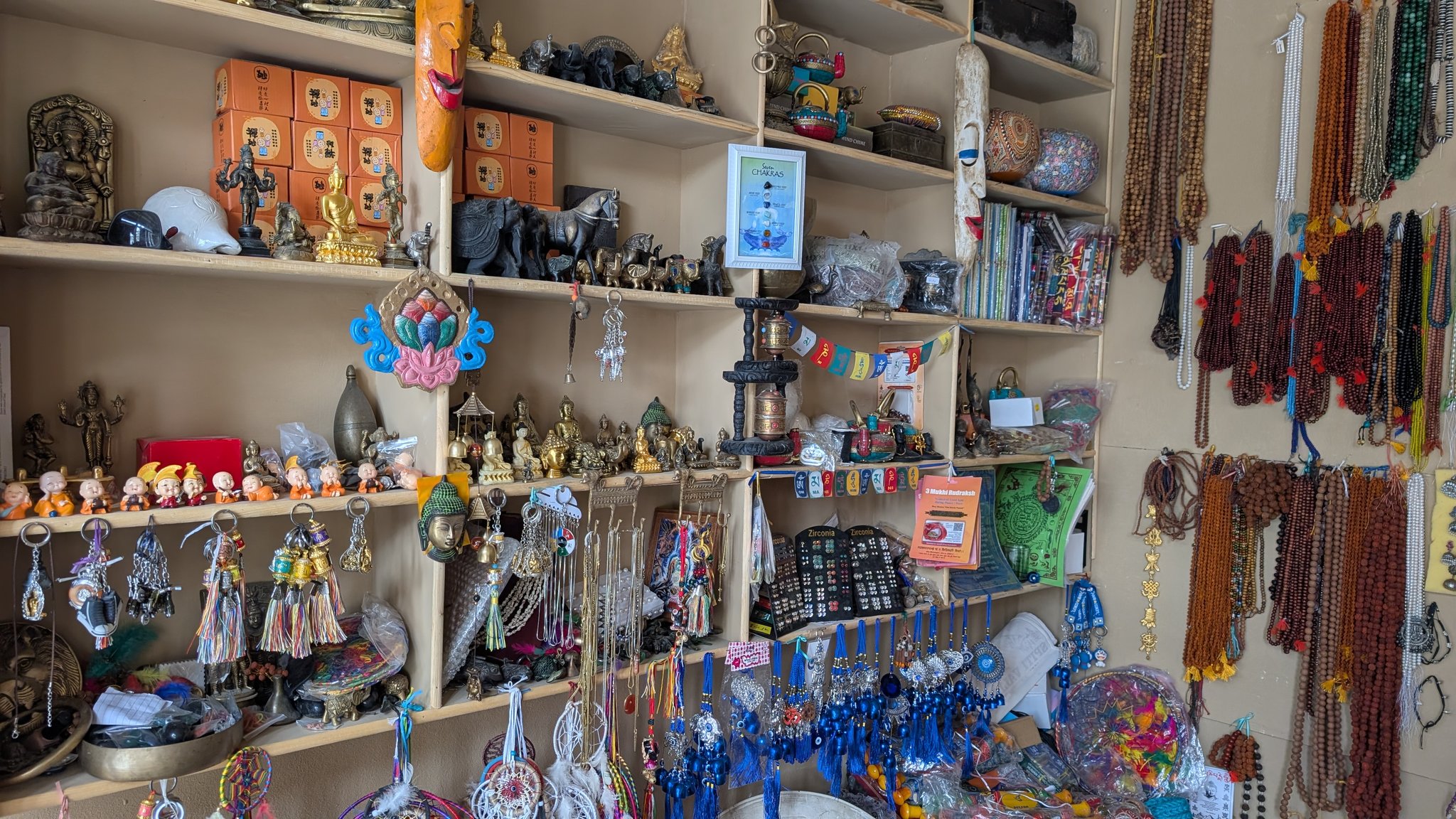
- Kaza market visit for Tibetan/Spitian jewellery and souvenir shopping
- Kaza monastery visit.
- Key-Kibber-Langza drive.
- Komic and Hikkim village visit.
- Chicham village visit.
The highest village in Asia, Komik, which literally translates to ‘eye of a snowcock’, is situated at a height of 4513 meters. Later, we drive to Hikkim (PIN 172114) where we visit the world’s highest post office in the world. The Hikkim Post Office has been run by postmaster Rinchen Chhering since its inception in 1983. After sending out a postcard, we drive to Langza.
Day 9 brings you to one of Spiti’s most breathtaking landmarks—the Chicham suspension bridge. Completed in 2017 after nearly 14 years of construction, this engineering marvel stretches across a dramatic gorge (carved by a tributary of the Spiti River) plunging a thousand feet below. It now links the villages of Kibber and Chicham, replacing the hair-raising hand-pulled Jhulla that locals once used to cross (from Chicham to Kibber or vice versa). Before leaving, make sure to sip a steaming cup of seabuckthorn tea at the tea stall by the bridge.
Once you are here, you can walk around the village and visit the ancient Lang (Temple) which is estimated to be around 1000 years old. Visit to Key monastery. Overnight stay at Cherring’s homestay, Kibber.
Kibber is one of the two (other is Korzok) villages from where the trekkers start their quest for Parang La pass.
Raacho Trekkers
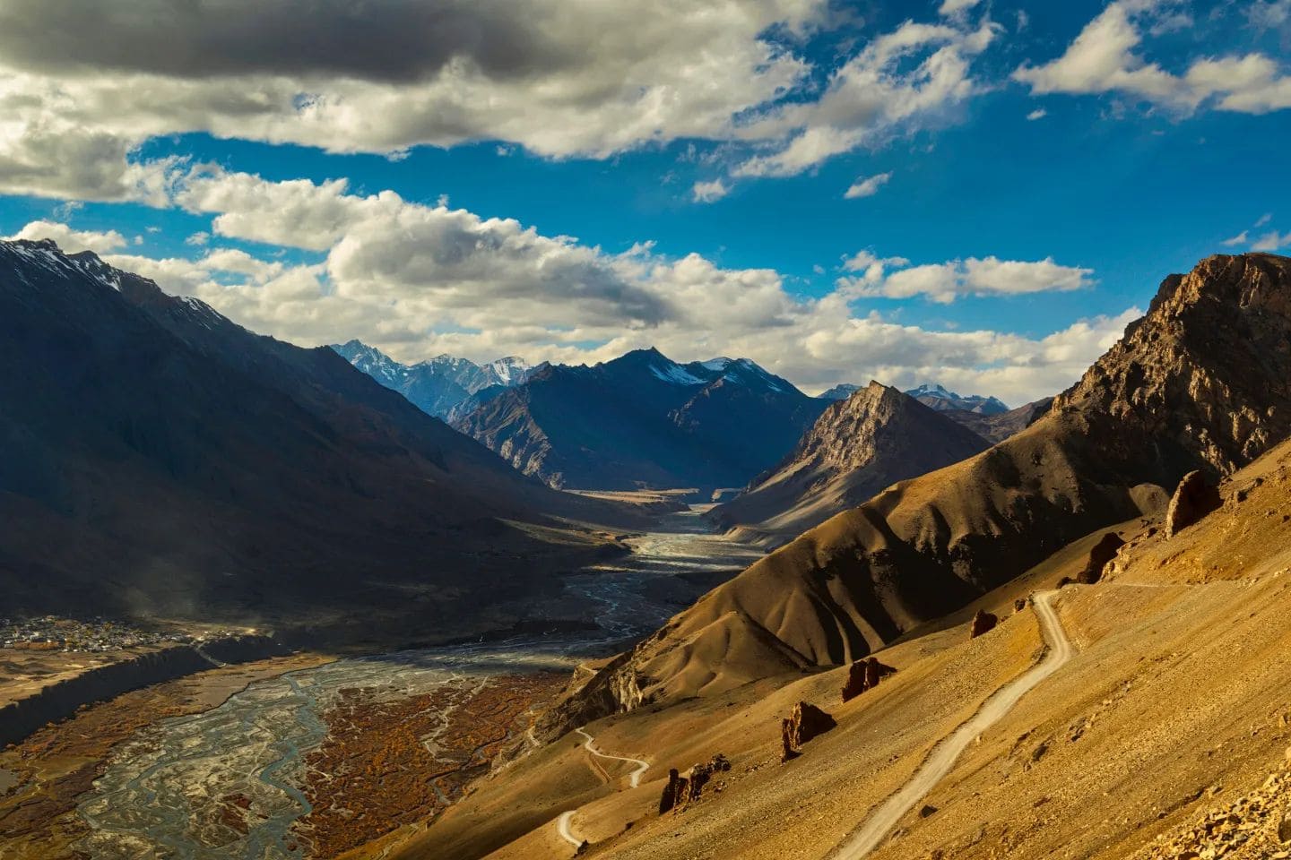
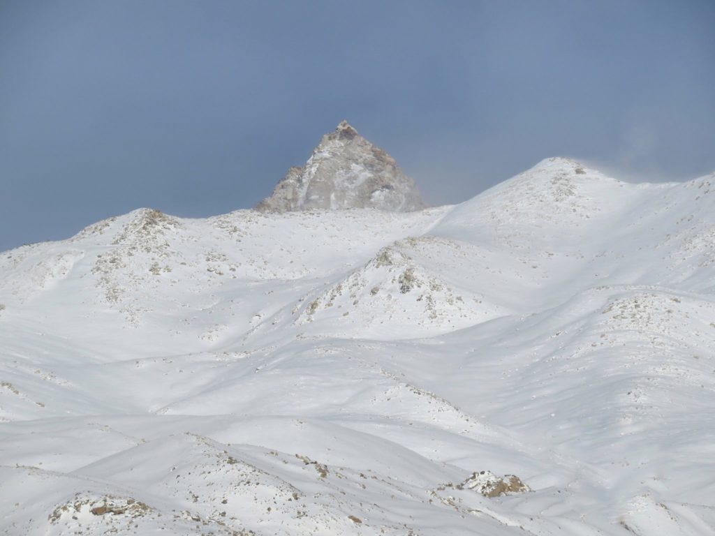
Day 10: Kaza → Kunzum Pass → Chandra Taal Lake (4270 meter)
Drive Time: 4 hours on Kaza-Kuzum-Batal road (NH505) and Batal-Chandratal lake connecting road | Distance: 102 km.| Altitudes: 14931 (Kunzum Pass) and 14010 feet (Chandratal Lake)
Bucketlist experiences
- Camping experience near Chandratal Lake.
- Explore small glacier lakes above Chandratal.
- Experience view of Spiti and Lahaul valley from 4551 meters high Kunzum-La pass.
Drive to one of the most photogenic places in Spiti Valley – the Chandra Taal Lake. Before that, we pass through the high altitude pass of Kunzum La. Stop by the stupa and pay tribute to the local goddess, “Kuzum Mata” as she’s known.
At 15,000 feet above sea-level, the Kunzum Pass connects Kullu and Lahaul to the Spiti Valley. Live your dream of camping comfortably in the Himalayas as you spend your evening gazing at the Milky Way and the millions of stars on a clear night. Overnight at a camp located 2 km away from Chandratal Lake.
Day 11: Chandratal Lake to Manali drive via Atal tunnel
Distance 110 km. 3 hours drivetime on Batal-Atal Tunnel (NH505) and Atal tunnel-Manali road.
Bucketlist experiences
- Experience savoury food at Chacha-Chachi dhaba at Batal.
- Crossing numerous streams and nallahs en route.
- Drive through Atal Tunnel – the engineering marvel by BRO (Border Road Organisation.
On the 10th day of this Spiti Valley tour, drive from Chandratal Lake towards Manali. Drive through the engineering marvel i.e. Atal tunnel and drive to Manali to end our breath-taking Spiti Valley sojourn. Overnight in a hotel in Manali.
Day 12. Manali to Chandigarh.
After breakfast, enjoy some brilliant views of the Himalayas from your hotel in Manali. Proceed to Chandigarh after breakfast. Drop off at Chandigarh airport in the afternoon. The Spiti circuit tour ends here.
₹ Cost Inclusions in Spiti Circuit Trip
- All arrangements for overnight stays during the trip.
- All food expenses.
- Driver, fuel and toll charges.
- Food will usually consist of morning breakfast, lunch, evening high tea and dinner.
- Special trained certified guides trained for emergency situations.
- Local guides and workers with in-depth knowledge about the local area.
- It will be a cultural and traditional experience as all stays will be mostly in villages.
- Inner line permits and arrangements en route will be arranged by the operator.
- All stays and lodging on a twin sharing basis shall be provided.
Exclusions
- Any kind of personal expenses.
- Camera fees or any other costs arising out of unforeseen circumstances and situation beyond our control.
- Anything not mentioned in the inclusion section.
🧭 Places to visit en route Kinnaur, Spiti and Lahaul
Narkanda

Narkanda is a small town in the Shimla district of Himachal Pradesh. It is located at an altitude of 2750 meters on the Hindustan-Tibet Road (NH 05). Surrounded by the forest Kinnaur – Garhwal Himalayan Range. The experience of a panormic view from the Hatu top is not to be missed.
Tani Jubbar Lake
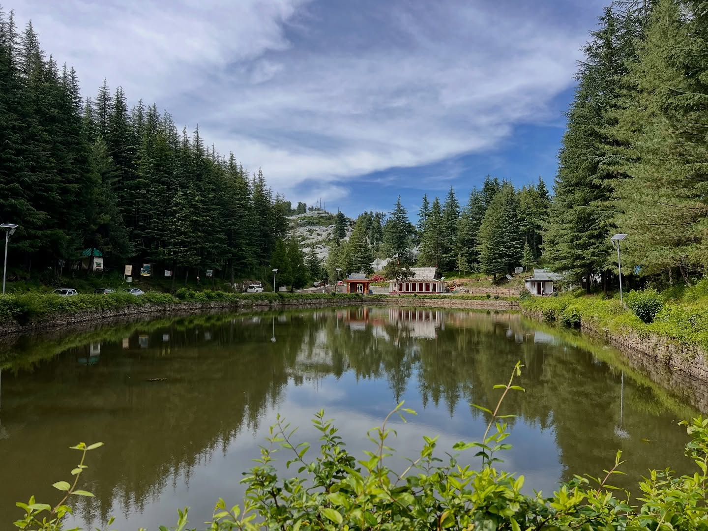
Located just 10km road distance away from Narkanda (On Narkanda Thanedar Road), this is a small sacred lake cradled by deodar forests, mountain meadows and apple orchards, with temple of local deity Nag Devta beside it. Community structures nearby reflect a blend of local architecture and subtle colonial-era influences.
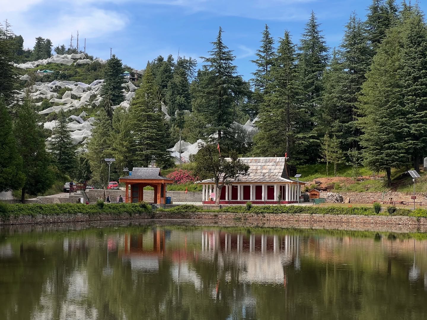
The term “Jubbar” translates to meadows in the local Pahari dialect, perfectly embodying the tranquil grassy expanses surrounding this lake.
Padam Palace, Rampur Bushahr
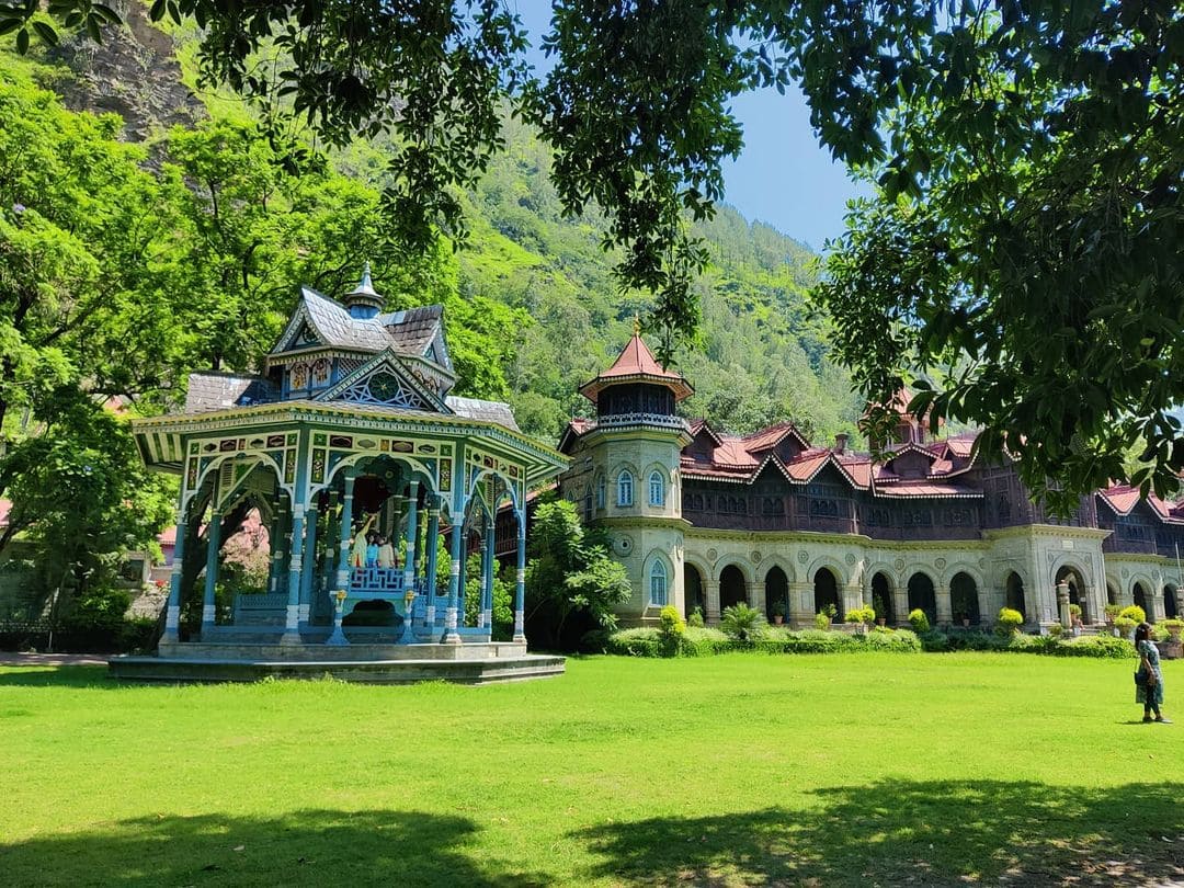
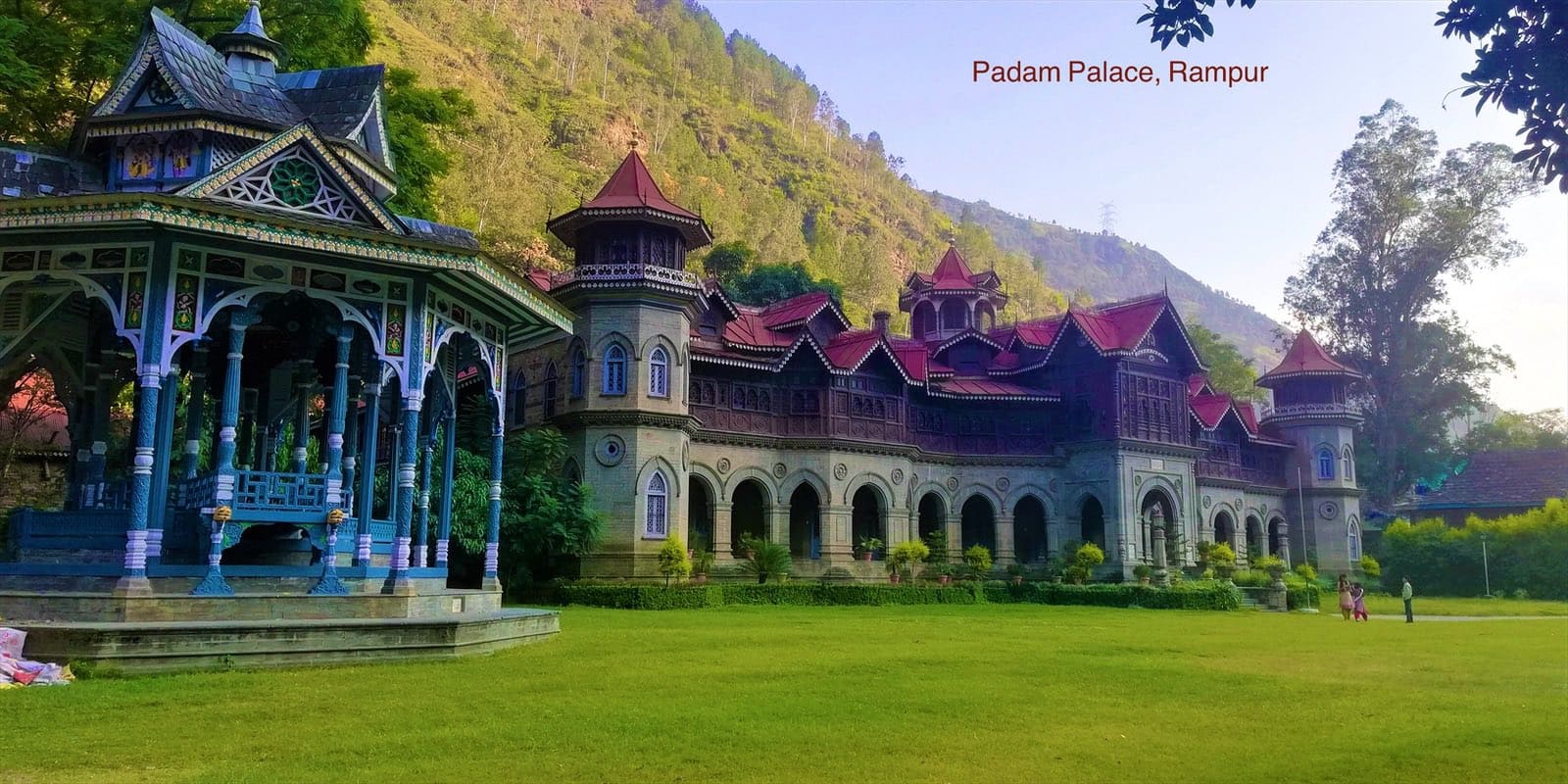
The palace of erstwhile Bushahr princely state is built in neo-gothic architecture. Built between 1919 and 1925 for the Raja of Bushehr, the main building is still private, but one section is now the Nau Nabh Hotel, and the garden is open to visitors. From here you can admire the facade’s stone arches, carved-wood upper storey, peaked gables, and turreted towers. In front is a remarkable multi-gabled bandstand carved with peacock figures.
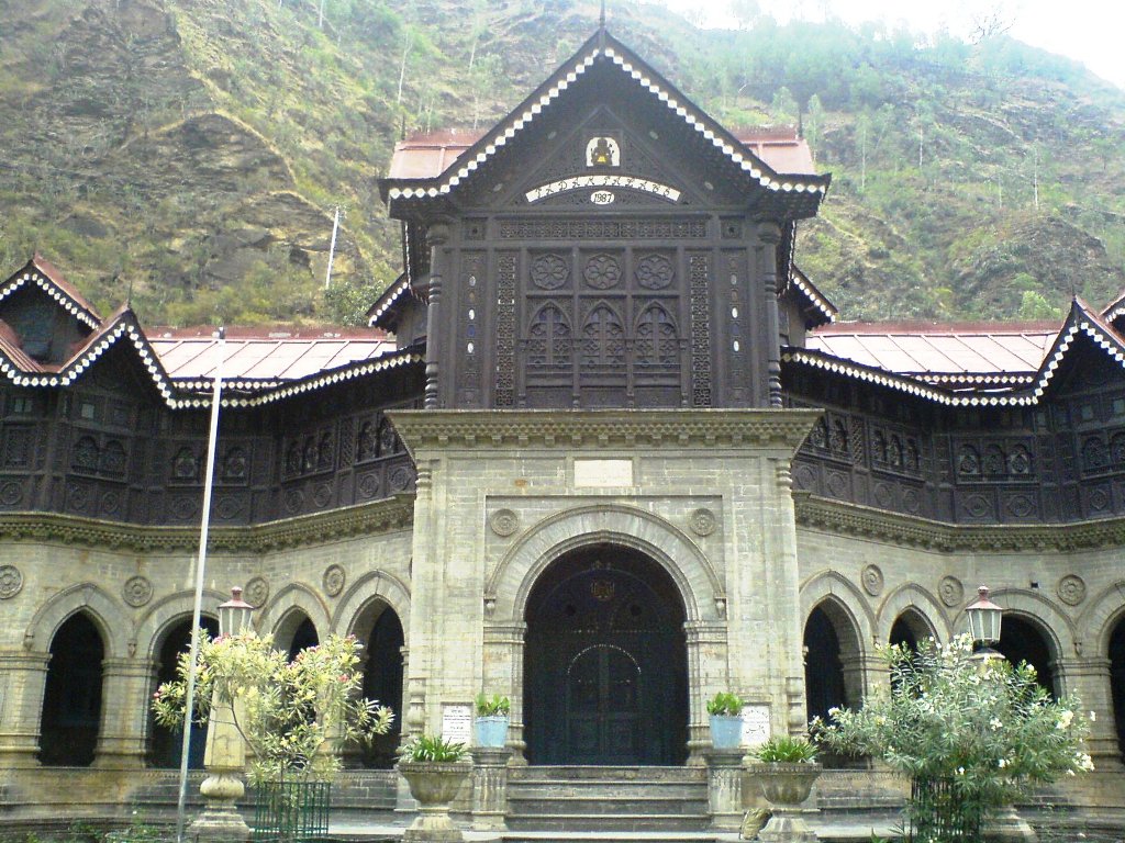
Sarahan
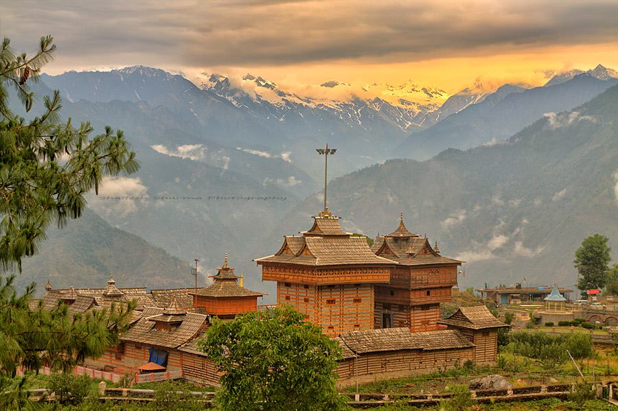
Sarahan is a small village near Jeori town. It is the site of the Bhimakali Temple, dedicated to the goddess Bhimakali, the presiding deity of the rulers of the former Bushahr State. The temple is situated about 170 kilometers from Shimla and 12 kilometers from Jeori town.
Sarahan Pheasantry
Also known as Jajurana Bird Sanctuary, this park is worth a visit. It hosts Jajurana, the state bird of Himachal Pradesh and a few other rare birds. Please note that the sanctuary remains closed from July to September for bird mating season. If you are traveling in any month apart from these three, a visit is highly recommended.
Sangla/Baspa valley
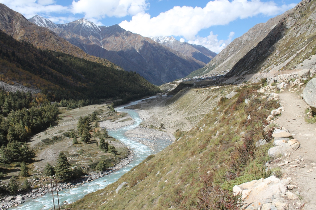
Bordering along western Himalaya with Tibet and Garhwal, the Baspa valley of Kinnaur has been open to visitors since the early nineties. The valley got its name from the Baspa river which originates from Chung Sakhago pass and meanders for around 30 km before meeting Satluj on its left bank near Karcham. Unlike the Spiti valley and Hangrang region of Kinnaur, the Baspa valley is a green paradise in largely barren mountains.
Baspa valley or Sangla valley is known for fruit-laden orchards, cedar-covered slopes and flower crusted meadows. Bhojpatra tree is abundantly found in the Chitkul region. A land of blue skies, buzzing Baspa river, soaring peaks, deep valleys, apple orchards, and syncretic culture — Baspa valley a place for people who are seeking genuine peace and soul-calming solitude far, far from the madding crowd. The fort of Kamru is another landmark in Baspa valley.
Chitkul, Rackcham, Sangla, Kamru and Chansu villages should be on your bucket list if you are visiting Kinnaur for the first time.
Kalpa Village
A small village about 10 kilometers from district headquarters Reckong Peo, known for the magnificent view of Kinner Kailash peaks. The focal point is Chini village and surrounding places like Kalpa Narayanas temple and Buddhist monastery.
Kalpa will probably be the last town where your phone will work flawlessly, no matter which network you are on. As you cross Kalpa and continue towards Pooh, your phone services will be a come and go before it completely dies. Only the BSNL network works in the Spiti & Lahaul valley.
Reo Purgyil peak view
At an altitude of 6816m, it is the highest peak of the state of Himachal Pradesh. You can get a good view of the peak from Khab Bridge if the weather is clear. If not from Khab Bridge, you will have to go up to Namgia or Tashigang village to get a clear view. Nako Village is located on the slopes of this mountain.
Nako Lake & Monastery
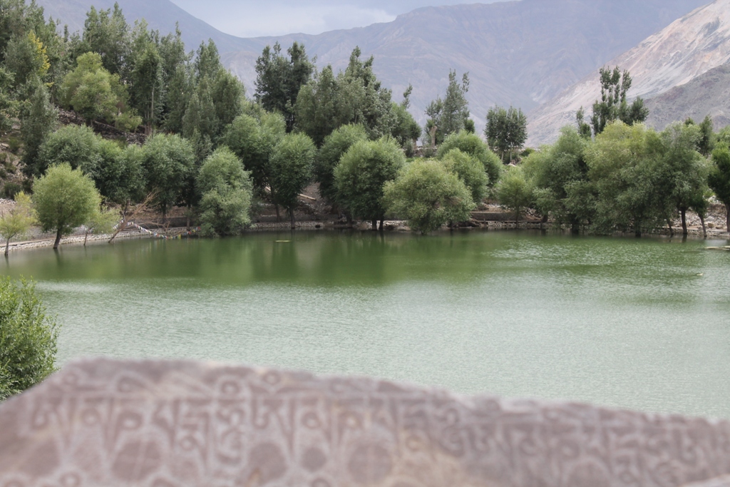
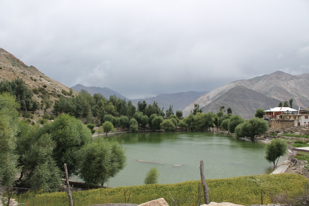
A small man-made lake in the village of Nako. It is not much to look at during the daytime but try some photography around the lake at either dusk or dawn and you will be able to get some good shots.
Nako Monastery is an 11th-century ancient monastery located in the village of Nako. It was built by Buddhist Mahaguru Rinchen Zangpo who translated many Sanskrit Buddhist texts into Tibetan. He founded around 100 monasteries in western Tibet including Tabo monastery.
Tabo Monastery
Tabo Monastery: An ancient monastery believed to be over a thousand years old and one of the holiest. Founded in 996 AD it is also known as Ajanta of the Himalayas. Many priceless collections of scroll paintings, manuscripts, well-preserved statues, frescoes, and extensive murals can be found here.
Advisory
This over 1,000-year-old masterpiece of mud structure (currently under the protection of the Archaeological Survey of India) is built from rammed soil. Its celebrated frescoes and mural paintings — among the finest surviving examples of Buddhist art in the world — face a growing threat from increasing rainfall driven by climate change. Moisture is steadily seeping into the ancient mud walls, deteriorating the outer structure and eroding the irreplaceable artwork within. Some of them have already sustained damage. When visiting, please exercise the utmost care and respect inside the monastery complex, particularly within the main temple, Tsug la Khang. Avoid touching the mud walls, mural paintings, and any artwork inside the monastery premises.
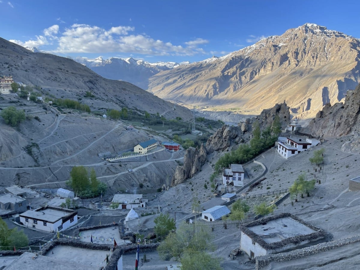
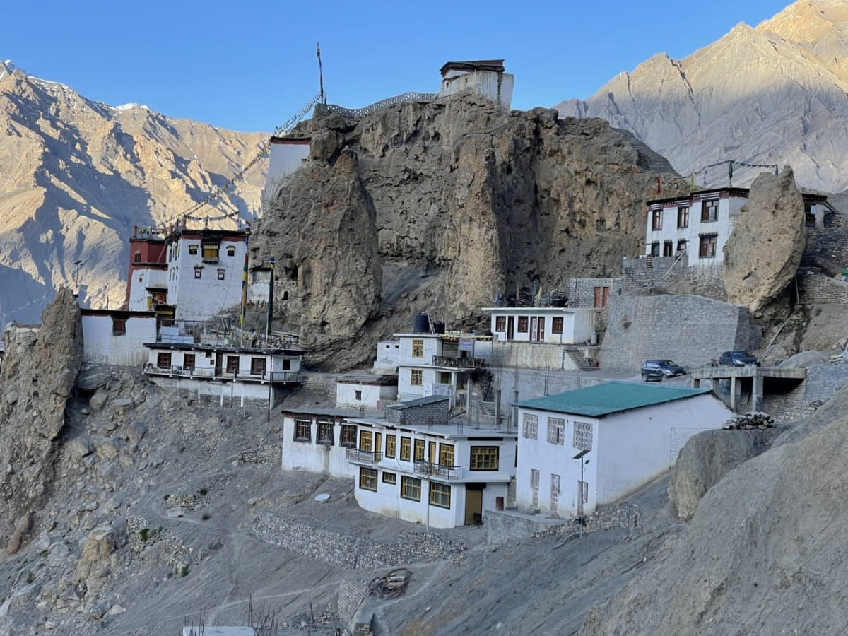
Dhankar Monastery
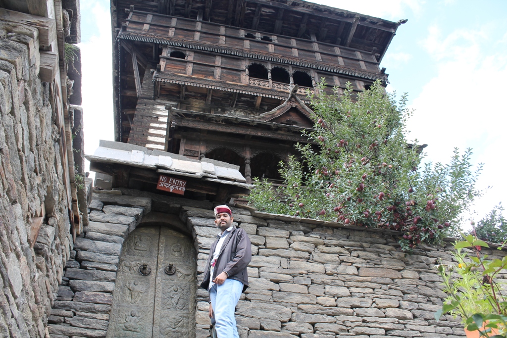
Also known as Dhangkar Gompa, it is an ancient monastery built on a 1000 foot high cliff overlooking the confluence of Spiti and Pin Rivers. Apart from its heritage, this monastery is also famous for its spectacular setting. “Dhang” means cliff and “Kar” means fort, hence the literal name of the place is “Fort on a cliff”.
Key Monastery
The Key monastery.
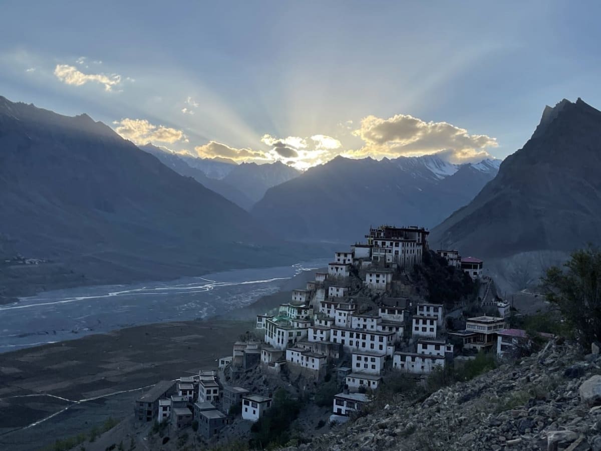
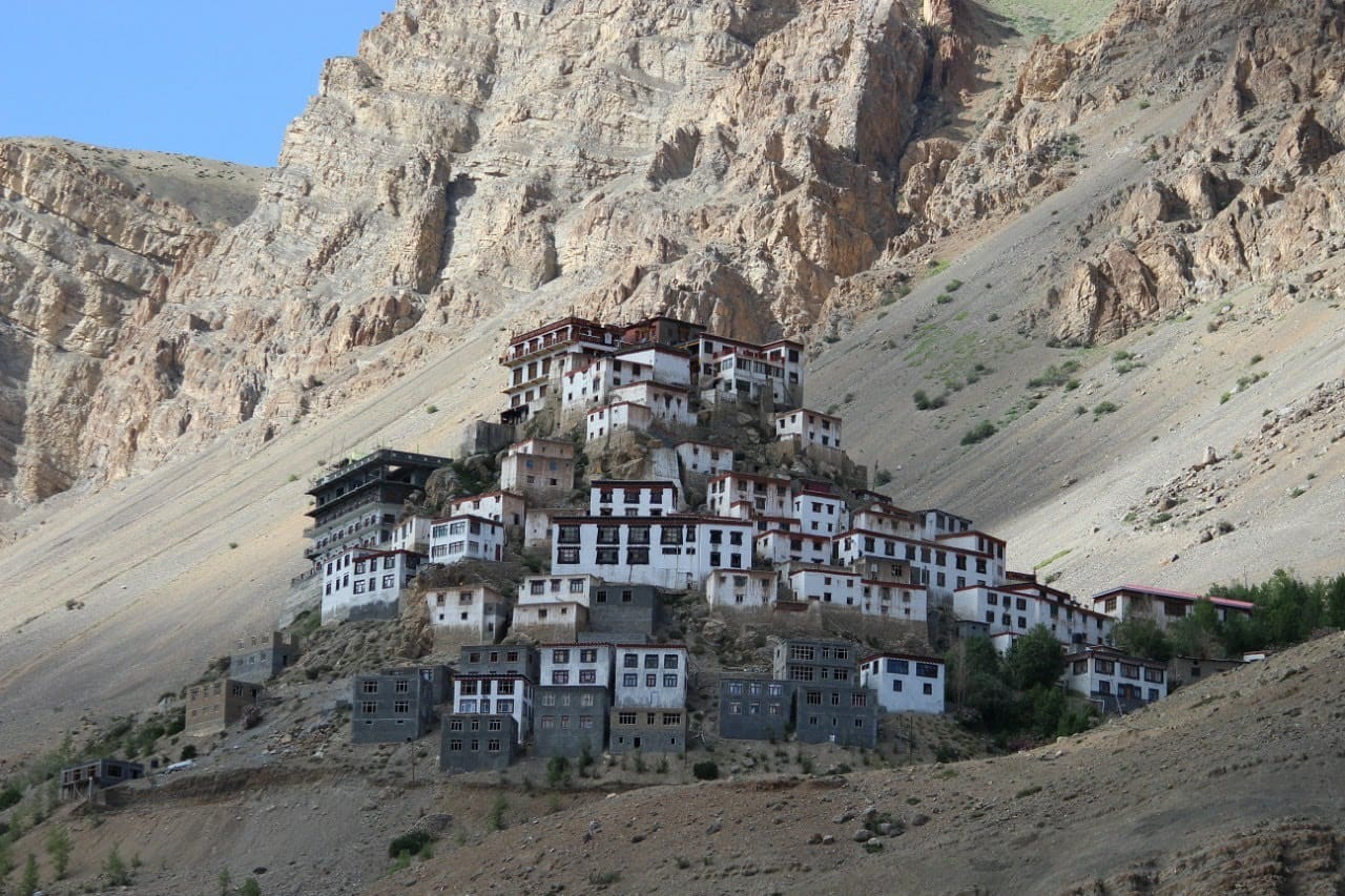
Also known as Kye or Ki Gompa, it is one of the largest monasteries in Spiti valley that also serves as a training center for Lamas. It is believed to be over a thousand years old and has a vast collection of ancient murals and books.
Kibber Wildlife Sanctuary
It was established in 1992, Kibber is India’s only wildlife sanctuary in cold desert and is home to several rare animals like Ibex, Blue Sheep, Red Fox, Tibetan woolly hare, Himalayan wolf, lynx, pika, Tibetan wild ass.
Kunzum Pass
Your first high altitude pass of the journey, unless you have somehow managed to climb up to Shipki La in which case Kunzum will be your second. Connecting the valleys of Lahaul and Spiti, this pass is at an elevation of 4,590 meters, higher than Rohtang La. It remains closed from late October until early June.
Chandratal Lake
A beautiful lake is also the source of the river Chandrabhaga. If you can manage to be around here after sunset, it is a perfect place for capturing some magnificent sky and milky way pictures.
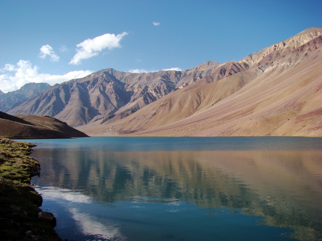
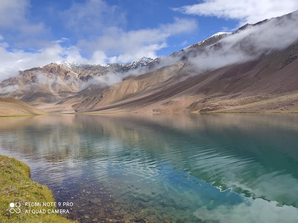
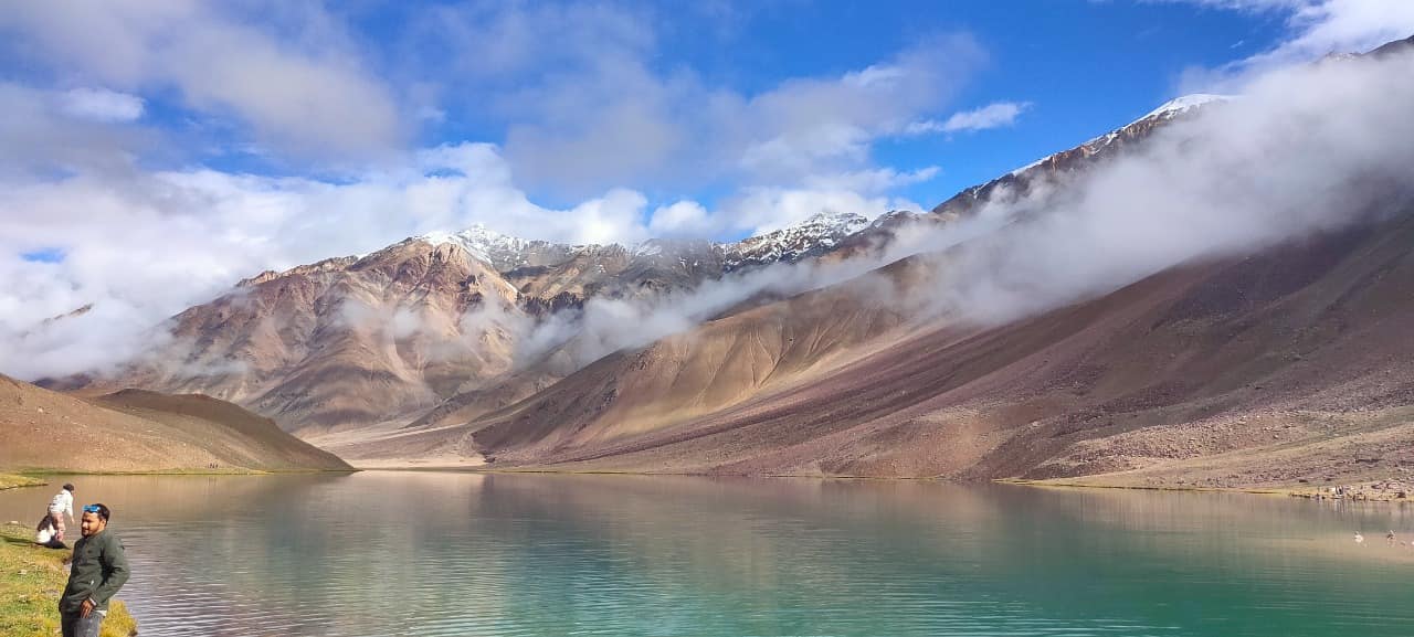
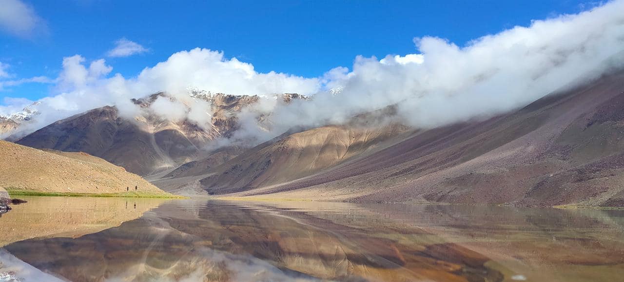
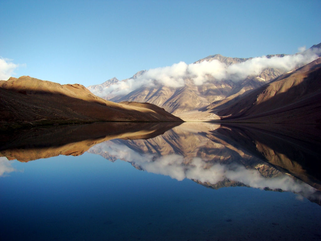
This small lake is one of the key highlights of the journey to Spiti valley and a perfect camping spot. There is also a legend associated with this lake. The confluence of the “moon-born” Chandra and the “sun-born” Bhaga takes place at Tandi, where the fabled Chandrabhaga or Chenab River comes into being.
Interestingly enough, Wikipedia article refer this lake as Tso Chigma. Tso is a Tibetan / Bhoti word which translates to lake, but there is no reference of Chigma either in Tibetan or Bhoti language. A lake is referred to as Dhar in Spiti vernacular language.
Rohtang La
The mighty Rohtang pass, the spot where you will cross over to Manali and finish your Spiti journey. The name of this pass literally means “a pile of corpses” which I believe attributes to the fact that a lot of people died while crossing it in ancient times. Expect to find snow at the top no matter which month you are traveling in. The vistas around from the top of the pass and even on the ascent/descent are quite breathtaking.
Palari Top
Palari (or Balari top) is one and hour hour hike away from Demul village. From this vantage point, one can see about 15 (including Demul) villages of Spiti valley.
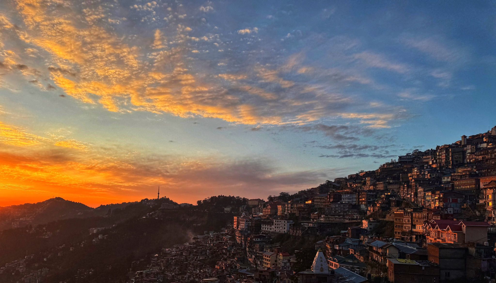
📍 Shimla
📍 Chitkul – India’s Last Inhabited Village near the Indo-Tibet Border
📍 Kalpa
📍 Khab Sangam – Confluence of the Spiti & Sutlej Rivers
📍 Nako
📍 Tabo Monastery (Over 1,000 Years Old)
📍 Dhankar Monastery
📍 Pin Valley National Park
📍 Mud Village
📍 Key Monastery
📍 Kibber
📍 Chicham Bridge – Asia’s Highest Suspension Bridge
📍 Langza – The Fossil Village
📍 Hikkim – Home to the World’s Highest Post Office
📍 Komic – One of the World’s Highest Motorable Villages
📍 Kaza
📍 Kunzum Pass (4,551 m)
📍 Chandratal Lake
📍 Atal Tunnel
📍 Sissu
📍 Manali
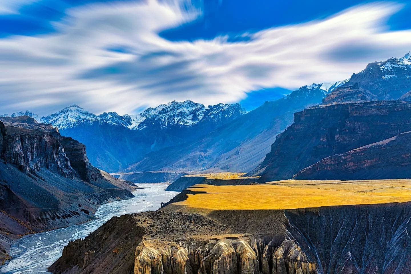
From the dramatic cliffs of Dhankar to the peaceful monasteries of Spiti, from the crystal-clear waters of Chandratal to the thrilling roads of Kunzum Pass, every frame in this film showcases the timeless beauty of the Himalayas from above. If you love travel, drone cinematography, road trips, mountains, and Himalayan adventures, this journey is for you.
🎥 Filmed by: Srihari Karanth
Spiti Road Trip during Summertime
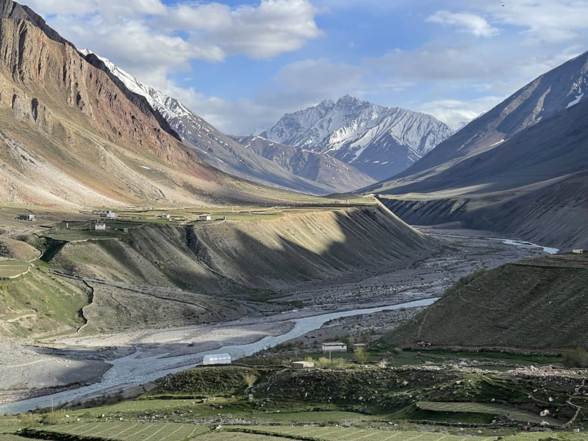
An overland journey of over 1,200 km across seven districts of Himachal Pradesh — threading through celebrated hill towns, alpine Deodar forests, high-altitude cold deserts, and some of the most remote valleys on the old Hindustan–Tibet Highway. The route takes you through Narkanda and Sarahan before climbing into Kinnaur — drive past Kalpa’s views of the Kinnaur Kailash mountain range and deep into the Hangrang and Tidong/Tirung valley of Kinnaur. From there, the route enters into Spiti, the cold desert at the heart of the circuit loop, before crossing back over the Kunzum Pass and through the Atal Tunnel and Manali to close the loop at Chandigarh.
FAQs
BSNL cellular network has wider coverage in Spiti valley and Kinnaur, esp in border regions. Reliance Jio and Airtel, however, offers better internet speed and connectivity in this region.
In summers, the maximum temperature crosses the 20 degrees Celsius mark in Spiti valley. During sunny daytime, you’ll feel comfortable just by wearing a t-shirt and trousers. It is always good to get wrapped in layers of clothes, as the weather can change anytime in the Himalayas. Even if the sun starts shining again, you can always get rid of the outer layers of clothing.
Here is the packing list (summers) for Spiti valley:
T-shirts.
A windcheater/ rain jacket.
Jeans/trousers.
Light woolen.
A cap/hat.
Sunglasses.
A pair of hiking shoes.
3/4 pairs of regular socks.
A water purifier and filtration bottle (avoid plastic bottle).
Personal hygiene essentials.
Sunscreen sunblock cream.
Spiti valley packing list (for winters):
A pair of good quality waterproof trekking boots.
Three pairs of cotton socks.
Two pairs of waterproof hiking pants.
One pair of shorts
Two pairs of fleece jumpers.
Two pairs of thermal tops and bottoms
One down jacket.
Headgear (1 beanie/skull cap, 1 buff, and 1 trekking cap).
A pair of thick gloves
Personal hygiene essentials(alcohol-based gel hand sanitizer, soap, towels, toilet papers, baby wipes, etc.).
UV-block sunglasses.
First aid kit.
A water purifier and filtration bottle.
Spiti valley is acclaimed for its distinctive moon-esque landscapes, Buddhist monasteries and interesting landforms. 5 entities that define the Spiti valley are:
Chandratal — the lake of moon.
Buddhist monasteries of Ki, Kaza, Kungri, and Tabo.
Snow leopards of Kibber —the grey ghost of the Himalayas.
Fascinating Tibetan culture and customs.
Fossils — dating back to the Triassic period (252-201 million years ago) — of Langza village.
Shimla to Narkanda-Rampur Bushahr-Powari-Pooh-Dubling village drive is on National Highway 5 (NH5). The Dubling village to Nako-Tabo-Kaza drive is on NH505. Kaza is the headquarters of Spiti valley. During winters, Shimla-Narkanda-Rampur road gets closed for a day or two whenever there is a long spell of snowfall. During such events, take the Shimla-Suni-Rampur Bushahr route along the Satluj river. This route stays open for all 365 days of the year.
It takes longer — when compared from Manali to Spiti valley (Via Atal tunnel) route — to reach Kaza from Shimla.
Shimla is one of the two places (second is Manali town) to start the Spiti valley circuit tour.
The road from Manali follows the Solang Valley-Atal tunnel-Gramphu-Batal-Kunzum Pass-Losar-Kaza route. The distance from Manali to Kaza is 183 km, and it takes about 6-7 hours (at one go) to reach Kaza. Manali-Kaza is a shorter route than the Shimla-Kaza route.
Though the Atal Tunnel has hardly reduced the road distance between Manali and Spiti valley by nearly 20 km, the drive time between the two places has now been reduced by over 2 hours.
Manali town is one of the two — the second is Shimla — places to start the Spiti valley circuit tour.
You need to follow Ambala-Zirakpur Expressway on National Highway(NH) 44 and Zirakpur to Shimla (111 km) on NH5 in Himachal Pradesh. Shimla to Narkanda-Rampur Bushahr-Powari-Pooh-Dubling village drive is on NH5. Dubling village to Nako-Tabo-Kaza drive is on NH505. Kaza is the headquarter of Spiti valley.
Yes. The circuit is doable in October, though, the weather gets highly erratic — after September — in high altitude regions of Kinnaur, Spiti valley and Lahaul valley.
No. The Manali-Spiti route gets closed when thick layers of snow blankets the Kunzum pass in November/December. The traffic movement resumes only after March month.
Though the Manali to Spiti valley route gets closed — most often after November/early December till March — during winters, the Shimla-Narkanda-Rampur-Nako-Kaza road stays open even during wintertime. During long spells of snowfall, Shimla-Kaza road may get closed for a day or two. BRO team from Project Deepak and local administration employs dozers, snow cutters, and excavators to clear the snow and reopen the route after a spell of snow in the route. Ping us to get the latest road and connectivity updates.