

The 28-year-old French adventurer Eliott Schonfeld, winner of the GEO Adventure contest, crossed the Himalayan chains on foot and on horseback from August to December 2017. After four and a half months of trudging in trans-Himalaya, he gradually got rid of the modern comforts & paraphernalia. The aim was to replace the products of modern civilization with their natural alternatives adopted by the local communities of the Himalayas.

My body is tossed in all directions as Rinpoche, a horse farm owner, maneuvers his 4×4 on the broken stone roads that crisscross the Ladakh range. My heart and head hurt like being caught in a vice. Going from Paris(with an elevation of 35 m) to the 3,500 meters of average altitude of this high desert plateau, it takes time and I think I am not yet acclimatized. But for now, it is not vertigo that worries me than the new world around me.
August 10: Choosing The Horse in Ladakh
I spent a few days in Leh, the regional capital of Ladakh Union Territory of India, to find someone to sell me a horse. I witnessed the Trans-Himalayan mountains up close.

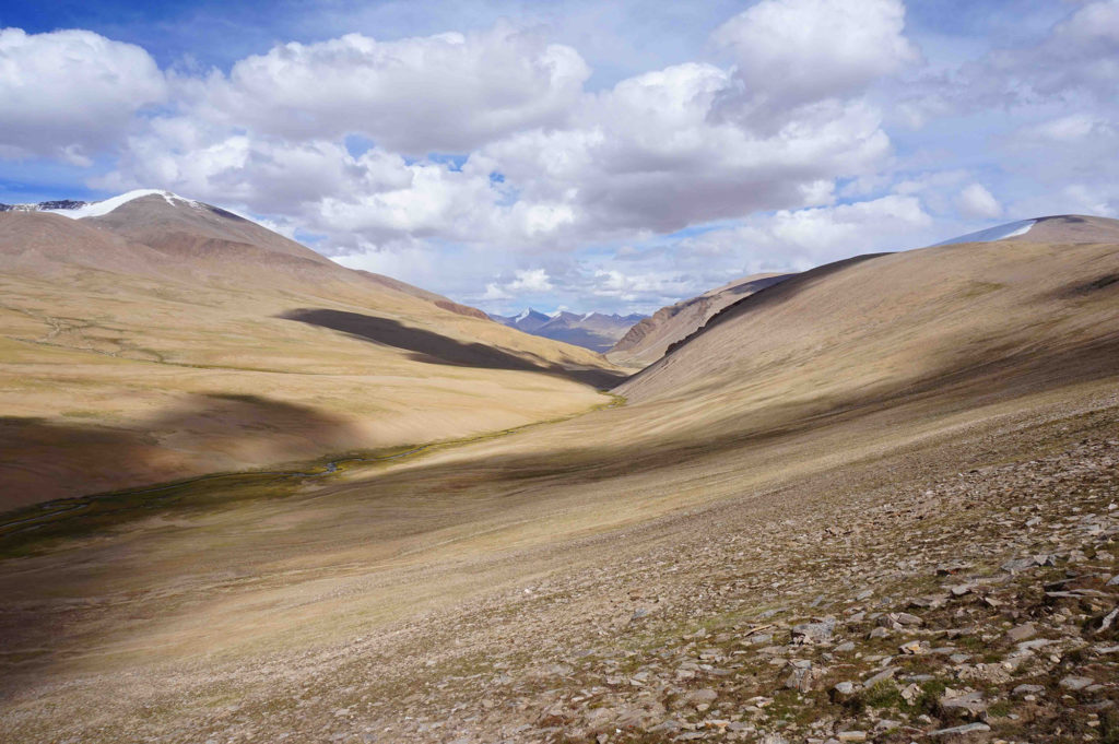


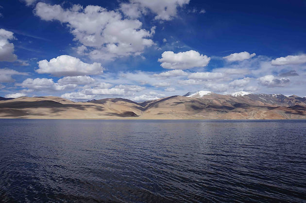
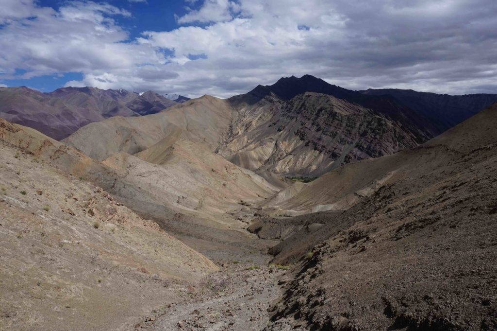
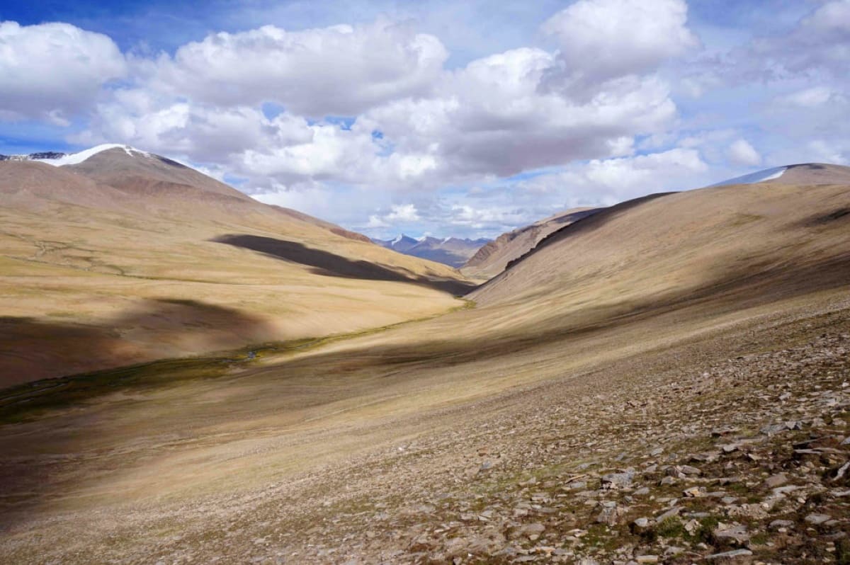
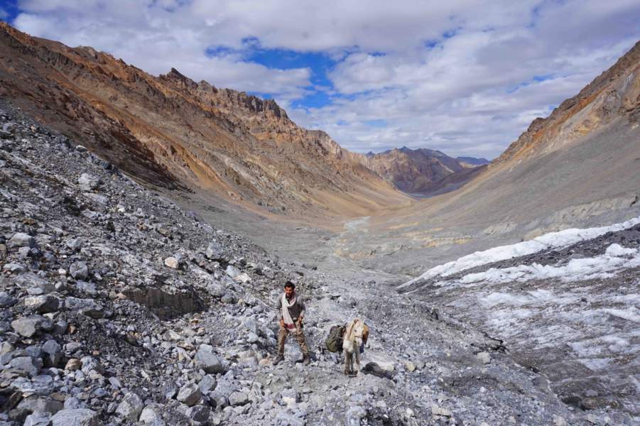
Ladakh is a magnificent high altitude cold desert… but very sparsely populated. Before clicking this image, I walked for weeks without meeting a single soul. Then, seeing the village of Stok – the green patch at the end of the gentle slope – I felt immensely joyful.
They are no longer on the horizon, but vertically, erected like a tangible wall, and too high, much too high. Why did I decide to tackle such monsters? For me, who had spent all my life at sea level should have started with the lower altitudes. After two hours of driving and deep contemplation, we reached the horse farm. I see a tent in the shape of a teepee, and all around, thirty horses grazing peacefully.
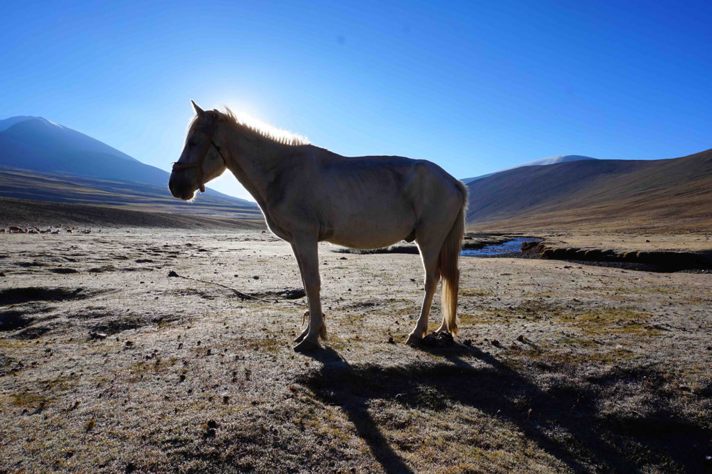
The introductions were brief & the farm owner offered me a horse. The horse was white & not very big. Rinpoche helped me to saddle the horse, gave me some pieces of advice and the animal’s rope, then left me to my fate.
In front of me, around 2,000 kilometers of trail awaits me to Nepal. I calculated that it would take me five months to get through it. Before I start, I decide to baptize my steed. He needs a name that is familiar & comforting in the midst of the unknown universe that I am about to explore. It’s decided, his name will be Robert. My Ladakhi horse would be called Robert.
September 4: Robert’s fall in Spiti valley
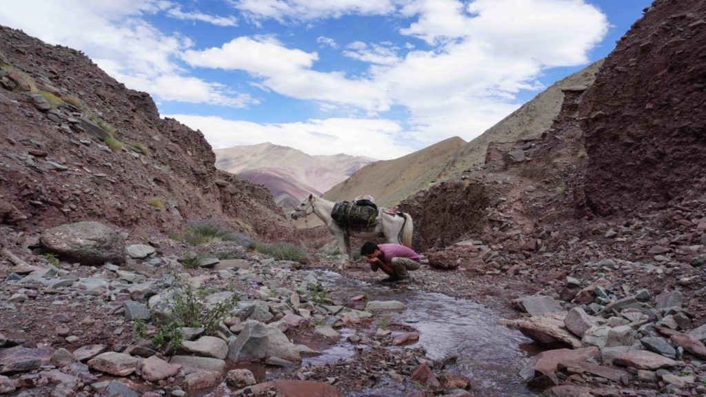
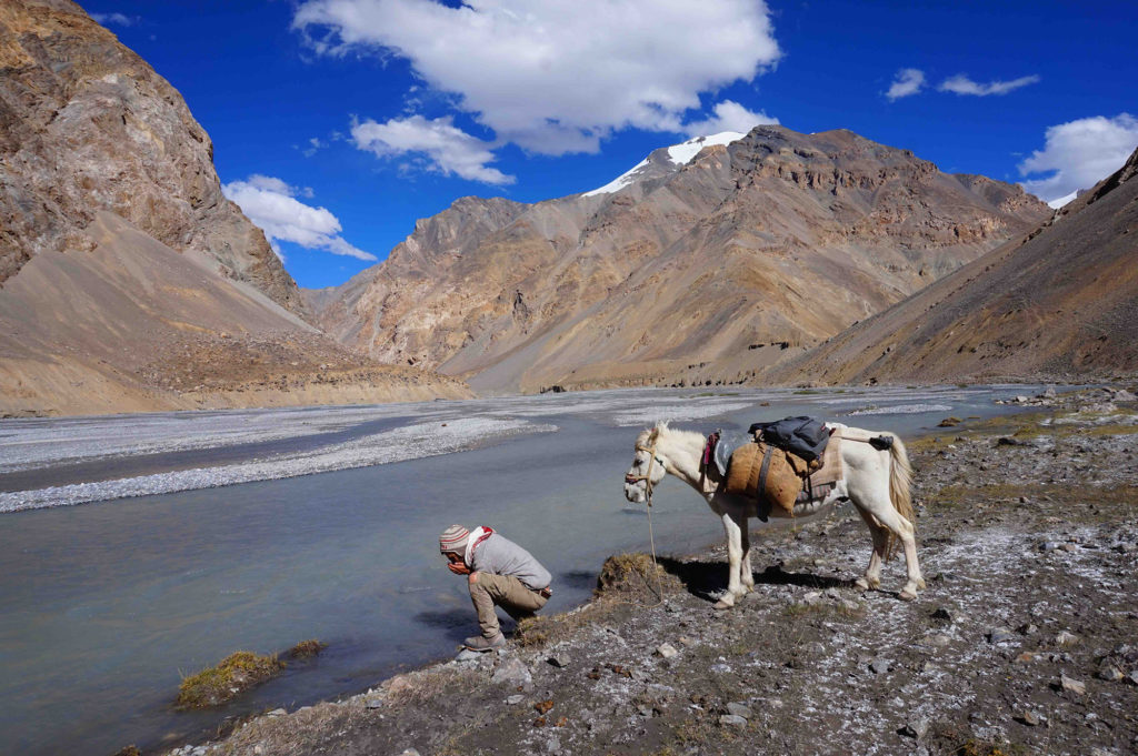
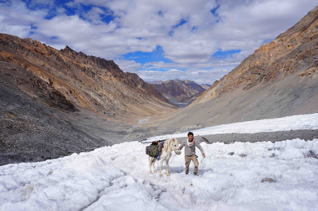
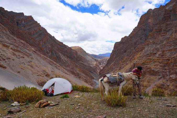
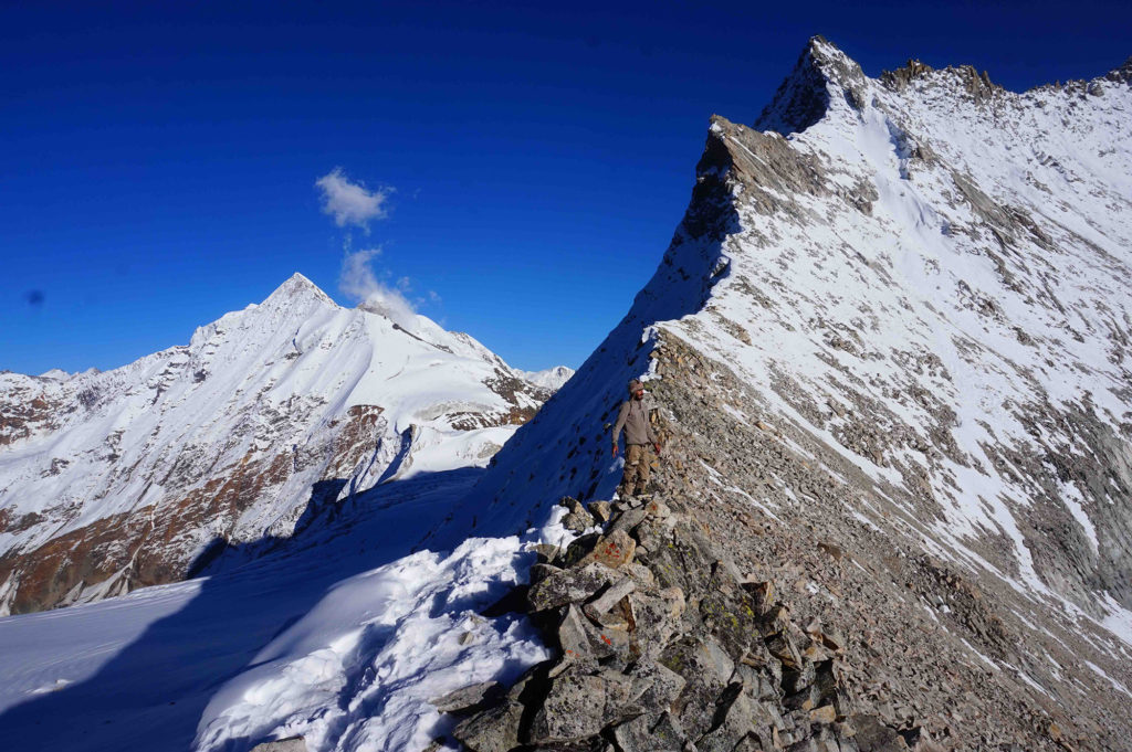
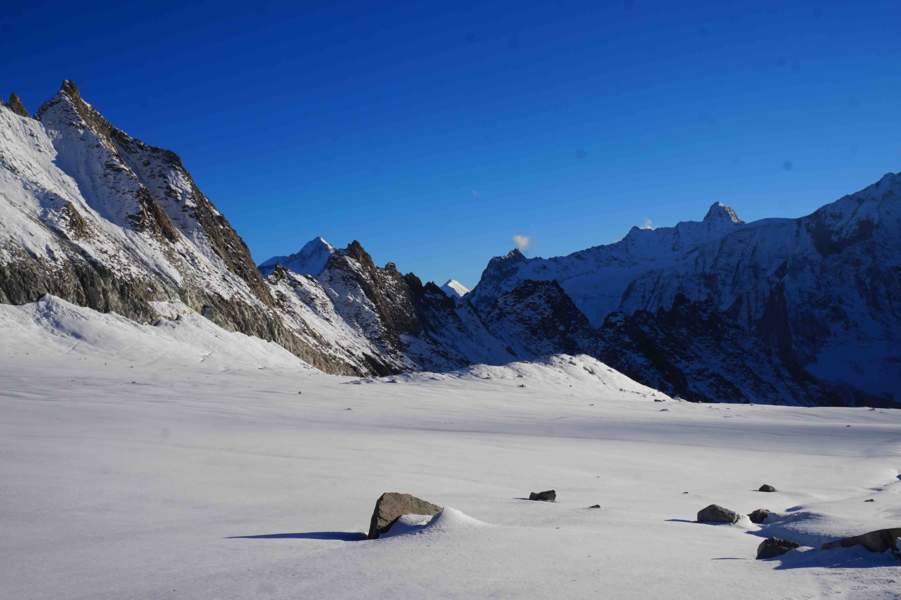
We had been progressing on high altitude trails for a month now. Robert never gave up. As for me, I ended up taking the plunge and felt at ease when we reached Spiti valley, a cold mountain desert in the Indian state of Himachal Pradesh, the most perilous mountains since the beginning of the expedition.


I crossed the Manirang pass (also spelled as Manerang) on one fine morning, a pass at an elevation of 5,590 meters. The landslides on this route are normal, and you have to remain focussed on each step. Four hours walking continuously… and an obstacle blocked our path — a gigantic rock was in the middle of the descending route. To move ahead, there was no choice except to climb over it.
We ventured on the rock surface and progressed a few meters when suddenly the rope that connects me to the horse yanks me back. Robert had lost his footing, he was sliding down the slope. Panicked, he struggles to get up, but that only accelerated his fall. My heart was racing. At this rate, it would fall permanently into the abyss and crash 20 meters below. I pulled the rope with all my might, but to no avail, I had to let go of the fear of being dragged myself into the void.
But a miracle happened: Robert landed on a narrow ledge from where he can no longer move or risk falling into a deep gorge. I tried everything possible to get it out of there but with my 60 kilos weight did not make the cut. There was only one thing to do: descend to the last village I encountered, 20 kilometers before, and 1,000 meters of elevation drop.
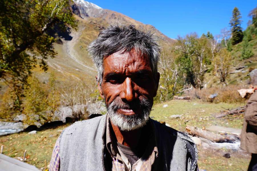
I reached there at night, exhausted and in tears. Watching me in distress, the villagers decided to organize a rescue mission. Two men, Tanzin and Karma, offered to accompany me with ropes.
After an exhausting return trip, we left for six hours of night climb. We arrived at the accident site, at 2am, I pointed my flashlight on the ledge, I scanned the light beam down the slope, expecting the worst. Robert was there, unharmed. He quietly turned his head towards me, with an air that seems to say: “But what have you done for the past ten hours?”
Bewildered, released from an immense weight, I exploded with laughter and went to hug my trek partner. I’ll never know how he got out of there alone, getting away with a few scratches. As for me, I had walked 60 kilometers, 20 hours straight, with 3,500 meters of cumulative elevation… for nothing! Whatever. Considering the relief I felt, it was worth it.
September 27: Waking Up From Oblivion In Kinnaur
But what took me? How can I be so stupid? I’m going to cross the roof of the world and I’m not carrying a pair of gloves… As I climb the frozen mountain range(Kinnaur Kailash range) that separates me from the pass of Charang-Chitkul pass or Charang La, I curse myself out loud. I’m paying for being thick-skinned. Because I was using my bare hands to climb, I no longer felt my fingers. Of course, I did not take crampons or ice axes either and I had to kick in the ice to create required traction.
Glued against the wall, I assessed my progress. It took me some hours to climb just 200 meters from a vertically packed ice slope. I told myself that I did well to sell my little Robert to a horse breeder a few days earlier. No matter how well he showed his talent as a tightrope walker, he could never have climbed such a thing. I finally reached my goal, at 5,300 meters above sea level, I was at Charang-La pass.


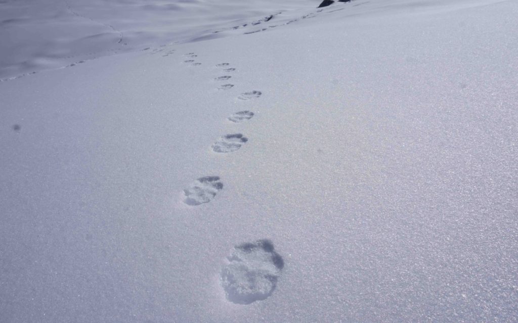
As I caught my breath, I observed the thick layer of snow covering the ground. I was not the only one to have successfully climbed that day. Pugmarks of a snow leopard, all fresh, dotted the ridge before disappearing on the other side. Amazed, I touched the imprints of paws’ of the grey ghost, so beautiful, so pure. Then I scanned the surroundings, hoping to catch a glimpse— not a single soul found in sight. I hoped I didn’t scare him off. The Himalayan grey ghost lurks, I can feel it. Even invisible, he accompanies me.
October 1, 2017: Going Incognito in Baspa valley
I had been walking very close to the Indo-Tibetan border for three weeks now. I had absolutely no permission to venture in these troubled terrains. Because of the territorial conflicts between India and China, the region is tightly controlled. Tourists and Indians are required to obtain permits to do any activity on the border areas. Traveling alone is prohibited.
I managed to sneak through the last military posts by walking during the night. It seemed to be playing a cat and mouse game with the Indian army patrols. More than the detours that I was forced to make, the anxiety of getting caught made every step more painful.
According to my maps and the villagers of Chitkul, the route is restricted up to the Lamkhaga pass (5,280 meters). After crossing Lamkhaga pass, I would be back in the free zone. The weather was perfect, the sky was of a serene azure color. I was walking at a leisurely pace, at a distance, I saw two silhouettes. Two trekkers, bags on their backs, were heading in my direction.
As I was about to greet them, my head spun. They were not trekkers, but soldiers. They were not two, others were behind them. I ran towards a big boulder. A minute later, I heard the sounds of the boots of the first patrolmen, around 20 meters from me, in camouflage dress, weapons on the back. It was the Indian Tibetan Border Police(ITBP), the sentinel of the Himalayas.
I curled up as much as possible in my hiding place. Getting caught here would be fatal, I was aware of it. I was trekking without due authorization, with a satellite phone and a camera. I could never make them swallow that I was unaware of the restricted area. I would have ended up in prison. I was trying to calm down. The march of the soldiers continued. Twenty or thirty men had already passed. When will it stop, damn it? It was like the whole army of the subcontinent was hidden in these mountains.
After a while, silence fell. I stood still for another fifteen minutes, then got out of my hole. At a distance, the Indian army men went up the valley and trekked to the exact place where I had planned to pitch my tent. I realized that this situation, which could have turned serious, has become a godsend for me — the army men had mapped a track in the deep snow, which made my ascent infinitely easier. One soldier even dropped food just before the summit: caramels & a packet of noodles. The army mend does it to lighten the load and use it on their return journey.
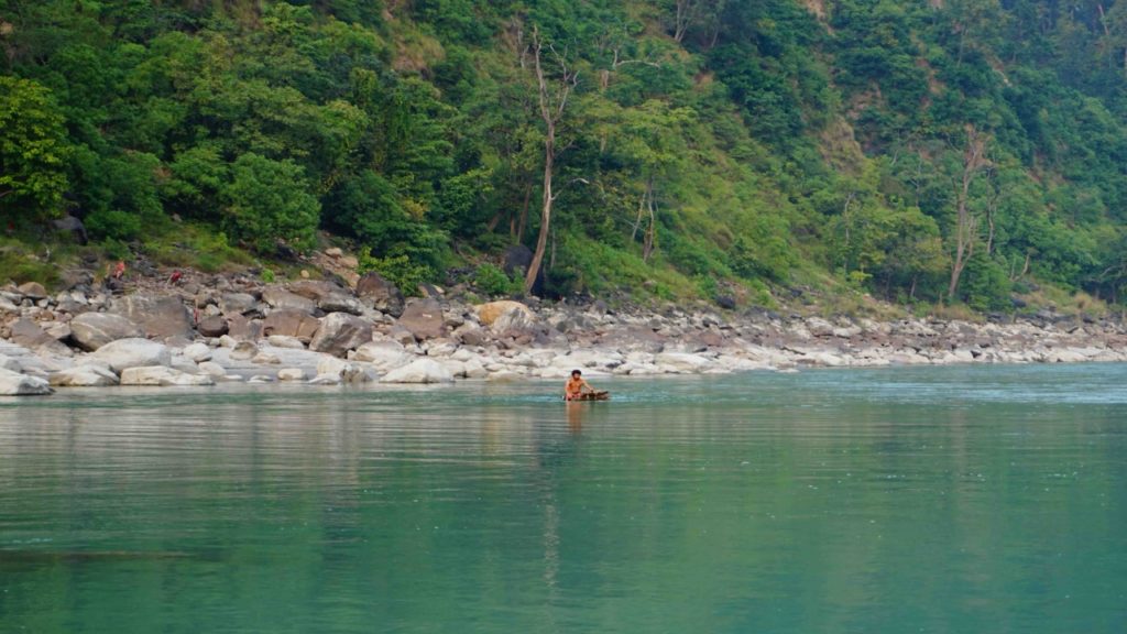
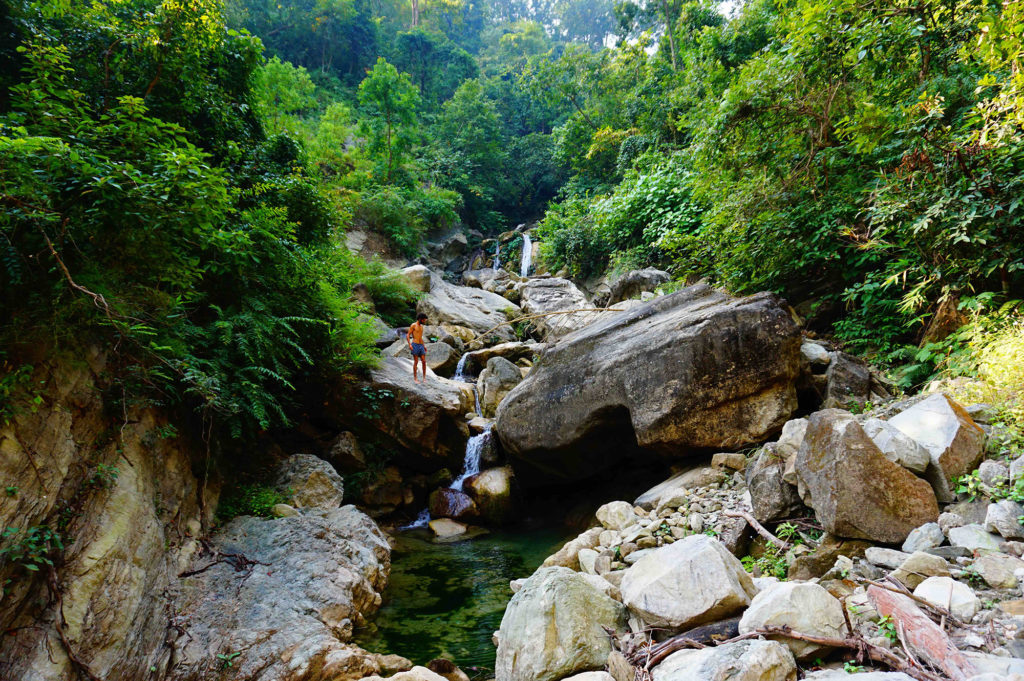
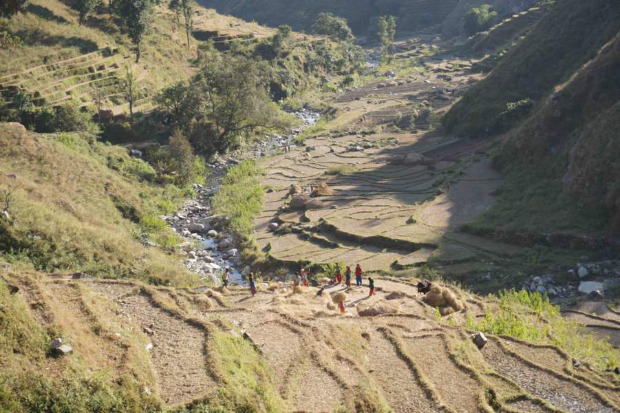
October 20, 2017: Paradise found in Nepal
On my raft, I assume myself for Tarzan. The langurs & the white and black monkeys that populate the jungles of the middle Himalayas, jump from tree to tree while I raft on the Mahakali, river marking the border between India and Nepal.
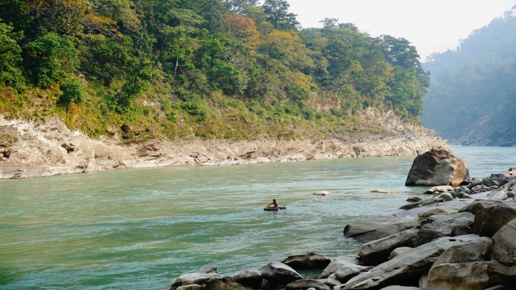
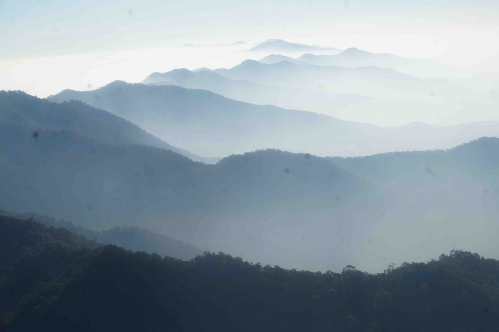
I started my descent a week ago, letting myself be carried by the currents. I still had 200 kilometers to sail to Banbassa, the Nepalese border post. I finally landed in Nepal on a riverbank. I started my exploration deep into the forest, where I came across natural pools, large holes in the polished rock filled with turquoise water, and linked together by the pearled necklace of the waterfalls. Paradise, I tell you.

I loved to explore, like a tracker, for the traces of wildlife that swarmed around me. Here, a wavy line on the ground indicated the passage of a snake. There, handprints, tiny feet: probably a bunch of macaques. Farther on, between the trunks, the gigantic web of a Nephila Pilipes, a spider with long legs, capable of capturing small bats in its nets.
Nothing makes me happier than blending in such wilderness. I certainly feel very small, vulnerable amidst nature. But the feeling of this insignificance, instead of frightening me, releases me. It teaches me not to make humans the measure of everything anymore.

Perfect places to pitch the tent and observe the traces of monkeys … or tigers!
What terrifies me would be an entirely “civilized” world, where the city, the road, and the cement would have thrown their grip on everything. And where a man would only meet himself. That’s what I was thinking, lying on a bed of palm leaves, by the fire. A string of green dots lit up in the warm air. The fireflies had started their ballet of stars, while hundreds of little beings, carpeted in the trees, were singing the big night concert. That evening, I slept well.
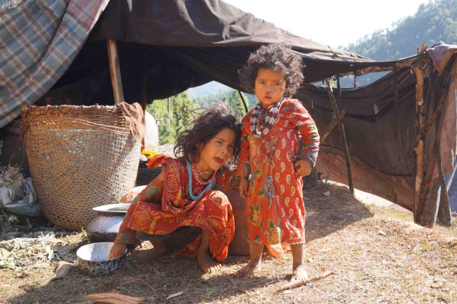
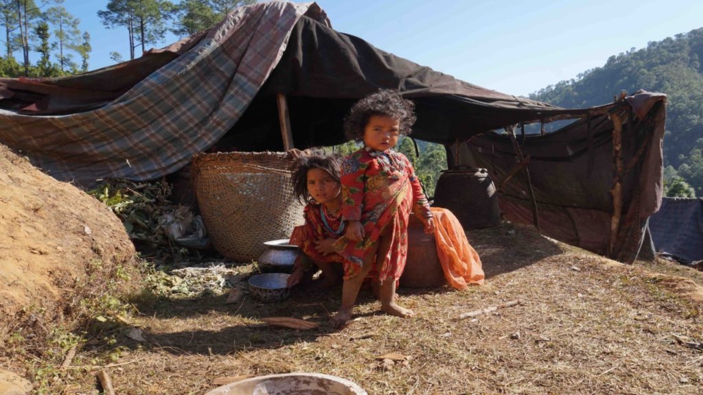
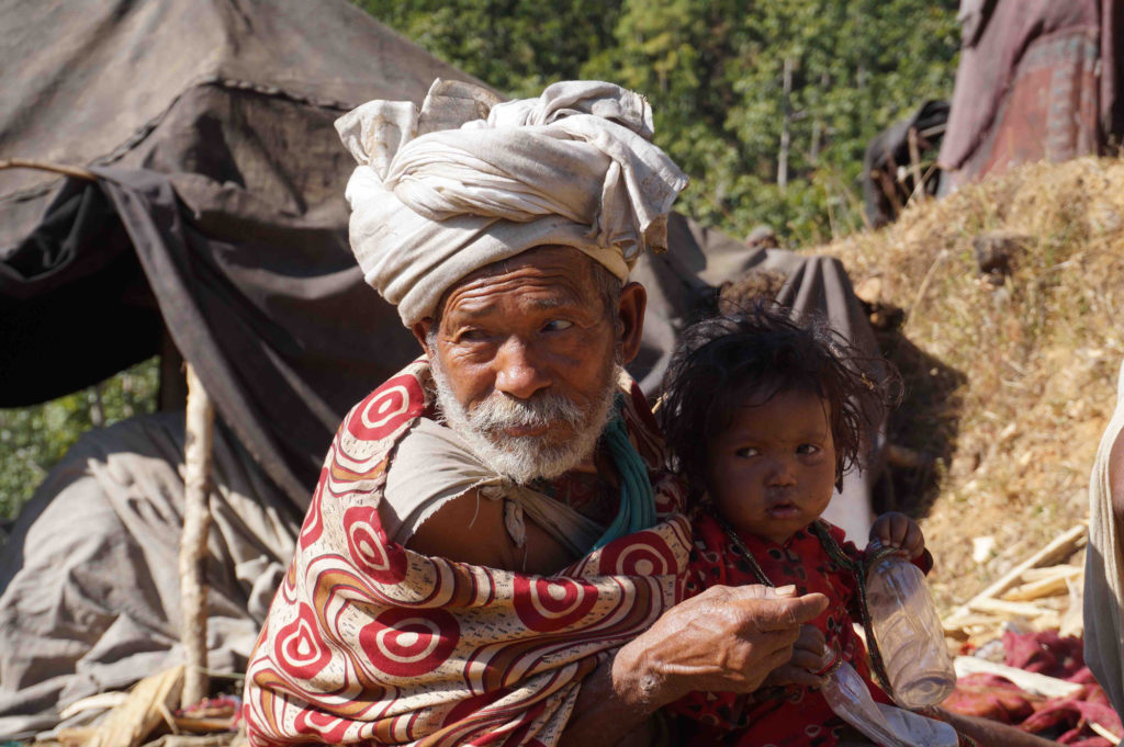
November 10, 2017: Meeting the people of Rautes: The Last Nomadic tribe of Nepal
Before I started this expedition, I had a dream: to meet the Rautes. This nomadic tribe, whose name means “kings of the forest”, lives in the remote jungles of western Nepal. These are hunter-gatherers who track down the monkey and feed on wild fruits and tubers.
After ten days of research & miles & miles going around in circles, I was on the verge of giving up when luck struck me. From the top of the hill that I had just climbed, there was indeed one of their encampments that I discovered at the bottom of the valley. Shelters, made of branches and foliage. Under one of them, a man was cleaning peppers. A woman came back from the forest with some trunks under her arm, and a teenager who was cutting something out of a large piece of wood.
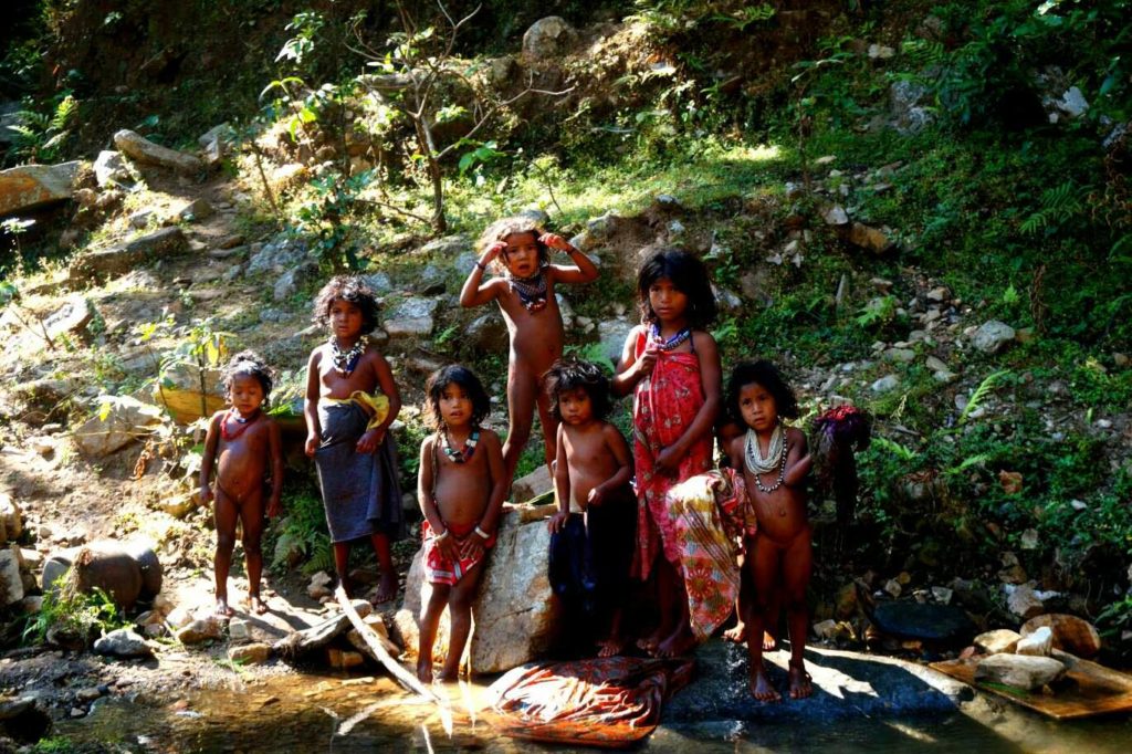
The children, who were playing in the river, finally noticed my presence. Intrigued – I must have appeared to them as an extraterrestrial – they surrounded me. It provoked the adults, who looked suspicious and started talking. They were very small, dressed in a light dress that revealed parts of their body. They finally lead me to the royal tent – because the Routes have kings. A man even more naked than the others came out and stared at me straight in the eyes. I greeted him in a solemn way, then shook his hand, impressed. It is the first time that I shake the hand of a king. It is also the first time that I have seen royal testicles. What a day!
December 6, 2017: The Final Offload
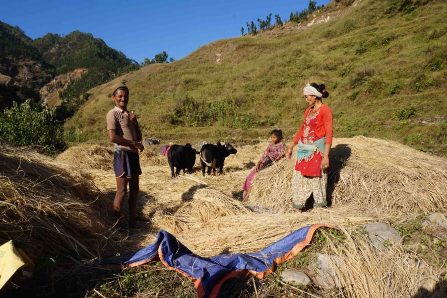
I left the wood and stone hut that I built for the night and extinguished the brazier ignited by friction. Handmade bag on the back, goat skin on the shoulders, the bamboo fire starter, on one hand, I feel metamorphosed. I had set myself a challenge: replace all of my Western things with their natural counterparts. Not only did I manage to take it up, but in addition, I absolutely did not have the impression that it is limiting. On the contrary, I felt more free, independent. I learned to settle for the basic & minimum, to build what I needed to survive.
If I had been told a few years ago that I would be able to manage on my own in nature (and what nature!), I would not have believed it. After three days of a final ascent through the rocky peaks of the Dolpo region, in northern Nepal, I finally reached the Phoksundo.
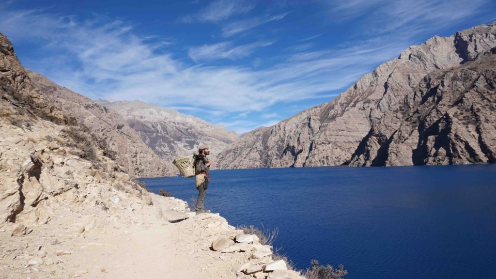
Phoksundo is the most beautiful lake I have ever seen: an aquamarine crescent moon set like a relic in the galaxy of the Himalayan mountains. I sat in front of this splendor and allowed myself all the time it takes to soak up this moment. I felt good and would have gladly stayed there for days to meditate … if only I could. But the first snowflakes began to fall. Winter was coming. I was thinking about going back, going back to college, and going on with my life. Once again in Paris.

[starbox]


Eliott is a French wilderness exlorer, filmaker, director, writer, and winner of the GEO Adventure contest. In 2012, when he was just 19, Eliott got lost in the wilderness of the Australian tropical forest. For many days, he endured hunger and exhaustion while finding a way. This life-changing experience led him to explore the wild and remotest places across the globe. His minimalist camping and hiking style has often led him to frequent encounters with wild animals and testing of the surviving skills. Before traversing across the Himalayas, he explored the steppes of Mongolia, Gobi Desert, and Alaska. In 2017, he hiked solo (and 2000 km with a horse) for 140 days from Ladakh in India to Kathmandu in Nepal in search of the last tribe of hunter-gatherers tribe of Indian subcontinent.

Leave a Reply Cancel reply