
I wonder why people who plan to explore the most beautiful state of Himachal Pradesh only end up visiting Shimla or Manali. What a lost opportunity to experience the real beauty of Himachal Pradesh, which lies in locations beyond these popular towns.
I was fortunate to visit this amazing place last year, a first-hand experience that is unheard of by many.
Through this blog, I intend to share more about the true beauty of this small village, so the next time you consider this on your bucket list as well.
This is a small village in Himachal Pradesh called Chitkul (or Chhitkul) –The Last Inhabited Indian Village of India.
I had never heard of Chitkul until then. But always wanted to visit Himachal. I think it’s one of the most scenic states in India. Friends recommend the more regular options of Shimla or Manali for the trip.
But I always preferred visiting locations that exist beyond the obvious. Destinations that have been far less traveled.
And that’s how, during some preliminary research, I came across the Chitkul–the last inhabited Indian village on the Indo-Tibet border and a part of the Sangla Valley. It’s the last point in India where one can travel without a permit.
Under the Vibrant Villages Programme of the Government of India, Chitkul and 76 other (including Charang. Pooh, Nako, Leo, and Chango) border villages or Kinnaur and Lahaul-Spiti District were declared as the first village of India.
Indian Express
The program was announced in the government budget of 2022-23 for the mobile, road, and internet connectivity, social entrepreneurship, skill development, infrastructure and rural tourism development of border villages of India that are located along India-China border.
The government also asked the people to call such villages as ‘country’s first village‘ instead of the ‘the last village of India’.
The sheer beauty of this place I witnessed online through pictures and blogs helped me make up my decision to visit Chitkul.
Chitkul Village
And I planned this very special trip to Chitkul in almost a week’s time. I would go on to add that it was one of the best experiences I had in my life and hence this became my first travel blog.
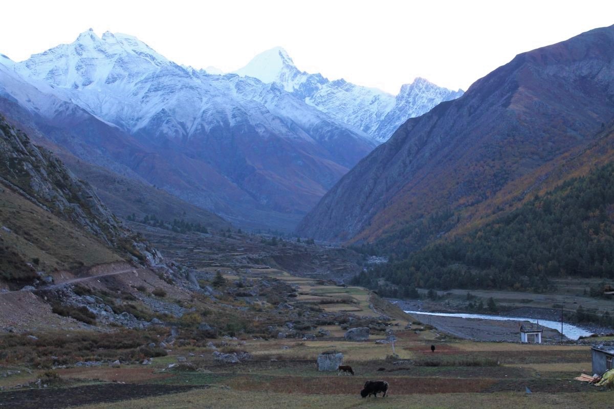
Nestled in the picturesque Kinnaur Valley lies Chitkul. An adventure lover’s delight, a geography enthusiast’s paradise, and an all-out, enchantingly surreal landscape lends Chitkul its eternal delight!
All About Chitkul
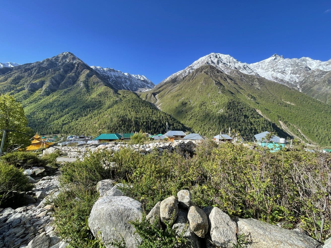
Chitkul’s height is about 11,319 Ft in altitude, which is assured enough to make it a hard-to-reach paradise. As they say, all things worth having in life never come that easy, so I say, Chitkul should be on that list.
If traveling to offbeat places is what gets your rhythm going, Chitkul should be a must-have on your list! No internet connectivity in this paradise (though BSNL works fine for audio calls in Chitkul).
It makes you disconnected from the world and complements your connection with the beautiful environment and binds you to nature, and much more.
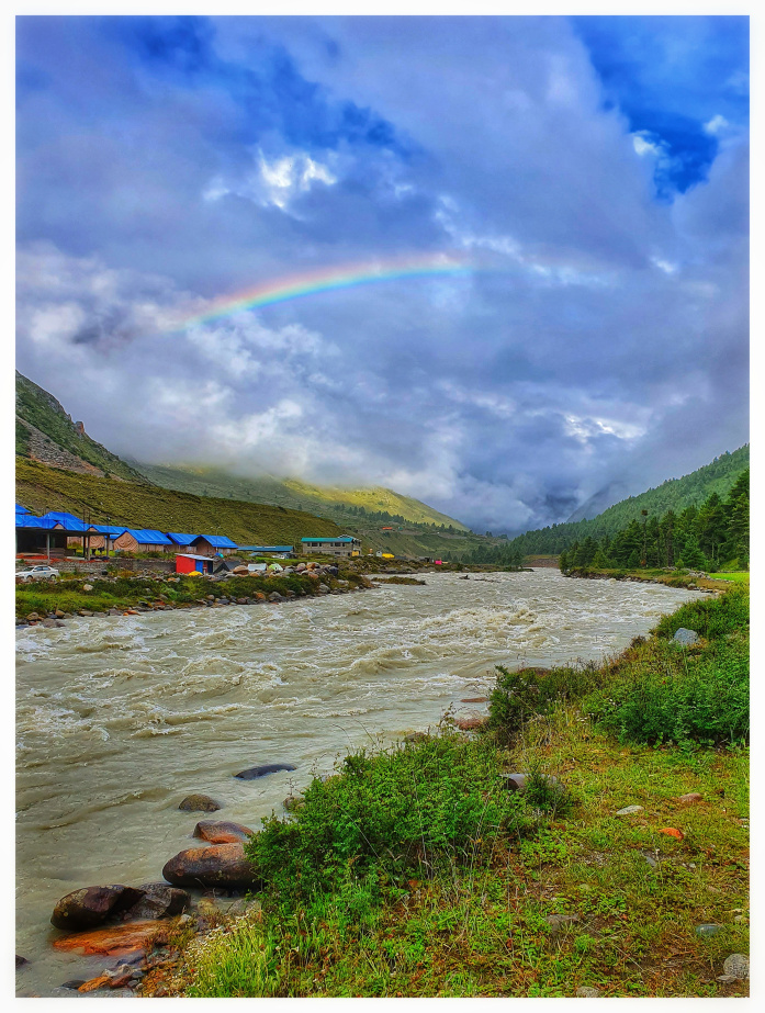
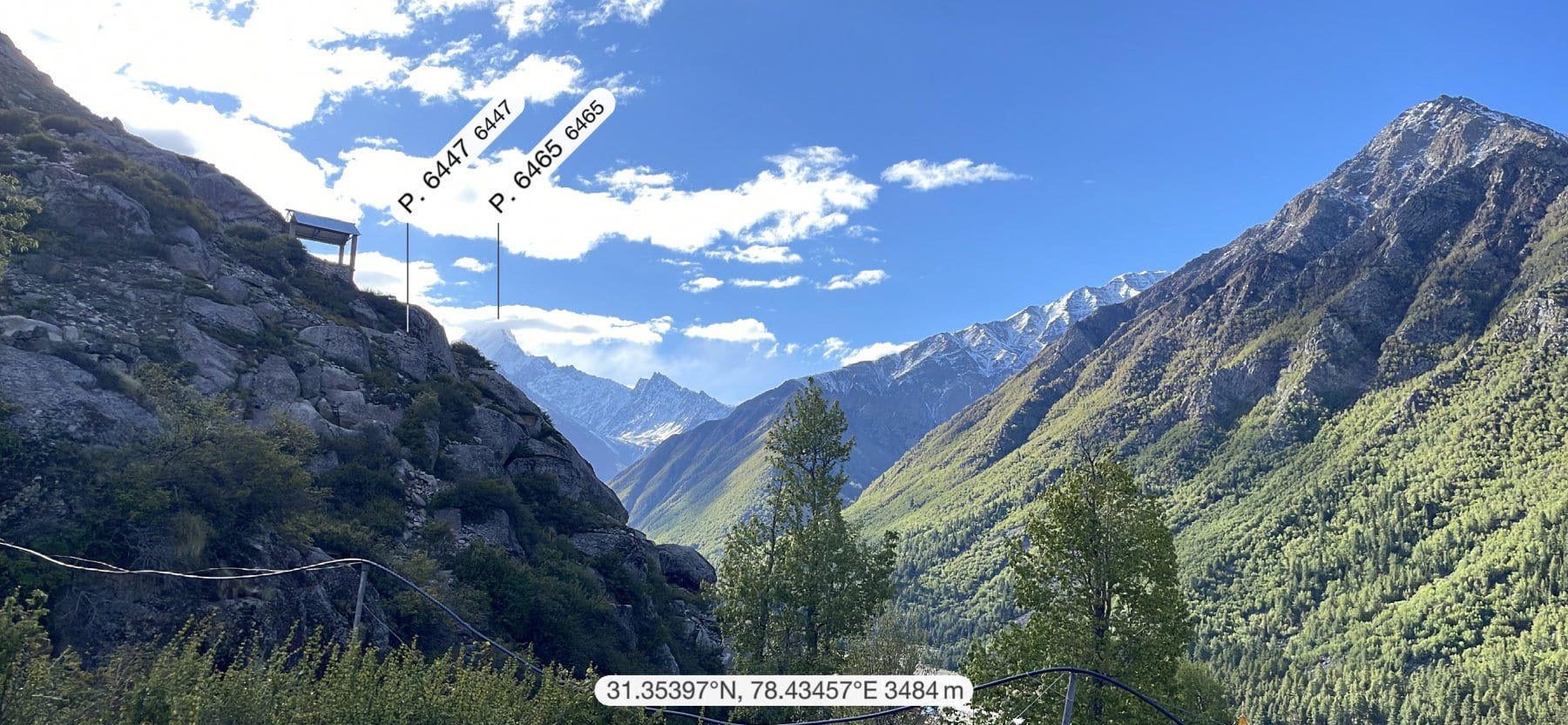
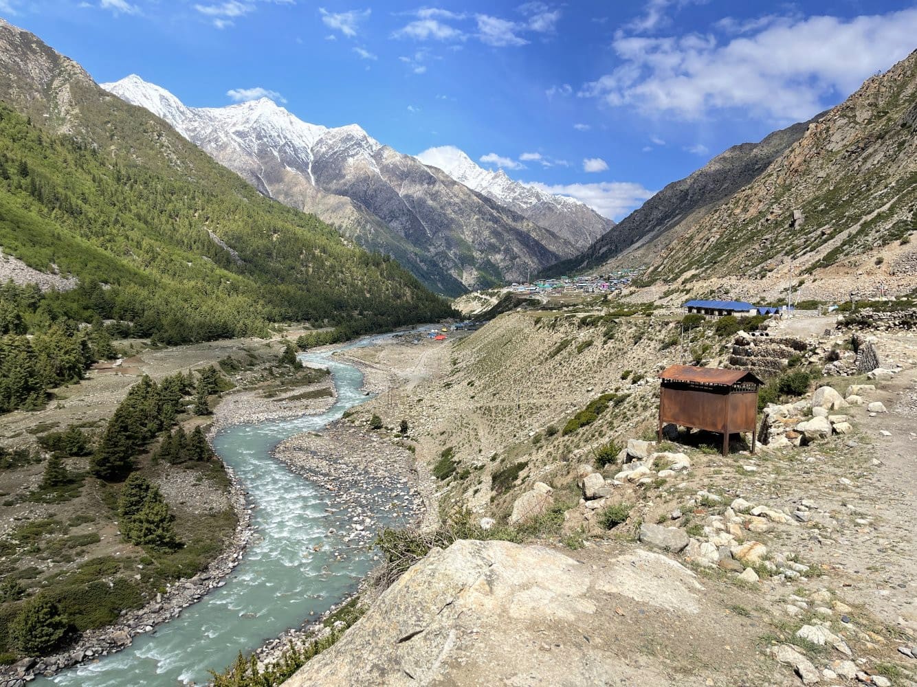
With Kinner Kailash visible in the backdrop, Chitkul brags of uncompromising views, from its soft spot on the Baspa River. On the left bank of the Baspa, there lie snow-clad mountains that you can look on until you wish and on the right bank, there lies an expanse of multi-color orchards.
Chitkul bagged the award of the best “tourism village of 2023” on October 1, 2023.
The remote Chitkul village in Himachal’s tribal Kinnaur district has been adjudged India’s best “tourism village” of the year by the tourism ministry, officials said on Sunday.
The Tribune.
The slopes of this magical land are bound by the majestic Deodars and Chilgoza trees. Baspa valley also boasts of abundant orchards, catering to the world some of the finest ‘Golden Delicious’ apples. Also, this settlement is famous for its high-quality potatoes, given the conducive weather and the fertile soil.
The villagers are either Hindus or Buddhists, speak a Tibeto-Burman dialect known as Kinnauri, and wear distinct green Pahari caps. You got to travel back to the ancient mythology, where it is said that the people of Kinnaur were known as Kinnauras, the halfway between gods and humans. This further proves right the belief that Kinnaur is the land between heaven and earth!
Where is Chitkul Village?
Chitkul is situated in the Kinnaur Valley of Himachal Pradesh. Tibet surrounds Kinnaur on the east; Garhwal on the south; Spiti Valley on the north, and Kullu on the west. Interestingly, the Uttarakhand border is just ~ 40 km from Chitkul.
The distance from Delhi to Chitkul is 569 km and the nearest town of Sangla is about 24 km. Rakcham village is the midway point between Sangla and Chitkul and the drive from Rakcham to Chitkul is breathtaking, adventurous and just 916 22K PURE GOLD beautiful!
The Indo-Tibet border is about 90 KMs from the Chitkul village. But, no civilian movement—without a permit—is allowed beyond Chitkul, which is why it is famously known as the last village before the Indo-Tibet Border. The area beyond the village is in control of the Indo-Tibetan Border Police, ITBP.

Weather in Chitkul
Summers are mildly cold temperature-wise, with highs of 20 degrees and nighttime temperatures around five degrees Celsius. Chitkul’s temperature stays pleasant or cool through most of the year, barring the months of winter.
Best time to visit Chitkul
The best time to visit is during the summer months, especially from April to June and September to October. The thrilling roads of India–Tibet Highway leading up to Chitkul and the clear blue skies make for the perfect adventure, with enough safety mixed in.
But, August to September is harvest season for the apples and makes for a sight to never be forgotten, with the entire vistas turning into colors of the fertility of the land. Since the winter months are uninhabitable, it isn’t a practical option.
How to reach Chitkul?
Reaching Chitkul will be an unforgettable journey. The thrilling adventure is unmatchable, thanks to the high escalation in the mountains in crossing different valleys of the Kinnaur region.
The lush green forested mountains complemented by the cobalt blue of the skies almost makes one forget the insanely difficult roads. There is a reason they are called the most treacherous roads in the world.
The best route to take (assuming that Delhi is the starting point) is via
Delhi » Chandigarh » Shimla (2200 mt) » Narkanda (2708 mt) » Rampur(1350mt) » Karcham (1813 mt) » Sangla(2696 mt) » Rakcham(3048 mt) » Chitkul (3450 mt).
Depending on the mode of transportation you may choose, you’d still have to travel a large part of your journey by road. Roads are decently maintained for most of the route. Here, the road takes you along the crest of the mountains, for the most part, gliding along many valleys and providing beautiful green vistas as your companion.
All pictures by Ramesh Tahlan.
Once Narkanda is passed by, you will be driving mostly downhill to reach the river bed of Sutlej, right up till Karcham, after which an ascend begins again towards Sangla and further to Chitkul!
But, it is always advisable to always be alert on the tricky Himalayan roads, splattered with hairpin bends and high ascends and sharp descends. Oncoming traffic can also be tricky to maneuver on single-lane roads. Also, a lot of the time you’ll be in awe of the local Himachali drivers and their daring skills!
Some travel tips about Chitkul
Hamlets such as Chitkul are best discovered on foot –explore the little alleyways and get a feel for a local villager. The population of Chitkul is just below 1,000; the town is full of culture and community.
Chitkul has three temples dedicated to Mata Devi; the oldest is said to be 500 years old. The entire compound is beautiful and a must-visit for experiencing the Kath-Kuni wooden architecture. The temple seems to have a high prominence in the Bengali culture, as you would see a lot of pilgrims from there!
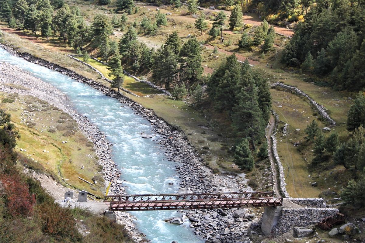
Unquestionably, you must walk down to the banks of the Baspa river and reawaken your soul by dipping your hands in the glacial water. The crystal-clear water will keep you enthralled.
Treks Near Chitkul
Chitkul is also the start or endpoint of many easy, medium, and difficult treks around the region. Some of them are:
Trek to Nagasti ITBP Camps
This is a relatively easier trek of about four kilometers. Do make sure to take a water bottle with you and keep sipping water every now and then.
Ranikanda Meadows hike
About 10 km in totality, the trek from Chitkul to Rani Kanda Meadows is completely worth it. Easy to Medium in difficulty level, the panoramic views of the vistas and the valleys will make the effort completely worthwhile on your trip to Chitkul.
Borasu Pass trek, Lamkhaga Pass trek are others which you have got to try. Try your hand at Off-roading, bouldering, climbing & slacking.
The next most interesting activity you can do is, go fishing in the fresh, crystal-clear water of Chitkul. Both rainbow and brown trout fish can be seen swimming against the water.
Hindustan ka aakhri Dhaba (“Last Dhaba of India”) is always on the list of must-do things of visitors.
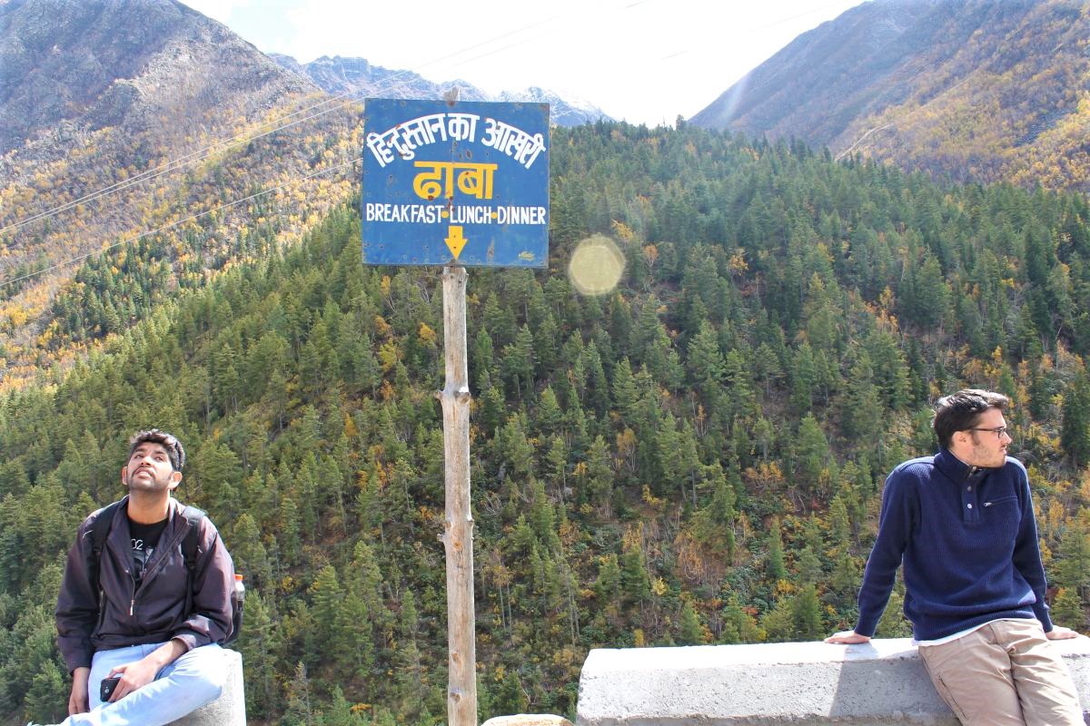
There are many such dhabas splattered across Chitkul’s end of the road, and one can choose whatever they fancy. Momos & Thupka are easily available, emphasizing the Tibetan influence and ancestry of the place. Of course, the staple affair of Maggi, Paranthas are aplenty.
Stay in Chitkul
A PWD Rest House is available at Chitkul. This place has basic amenities and even if you’re visiting for a day trip, you can easily use the facilities.
If you’re planning on spending a few days in Chitkul, which I highly recommend, then do try the Wanderer’s Nest or The Zostel at Chitkul.
This place is at a higher elevation and provides views that will be etched in your memory forever. While the place is basic, the staff is extremely courteous and the food is always piping hot.
You can check the list of some good accommodation or stay options in Kinnaur Valley. A lot of the old-school Himachali wooden houses are converted into hotels and provide exceptional views. However, due to isolation, these places tend to be slightly more expensive.
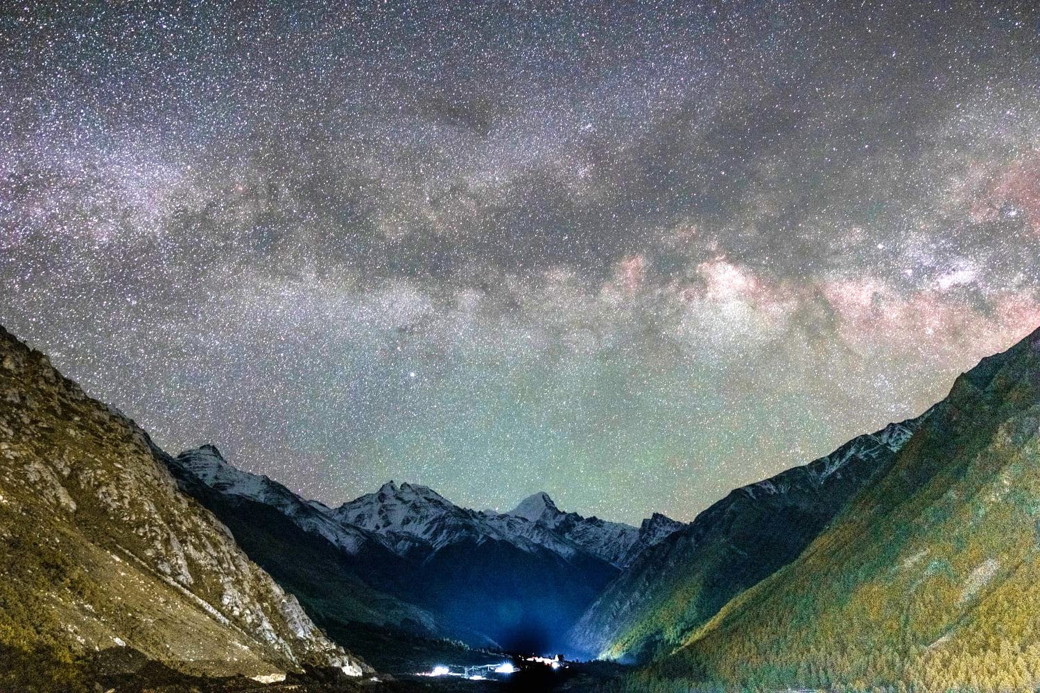
There are a few camping spots near the village, and you can easily spot some locals to help you out! So, do not hesitate to take your camping gear and spend a night beside the Baspa river under a billion-star night sky.
It’s been almost a year since I had been to Chitkul, but the experience is still fresh in my memory. Probably, it is one of those special destinations which you can’t let go of. I wanted to share this wonderful place with as many travelers as possible. Don’t miss it during this lifetime!
FAQs
Our guides are certified and have been trekking the Himalayas since childhood(all are local guides). They are well equipped and well versed with the terrain, route, the people and local culture.
We don’t provide trekking or camping gear or rent.
The guides and porters are adequately trained and skilled in handling emergencies. You will get immediate first aid and all necessary help if required. In case of a medical emergency the porters & guides will carry you to a lower altitude and will contact the rescue authority.
When it comes to packing for a trek in an efficient way so that you have maximum flexibility with minimum weight, we advise trekkers to pack only what it essentially needed. Packing things that are not required will overburden porters & mules and hamper the probability of competing a high altitude trek like Lamkhaga.
Clothing & Gear
- Trekking pants and jackets.
- Rainproof pants and jackets.
- Thermals underwear.
- A pair of gloves.
- Short-sleeved trekking shirts.
- Long-sleeved trekking shirts.
- Woolen cap/ beanies.
- Insulating jackets.
- Fleece-lined jacket.
- Lightweight Sweaters.
- Trekking boots.
- Flip-flops or river shoes
- First Aid.
- Sanitary pads/ Tampons.
- Toiletries.
- Sunscreen.
- Hand sanitizer.
- Quick-drying towel.
- Water Bottle.
- Sunglasses.
- Chargers.
- Headlamp
Important Documents
- Photo-ID( Passport/Driving License/Voter ID/Aadhar).
- Fitness certificate.
Many people believe that they need immense physical strength to complete a trek like Lamkhaga, which is not necessarily true. Athletic strength is essential, but mental strength is equally important. Anyone with average physical strength and high mental strength can complete a trek like Lamkhaga pass.
Cardio (aerobic) exercises, like hiking, cycling, swimming, will help you achieve strength before the start of your journey. One crucial thing to remember is that trekking is not a race, so you need to keep up with ample breaks and acclimatization.
The best time to trek Lamkhaga is from May to September (barring the monsoon period). During the spring season (May month), wildflowers, including pink rhododendrons, bloom in the Kyarkoti Valley in Uttarakhand. Clear skies and stable conditions underscore the Lamkhaga pass trek during spring months.
The autumn month of September is renowned for its calming climate and favorable temperatures. Autumn month is a perfect time for night or dawn/dusk photography. Monsoon and winters are usually avoided because of the risks and difficulties presented by Garhwal and Kinnaur Himalayas.
You need to carry the backpack/daypack. The daypack consists of essentials like water, a camera, snacks, and rain gear. The heavy luggage will get carried by a porter.
The key to preventing altitude sickness is to acclimatize properly. In high altitude areas, you should not gain more than 600-800 m of altitude. We advise you to take things easy and not to trek in a hurry.
Regular hydration of at least 5 liters of water a day is a must. Diamox (acetazolamide) is not recommended. Diamox simply tricks the body into breathing faster (by increasing the blood Ph slightly) and in fact avoids symptoms. Acclimatization is the only treatment for high altitude sickness. Take medication only if it is recommended by your doctor.
Throughout the trek, numerous mountain streams of the Baspa Valley & Kyarkoti and the glaciers of Baspa & Jalandhari Gad are the main source of drinking water and cooking water. Mountain stream water & snowmelt water is perfectly safe to drink, although there may be issues with silt mixed water on rainy days. We filter water through the natural sedimentation process. We also recommend that hikers bring a filter fitted water bottle.
The trekking hours are not fixed. The prevailing weather conditions, terrain and walking pace of the group will determine the daily trekking hours. In general, we plan the trek for five to six hours of daily walking on average. In a group trekking expedition, it is essential for us to gauge every individual’s stamina level and plan our journey ahead accordingly. Starting the trek early is key to avoiding the midday heat and arriving at your destination early. This leaves with enough time to rest, acclimatize, and explore the beautiful Baspa and Kyarkoti regions.
There will be toilet tents. Our team digs a hole in the ground and then erects a toilet tent around it for privacy. We brief our guides to erect the toilet tent away from water sources and mountain streams, and on departure the next morning the hole will be filled and covered with dirt. We recommend that you always keep a roll of toilet paper and a hand sanitizer in your daypack.
We have a camp crew who set up the tents and also take care of the cooking and clearing up the trash.
Our trek leader is going to carry a first aid kit. We recommend that you bring a small personal kit of your own to deal with any bruises, scrapes or blisters that you may pick up along the way. The more difficult a trek is, the more exhaustive your personal first aid kit should be.
Generally, it is not required. The water from mountain streams is already purified and much better than the tap water you get in cities. You can carry a filter-fitted water bottle like Lifestraw Go Reusable Personal Filter Water Bottle.
The rule of thumb is to use several thin layers rather than just one or two thick layers. It helps you to peel or strip layers depending on the current weather conditions and the time of day. Use a fabric that soaks moisture away from your skin and dries quickly. Your outer layer should be fully wind and waterproof. We recommend that you wear good quality thermals, woolen socks, and a waterproof jacket. A windproof outer layer is essential to fight wind chills. Choose a thermal base-layer with fabric that sucks sweat away from your skin. You need to cover your hands and feet with high-quality gloves and socks, also a hat to cover your head and a balaclava to shield your face from snowy winds of Lamkhaga snowfields.
If you have no prior experience of walking long stretches on glaciers, you should bring crampons. Crampons fitted trekking boots help you get past the snow with ease(Lamkhaga trek route has a long snowfield stretch). Many people prefer walking on the glaciers without crampons.
You need good quality Gore-Tex boots with a strong grip and sturdy ankle support. Your boots must be fully waterproof and at higher altitudes (like the Lamkhaga base camp) we recommend boots with trekking gaiters to cross the Lamkhaga snowfields.
This is a rather personal preference. Many people swear by them, particularly on treks with long ascents(like Baspa river glacier snout to Lamkhaga pass summit) and descents, others consider that they get in the way and prefer to manage without them. If you have weak hips, knees or ankles, trekking poles can be effective in reducing the strain.
No. We carry good quality 4 season sleeping bags(up to -10℃ comfort range), mattresses and pillows.
There is no other way to train for Himalayan altitude than to slowly acclimatize. Our Lamkhaga pass trek itinerary has been carefully planned to allow for gradual acclimatization (at Chitkul and Ranikanda). Altitude sickness can impact the fittest trekkers as easily as the less fit. If you’re on a trek, the main advice is to keep your fluid intake up to stay hydrated. Diamox (acetazolamide) is not recommended. Diamox simply tricks the body into breathing faster (by increasing the blood Ph slightly). It actually covers the symptoms. The best treatment for high altitude sickness is acclimatization or descent to a lower altitude.
During the trek, your luggage is carried by a porter or a mule, and all you need to carry is what you need during the day, such as a bottle of water, camera, extra clothes, sun-cream, and a small personal first aid kit. We recommend a daypack of 15 to 30 liters for Lamkhaga pass trek.
There no definitive training regime that suits everyone because people have different fitness levels. A workout plan may work great for some and may not work for others. The best way to train for the Lamkhaga trek is to spend plenty of time walking and jogging for at least a month. Aerobic exercise training always helps, but there’s no substitute for simply walking & trotting for several hours at a stretch. It’s also a good opportunity to test out all your trekking gear, clothes and shoes – to make sure everything is comfortable and works well.
It’s not really a problem. You can walk at your own pace almost all the time because we have enough guides to support trekkers of all speeds. Occasionally, for safety reasons, the leader of the trek may pull the group together (e.g. in bad weather or in a difficult section of the trek, including crossing the Nithal Thach stream crossing section and the Lamkhaga base camp to Jalandhari Gad stretch) but in general, the group can string out and everyone finds their own comfortable walking pace.
The evaluation of your personal health is very subjective. Your fitness level is also set against the difficulty level of the trekking route, which includes different factors such as the number of walking hours per day, the total number of days, the duration and complexity of the descent, the terrain, the altitude, and the weather conditions. You need to have previous high altitude trekking experience to match the difficulty level of Lamkhaga. Without being physically and mentally fit, one can not climb Lamkhaga pass or for that matter any pass or a peak.
Leave a Reply